
Starting Point - Bristol Temple Meads station, Finishing Point - Bath Green Park station, Distance 15.9 Miles
The Bristol and Bath Railway path is a cycle route following what was once the Midland Railway's route between the two cities. More details about the route are given in the Sustrans page about the route. I cycled the route, though at 15.9 miles it is quite possible as a day's walk between the two cities which are still rail connected on the surviving lines of the Great Western Railway.
The line began with the Bristol to Gloucester Railway (Wikipedia article) built to Brunel's broad gauge. Opened in 1844, though incorporating some early wagonways in its route. This was aquired in 1845 along with the Gloucester and Birmingham Railway by the Midland Railway. It took nine years to overcome legal and technical issues before through trains from the standard gauge Midland Railway could run through to Bristol along dual gauged track from Gloucester.
In 1869 a branch from the Bristol and Birmingham route was built to connect it to Bath. A triagular junction was built at Mangotsfield. The route to Bath closed to passengers in 1966, a single track freight route to Bath surviving until 1971 to deliver coal to a gas works. The Bristol end of the Birmingham route was closed in 1970 with cross country services diverted on to the GWR route.
Starting at Bristol Temple Meads the route begins at the end of the car park on the Meads Reach Bridge. An interesting site worth pointing out is the former Avonside Engine Co's Avon Street works, an Ibis hotel on the corner of Avon Street and Pug Lane occupies the site now but a blue plaque marks the site of the works. More about Avonside Engine Co can be read on the Leeds Engine website, it being covered by the site as the firm was later acquired by the Hunslet Engine Co. The company later moved to a new site at Fishponds which we also pass on the railway route, Avon Street Works became a paper works.
Below - Blue plaque at the site of Avonside Engine Co's Avon Street loco works.

A short stretch of path along the old railway trackbed takes us from Chimney Steps to Princess street before the path has to take a detour around a household waste site that was served by a rail connection on a stub of the line connected to the GWR route just north of Lawrence Hill station. Further railway lines to the west originally took this route in to the Midland Railway's St Philips Station, the site has been redeveloped though.
We rejoin the course of the railway from St Philips Greenway, the path running alongside the derelict freight connection with its overgrown track still in situ. As the disused freight connection curves on to the GWR connection the former Midland route crosses over the GWR on a bridge.
As the path passes Clay Bottom, this was the site of Kingswood Junction with the Clifton Extension that linked to a joint line to Clifton and Avonmouth Docks. A short way along this line is the Royate Hill Viaduct. A line also went off to the south to a couple of coal mine, this is all redeveloped with modern industrial units now.
As the path passes the Morrisons supermarket on the left the Avonside Engine Co's works was on the right. At the time of my visit in 2019 the site had been cleared for redevelopment. It could be made out where the rail access in to the works site would have been by the dogleg in the wall alongside the railway path. At this point there was also a station to serve the Fishponds area, it was accessed by a footbridge from Filwood Road which the railway path still passes under. Vehicle access and the main station building was on the north side where the road in to Morrisons car park "New Station Way" is today. Aside from the wider space on the railway path, in which a sculpture "The Fishponds Fish" can be seen, there is no trace of the station.
Below - Site of Avonside Engine Co's Fishpond works.

Below - Site of the rail connection to Avonside's works and Fishponds station. Prior to 1970 I would have been stood on the Bristol bound platform at this point.

Further along the line we enter a cutting as the line reaches the Staple Hill area, this also had a station and one of the platforms of it can still be seen today.
Below - Staple Hill station
After the station the line passed through a short tunnel.
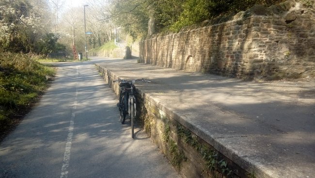
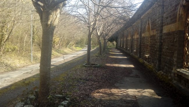
The next station we come to is Mangotsfield, the triangular junction mentioned earlier. Here the route to the north and the route to Bath diverged with platforms within the triangle of tracks for each route.
Below - Mangotsfield station today.

Below - 1958 shot of a train to Bristol from the north (By Bob&Anne Powell, CC BY-SA 3.0, https://commons.wikimedia.org/w/index.php?curid=46720184)

Below - The Bath route platforms with a section of retaining wall for the platform canopies on the left.

Below - Surviving retaining wall for the station canopies.

Below - The former platform for trains to Bristol from the north.
Continuing on the northbound side of the junction the trackbed has been descimated by the A4174. I continued on that side of the triangle to where it meets the road at the site of Mangotsfield North Junction and came back to the station before to take the south side of the triangle. Where this meets the road at the site of Mangotsfield South Junction it also meets the route of one of the earlier wagonways that moved coal from pits in this area to the River Avon, now a footpath known as the Dramway. I explored this earlier route largely on foot (partly as I was also having trouble with my bike at the time).
Beyond the A road and the landscaping that has taken place around it the former railway line to Bath can be picked up where it runs between Hobbs Lane and Siston Common and takes us to the next station site, Warmley. This is a well preserved station site, aside from the lack of tracks and trains. One of the station buildings now serves refreshments to passing walkers and cyclists. An art installation on the platform has the outline of passengers waiting at the platform edge. Also a restored typical Midland Railway signal box survives at the south end of the station.
Below - Warmley station

Continuing along the line the next stop was Oldland Common and it is at this point we encounter railwaay tracks as a 3 mile stretch of the route is operated as a heritage railway, the Avon Valley Railway despite tracks being in situ the cyclists and walkers are still able to continue along the railway route though as the heritage railway operates a single track line on what was previously a two track line.
Though a platform and run round loop are provided at Oldland Common this is not the main site for the heritage railway, that is further along the route at Bitton where the cycle track detours around their station site and sheds. Bitton station makes a handy stopping point for refreshments as the railway has a cafe providing meals in the station buildings.
Below - Hunslet 3163 Sapper at Bitton station

Having taken on fuel and drink at the Bitton station stop I continued along the path as it parallels the heritage railway (I went back a few days later for a steam train ride too) to Avon Riverside Station. This was not an original stop on the route but was added by the heritage railway to connect with boat trips on the river and a picnic area. Passing the buffer stops the cycle path has sole use of the trackbed again, though the heritage railway does have ambitions of pushing on towards Bath.
Shortly after crossing the River Avon the next stop was Kelston. Actually closer to Saltford, however the GWR had a station serving the village on its route. At this point there were lines at either side of the river with the Midland along the north side and the Great Western route on the south side which still operates today.
As the line aproaches Bath there is not surprisingly a bit of redevelopment on the former railway route, the cycle route deviates off the railway route to the south to follow the riverside in to Bath, missing a stretch of the railway route through Bath's suburban station Weston. A railway bridge survives on Osborne Road, the crossing keeper's house on Station Road at Weston is now in private hands as is the Weston station building. With the cycle path following the river it passes under the railway route twice where the railway bridged over a dogleg in the river. The path connects to Green Park which gave its name to the Midland's Bath station situated just to the north. Though no longer on the railway network the station thankfully survives. The overall roof covering part of the carparking for a Sainsburys supermarket and the buildings housing shops, cafes and a restauraunt.
Below - Bath Green Park station


Bath Green park was also famously the station for the Somerset & Dorset Joint line and parts of that route survive as a cycle route. I had intended to push on further on this bike ride, however with problems on my bike meaning poor brakes I had been having to ride cautiously and decided to avoid the following leg of the journey which also had some road sections. I will continue the journey at a later date though.
No comments:
Post a Comment