
Starting Point - Sowerby Bridge Station. Round Trip. Distance - 7.6 Miles
Above - Photo of the Railmotor at the Rishworth Branch platform at Sowerby Bridge from the Ryburn Valley Greenway site, this page is worth checking out as it gives a more detailed history of the route as well as some fantastic archive pictures.
Initially built to connect the village of Ripponden to the Calder Valley line at Sowerby Bridge, the scheme was extended to nearby Rishworth once work was underway. The line opened to Ripponden in 1878 and Rishworth in 1881. It was proposed to continue to Littleborough, a scheme that would involved considerable tunneling but would have shortened the Calder Valley route by 5 miles. It is hard to imagine that had this gone ahead we might have seen the express services on the Calder Valley route missing out Todmorden and Hebden Bridge.
Like the nearby Stainland Branch, this route also saw the introduction of Hughes Railmotors in 1907 to keep the railway competetive in the face of the expanding local tram networks, though this line too lost its passenger service in 1929, closing completely beyond Ripponden in 1953 and throughout in 1958.
Considering this was such an early closure it is remarkable how much remains of the old railway today, walking it you could easily believe that you were walking a line that had been in use in to recent years and just been removed having lost some freight source in the last decade or two.
The first evidence of the line is at the back of Sowerby Bridge station. One of the old station buildings survives as the refreshment rooms, though there used to be a much larger building at right angles to this facing on to the end of Station Road and at the opposite end of that building access to the small Rishworth line platform. The platform was added to coincide with the introduction of the Railmotors and saved trains having to reverse out of Sowerby Bridge station to take the branch. Some photos of the station with its now demolished grand main station building can be seen on Alan & Kay Glasby's Sowerby Bridge Then and Now page
Just beyond the station the line went in to a tunnel and this can be seen at the back of the small industrial site that occupies part of the former station site.

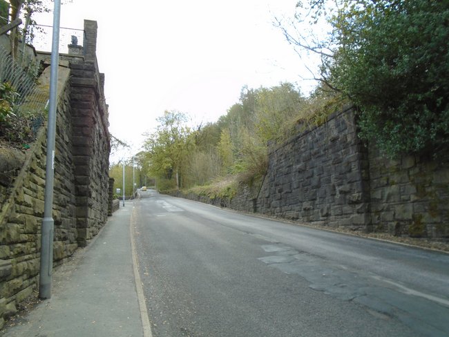
Since we can't go through the tunnel we have to go 'over the top' to pick up the route at the other end of the tunnel. It is worth looking at some of the historic railway remnants along station road.
Below - The station refreshment rooms, previously dwarfed by the demolished main station building that would have adjoined it on the right hand side.

Below - The former coal drops survive as a builders yard.

Below - The bridge over Holmes Road and the former coal drops.

From here I followed Norland Road, Boggart Lane, Sowerby Croft Lane and Watson Mill Lane to reach the point where I could see the other end of the tunnel. As the name suggests the last road originally gave access to Watson Mill, a woolen mill. This and the former Asquith Bottom Dye Works site are still ocupied by factories. The other tunnel mouth can be seen at the back of one of the modern factory buildings.
Where the road meets the former railway line was the site of Watson's Crossing Halt, a simple wooden platform added in 1907 for the introduction of the Railmotor service in the face of increasing tramway competition.

With the trackbed through the factory site in private ownership a little detour is neccessary here to access the railway line, doubling back along Watson Mill Lane and following Long Lane. A footpath goes off opposite where Long Lane meets Goose Nest Lane, this path can also be seen on the old maps. Close to where the path meets the former trackbed the bridge that originally carried the path over the railway can still be seen.

The line is situated in a hilly area and much of the trackbed is in cuttings.

Below - a 3/4 Milepost still in situ

Below - Bridge that would have once provided access to Mill House woolen mill.

Below - Old footpath bridge

Below - Milepost 30, couldn't figure out where the mile posts were recording from.

Below - A steeper rock sided stretch of cutting.

Below - The line curved on the approach to Triangle

Below - Stansfield Mill Lane bridge, Triangle station was immediately beyond the bridge with a station building on the right hand side accessed from the road.

Just beyond the site of Triangle station and the construction of a couple of houses next to the railway line has resulted in a substantial retaining wall.

Below - Bridge over the railway that appears to have given access to a farmer's field.

Below - Over 60 years since the line closed and still the odd bit of the trackwork turns up, such as this old fishplate.

Below - Another piece of steep sided cutting with retaining wall sections.

Below - Old bridge for a footpath linking Halifax Road with Hanging Stones Lane

Below - Milepost 31

Below - A short stretch of the railway wasn't walkable, a short detour along Hanging Stones Lane which runs alongside the old railway being neccessary.

Below - Old footpath between Hanging Stones Lane and a small field between the railway and the River Ryburn. The bridge is missing where this path passed under the railway.


As the railway passed through Ripponden there has inevitably been some redevelopment and we have to walk on the roads past the former station site which is now occupied by the houses of School Close.
Below - The bridge that carried Ripponden Old Bank over the railway at the approach to the station, now filled in.

Below - The abbutments for the bridge that carried the railway over Elland Road immediately south of the station.
On the far side of Elland Road a path leads back to the railway line where the old Height Walk footpath once crossed the line, the path follows the edge of the cutting for a short while, rather than the trackbed itself.

Below - Footbridge for a path that connected Quakers Lane with a path along the river, the approaches to Rishworth station were under the bridge with a signal box on the right. Beneath the bridge is a very short piece of fence with stones acting as a style on either side. I'm not entirely sure what the legal situation was walking around the former station site but it seemed to be a well trodden path.

Below - At the site the old map shows a crane (shown "Cr") there was what was clearly the remains of the base of a crane.

Below - Looking towards the end of the line, the platform can be seen on the left. The goods shed would have been on the right.

Below - The footings of the old station buildings. The nearest room looks to have been the toilets as some white glazed bricks can be seen.

Below - More footings of the old station buildings.

Though many of the platform edge stones and paving stones have gone, probably to several gardens in the area, a few of the platform edge stones could be seen. Still, not bad for nearly a century after the last passenger train departed.

Below - Pile of rubble at the site of the former goods shed.

There was an unusual arrangement at Rishworth where access from Oldham Road to the station site was via a wooden trestle bridge. This was likely built when it was still intended to extend the railway to Littleborough so may not have been seen as the permenant solution at the time. It was the conscerns about the state of this bridge that saw the line curtailed to Ripponden prior to full closure.
Below - Abutment for the station end of the trestle bridge.

Below - Stone pier for the trestle bridge as it crossed a mill stream. In the vegetation can be seen angled blocks on which the wooden trestle would have sat.

Below - End of the line, presumably the wall is made of reclaimed stone from the station site as this is where the access to the trestle bridge from Oldham Road would have been.

No comments:
Post a Comment