BROWSE JOURNEYS BY MAP VIEW

Saturday, 31 July 2021

Bristol and Bath Railway Path


Above - Bath Green Park station in 1962 (By Ben Brooksbank, CC BY-SA 2.0, https://commons.wikimedia.org/w/index.php?curid=10115309)

Starting Point - Bristol Temple Meads station, Finishing Point - Bath Green Park station, Distance 15.9 Miles


The Bristol and Bath Railway path is a cycle route following what was once the Midland Railway's route between the two cities. More details about the route are given in the Sustrans page about the route. I cycled the route, though at 15.9 miles it is quite possible as a day's walk between the two cities which are still rail connected on the surviving lines of the Great Western Railway.
The line began with the Bristol to Gloucester Railway (Wikipedia article) built to Brunel's broad gauge. Opened in 1844, though incorporating some early wagonways in its route. This was aquired in 1845 along with the Gloucester and Birmingham Railway by the Midland Railway. It took nine years to overcome legal and technical issues before through trains from the standard gauge Midland Railway could run through to Bristol along dual gauged track from Gloucester. 
In 1869 a branch from the Bristol and Birmingham route was built to connect it to Bath. A triagular junction was built at Mangotsfield. The route to Bath closed to passengers in 1966, a single track freight route to Bath surviving until 1971 to deliver coal to a gas works. The Bristol end of the Birmingham route was closed in 1970 with cross country services diverted on to the GWR route.


Starting at Bristol Temple Meads the route begins at the end of the car park on the Meads Reach Bridge. An interesting site worth pointing out is the former Avonside Engine Co's Avon Street works, an Ibis hotel on the corner of Avon Street and Pug Lane occupies the site now but a blue plaque marks the site of the works. More about Avonside Engine Co can be read on the Leeds Engine website, it being covered by the site as the firm was later acquired by the Hunslet Engine Co. The company later moved to a new site at Fishponds which we also pass on the railway route, Avon Street Works became a paper works.

Below - Blue plaque at the site of Avonside Engine Co's Avon Street loco works.


A short stretch of path along the old railway trackbed takes us from Chimney Steps to Princess street before the path has to take a detour around a household waste site that was served by a rail connection on a stub of the line connected to the GWR route just north of Lawrence Hill station. Further railway lines to the west originally took this route in to the Midland Railway's St Philips Station, the site has been redeveloped though.
We rejoin the course of the railway from St Philips Greenway, the path running alongside the derelict freight connection with its overgrown track still in situ. As the disused freight connection curves on to the GWR connection the former Midland route crosses over the GWR on a bridge.


As the path passes Clay Bottom, this was the site of Kingswood Junction with the Clifton Extension that linked to a joint line to Clifton and Avonmouth Docks. A short way along this line is the Royate Hill Viaduct. A line also went off to the south to a couple of coal mine, this is all redeveloped with modern industrial units now.
As the path passes the Morrisons supermarket on the left the Avonside Engine Co's works was on the right. At the time of my visit in 2019 the site had been cleared for redevelopment. It could be made out where the rail access in to the works site would have been by the dogleg in the wall alongside the railway path. At this point there was also a station to serve the Fishponds area, it was accessed by a footbridge from Filwood Road which the railway path still passes under. Vehicle access and the main station building was on the north side where the road in to Morrisons car park "New Station Way" is today. Aside from the wider space on the railway path, in which a sculpture "The Fishponds Fish" can be seen, there is no trace of the station.

Below - Site of Avonside Engine Co's Fishpond works.


Below - Site of the rail connection to Avonside's works and Fishponds station. Prior to 1970 I would have been stood on the Bristol bound platform at this point.


Further along the line we enter a cutting as the line reaches the Staple Hill area, this also had a station and one of the platforms of it can still be seen today.

Below - Staple Hill station

After the station the line passed through a short tunnel.
The next station we come to is Mangotsfield, the triangular junction mentioned earlier. Here the route to the north and the route to Bath diverged with platforms within the triangle of tracks for each route.

Below - Mangotsfield station today.


Below - 1958 shot of a train to Bristol from the north (By Bob&Anne Powell, CC BY-SA 3.0, https://commons.wikimedia.org/w/index.php?curid=46720184)


Below - The Bath route platforms with a section of retaining wall for the platform canopies on the left.


Below - Surviving retaining wall for the station canopies.


Below - The former platform for trains to Bristol from the north.


Continuing on the northbound side of the junction the trackbed has been descimated by the A4174. I continued on that side of the triangle to where it meets the road at the site of Mangotsfield North Junction and came back to the station before to take the south side of the triangle. Where this meets the road at the site of Mangotsfield South Junction it also meets the route of one of the earlier wagonways that moved coal from pits in this area to the River Avon, now a footpath known as the Dramway. I explored this earlier route largely on foot (partly as I was also having trouble with my bike at the time).


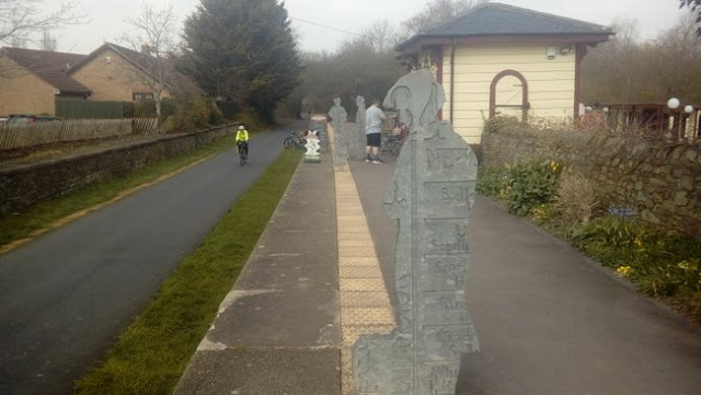
Beyond the A road and the landscaping that has taken place around it the former railway line to Bath can be picked up where it runs between Hobbs Lane and Siston Common and takes us to the next station site, Warmley. This is a well preserved station site, aside from the lack of tracks and trains. One of the station buildings now serves refreshments to passing walkers and cyclists. An art installation on the platform has the outline of passengers waiting at the platform edge. Also a restored typical Midland Railway signal box survives at the south end of the station. 

Below - Warmley station


Continuing along the line the next stop was Oldland Common and it is at this point we encounter railwaay tracks as a 3 mile stretch of the route is operated as a heritage railway, the Avon Valley Railway despite tracks being in situ the cyclists and walkers are still able to continue along the railway route though as the heritage railway operates a single track line on what was previously a two track line.
Though a platform and run round loop are provided at Oldland Common this is not the main site for the heritage railway, that is further along the route at Bitton where the cycle track detours around their station site and sheds. Bitton station makes a handy stopping point for refreshments as the railway has a cafe providing meals in the station buildings.


Below - Hunslet 3163 Sapper at Bitton station


Having taken on fuel and drink at the Bitton station stop I continued along the path as it parallels the heritage railway (I went back a few days later for a steam train ride too) to Avon Riverside Station. This was not an original stop on the route but was added by the heritage railway to connect with boat trips on the river and a picnic area. Passing the buffer stops the cycle path has sole use of the trackbed again, though the heritage railway does have ambitions of pushing on towards Bath.


Shortly after crossing the River Avon the next stop was Kelston. Actually closer to Saltford, however the GWR had a station serving the village on its route. At this point there were lines at either side of the river with the Midland along the north side and the Great Western route on the south side which still operates today.


As the line aproaches Bath there is not surprisingly a bit of redevelopment on the former railway route, the cycle route deviates off the railway route to the south to follow the riverside in to Bath, missing a stretch of the railway route through Bath's suburban station Weston. A railway bridge survives on Osborne Road, the crossing keeper's house on Station Road at Weston is now in private hands as is the Weston station building. With the cycle path following the river it passes under the railway route twice where the railway bridged over a dogleg in the river. The path connects to Green Park which gave its name to the Midland's Bath station situated just to the north. Though no longer on the railway network the station thankfully survives. The overall roof covering part of the carparking for a Sainsburys supermarket and the buildings housing shops, cafes and a restauraunt.

Below - Bath Green Park station


 Bath Green park was also famously the station for the Somerset & Dorset Joint line and parts of that route survive as a cycle route. I had intended to push on further on this bike ride, however with problems on my bike meaning poor brakes I had been having to ride cautiously and decided to avoid the following leg of the journey which also had some road sections. I will continue the journey at a later date though.

Saturday, 24 July 2021

Gloucestershire Dramway and Brandy Bottom Colliery


Starting Point - Westerleigh, Finish Point - Wills Bridge, Distance 6.4 Miles

I ended up walking much of the Dramway Path in Gloucestershire by accident. I had been intending to cycle the Bristol to Bath Railway Path and part of the Somerset & Dorset Railway, however not far out of Bristol I had problems with my bike. A few spokes on my back wheel broke and the only way I could carry on with the bike was by removing the rear brakes. Rather than pushing on with the ride I decided to walk along the remains of an earlier wagonway that existed before the railway line and ran alongside to the east for much of the way.

The Dramway is the name given locally to the Avon and Gloucestershire Railway, opened in sections between 1830 and 1834 it carried coal from pits to the east of Bristol down to the River Avon. Much more about the route can be read on the Dramway Path leaflet (PDF). 

1886 Map (1)  1887 Map (2) 1886 Map (3) 1883 Map (4)

I joined the trail just east of the former Mangotsfield railway station. Where Carsons Road crosses the A4174 the old railway route runs alongside the A4174 on the west and the Dramway runs alongside on the East. The later railway line took over the course of the Dramway near Shortwood. I followed the dramway / railway route to Westerleigh where a stub of the railway survives to serve an oil terminal. Though I stopped off at some of the sites whilst heading north I'll put them in order from north to south to make it easier to follow.

Not far south of Westerleigh is the chymney of Parkfield Colliery. The other colliery buildings are gone and private housing occupies the colliery site.

Below - Parkfield Colliery chymney and the Dramway tramway route

A much better survivor however is Brandy Bottom Colliery with many of the buildings surviving. At the north end of the site is what appears to be a weighbridge building alongside the former railway.

The two halves of a colliery winding wheel are placed either side of the path to mark the site of Brandy Bottom Colliery.


Below - Some of the surviving buildings of the former colliery.


Below - A map explaining the site.


Below - The buildings of New Pit at Brandy Bottom Colliery


Below - An egg ended boiler at the colliery site.


Also the site of an earlier horse gin wound pit head can be found in the trees next to the colliery site to the right in the above picture, although this is clear to see at the site it doesn't come out so well in a picture.

Further south and back to were the routes of the Dramway and later railway seperate and a short tunnel and a bridge on the former wagonway can be seen.

Below - Tunnel on the Dramway

Returning to where we joined the Dramway at the roundabout on the A4174 and Carsons Road near Mangotsfield and looking at the old and new maps the original curve in the dramway that the later railway route smoothed out can be seen and can be followed as a path. Zooming in enough on the Google map shows the Dramway name on the path. That path can be picked up again on the other side of the A4174, again marked as a dotted line of a footpath rather than the cycle route which is the later railway route. The dramway is again to the east of the original railway route. The path can be followed as far as the Hare Brewery at Warmley, from here people following the route are directed to the later railway route.

Looking at the satellite images on Google maps the route can be seen around the back of the buildings on the east side of High Street at Oldland Common, however apart from a small section of driveway there is no path at this point, just the boundry between the buildings and adjoining fields marking the former dramway route. The route similarly continues to the west side of High Street where the boundries of properties on School Road and Saint Annes Drive meet. The Dramway path pickes up the course of the old wagonway again off Cherry Garden Lane to Willsbridge Mill. From here there would have been a short tunnel and the remaining route down to the River Avon seems to be lost in the fields.

Saturday, 17 July 2021

Penydarren Waggonway


Starting point - Merthyr Tydfil station, Finish point - Abercynon station, distance 9.6 Miles

Above - Replica of Richard Trevithick's Penydarren loco at Swansea's Waterfront Museum

Strictly speaking the Merthyr Tramroad, this route is noted for being the route where a steam locomotive hauled a load for the first time in 1804. Richard Trevithick's locomotive was built at the Penydarren Ironworks, one of four Ironworks in Merthyr Tydfil the railway served together with Dowlais, Plymouth and Cyfarthfa. Prior to the construction of the tramroad materials produced in the works had to be transported to Cardiff by packhorse. Cyfarthfa had a canal connection and the other works were connected to Cyfarthfa by wagonway, however due to the terrain of the South Wales valleys there were numerous locks on the canal and it suffered greatly from congestion. The tramroad met the canal at Abercynon, cutting out a large section of canal. Proposals to carry the tramroad on in to Cardiff were unsurprisingly opposed by the canal companies.

Much more detail about the tramroad and Trevithick's engines, together with other interesting early locos subsequently employed can be found in this Industrial Railway Society article.

The famous run to prove a steam locomotive could haul a 10 Ton load on the tramroad took place on 21st February 1804 after a number of trial runs in the days before. The run was part of a 500 Guinea bet. It took 4 hours 5 minutes to complete the 9 3/4 miles, so actually slower than using horses but the bet was won. One of the main problems was the weight of the engine breaking the tramroad tracks. Horses continued to be used on the tramroad and the locomotive was used as a stationary engine. More about Trevithick's engine and the demonstration on the tramroad can be read on the Wikipedia article.

In 1841 the Taff Vale Railway opened and was connected to Dowlais works in 1851 via the Dowlais Railway. Some of the earlier works were closed and the tramroad gradually closed in the late 1800s. Unfortunately the old Ordnance Survey maps below are long afrer the hayday of the tramroad and parts of it had been closed. 

1881 Map (1)  1901 Map (2)  1884 Map (3)

Current Map

The route is largely a cycle route today and can be seen on the above map, make sure bicycling is selected in the left hand menu and it is highlighted in green following the River Taff to the east between Merthyr Tydfil and Abercynon. It is very easy to follow the route of Trevithick's engine on a bike, and somewhat quicker. It is would also make an easy walk with good connections from the nearby railway route on the old Taff Vale Railway line.

Sustrans page about the cycle route

Below - Bridge built for a Penydarren canal branch but subsequently used for railway lines in Merthyr Tydfill


Below - Tunnel on the Penydarren tramway


Below - Stone sleepers on the Penydarren tramway near Quakers' Yard


Below - Bridge on the Penydarren tramway near Quaker's Yard


Below - Stone sleepers on the Penydarren tramway near Quaker's Yard


Below - Bridge on the Penydarren tramway near Quakers' Yard


Below - Monument to the Penydarren tramway outside Abercynon Fire Station.


With the route of Trevithick's engine completed I locked my bike outside the Navigation pub and went for a drink. The bike didn't blow up while I was in the pub.


Saturday, 10 July 2021

Brakenhill Light Railway

Starting Point - Fitzwilliam Station. Round Trip. Distance 7 Miles


I first heard about this line from the book "The Light Railway King of the North" (look for this book on the Railway and Canal Historical Society website). One of several light railway schemes developed across the north by Sebastian Meyer. The main purpose of this scheme was to move stone quarried near Ackworth, the line ran from Hemsworth Colliery to Brackenhill Junction near Ackworth on the Swinton & Knottingley Joint Line. Though Hemsworth Colliery was on the Great Northern Railway close to the present Fitzwilliam station there wasn't a direct connection to the GNR, if goods were to be forwarded to the GNR system it would have had to be through the sidings of Hemsworth Colliery which were connected to both lines. Originally it had been planned for the line to have a south facing connection to the GNR near Hemsworth station and to just run from there to Ackworth with a branch to Brackenhill which was not built. Earl Fitzwilliam who owned Hemsworth Colliery and much of the land in the area on which the railway was to be built objected to the initial scheme though, preferring a line to connect with the S&K which would provide another route and company by which his coal traffic could be moved. 
Opened in 1914, the line was operated by the North Eastern Railway and subsequently by the  LNER and BR until the line closed in 1961. The North Eastern were partners with the Midland in the S&KJL, as a result any through traffic worked through from the S&K end and it was operated as a branch of the S&K.
As mentioned Hemsworth Colliery was close to the current location of Fitzwilliam station, this is on the line from Leeds to Doncaster. The site of the colliery is now the Fitzwilliam Counrty Park and is accessible from just across the road from the station entrance.
Below - Former colliery winding wheel at the site of Hemsworth Colliery.


Below - The Miners Club on Wentworth Terrace adjacent to the site of Hemsworth Colliery


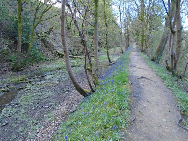
The path that followed the Brackenhill Light Railway runs along the eastern edge of the country park.
Below - Former trackbed passing the former site of Hemsworth Colliery, now a tree lined path around the eastern edge of Fitzwilliam Coutry Park.


The railway would have gone in to a cutting and crossed under Rose Lane, however this cutting has been filled and the footpath now crosses Rose Lane on the level.
Between Rose Lane and Wakefield Road, the side of a yard alongside the former line is still in the construction industry, being Tarmac's Ackworth Asphalt Plant. Some of the associated buildings such as huts and weighbridges may have been around when the railway was in use.


The line passed through Ackworth Moor Top and the village has obviously seen a lot of housing development since the railway closed. The course of the railway has been retained, but sections of steep stone lined cuttings have been filled in so it now gives the impression of being a strip of green on which the residents of the modern housing can walk their dogs rather than that of an old railway. The path now has the name Tom Dando Way.

Where the line passed under Barnsley Road the path is at original track level, demonstrating the steep stone sided cuttings excavated for the line.


Beyond here the modern housing of Millgate now occupies the trackbed, as does the meeting point of the back gardens of Doncaster Road Estate and Beverley Garth. I continued via Doncaster Road and Tan House Lane to where the connection to the S&K line can be seen on the Google satelite images. The railway would have crossed over Tan House Lane on a bridge and the embankment has since been removed completely level with the field.


The final stretch of embankment up to the former Brackenhill Junction is in situ but is clearly signposted as a private road, this is used for railway maintenence vehicles to access the S&K Route. Across the fields the 6 arches viaduct that takes the S&K over the River Went can be seen.

Saturday, 3 July 2021

Sowerby Bridge - Rishworth Branch Line


Starting Point - Sowerby Bridge Station. Round Trip. Distance - 7.6 Miles

Above - Photo of the Railmotor at the Rishworth Branch platform at Sowerby Bridge from the Ryburn Valley Greenway site, this page is worth checking out as it gives a more detailed history of the route as well as some fantastic archive pictures.


Initially built to connect the village of Ripponden to the Calder Valley line at Sowerby Bridge, the scheme was extended to nearby Rishworth once work was underway. The line opened to Ripponden in 1878 and Rishworth in 1881. It was proposed to continue to Littleborough, a scheme that would involved considerable tunneling but would have shortened the Calder Valley route by 5 miles. It is hard to imagine that had this gone ahead we might have seen the express services on the Calder Valley route missing out Todmorden and Hebden Bridge.
Like the nearby Stainland Branch, this route also saw the introduction of Hughes Railmotors in 1907 to keep the railway competetive in the face of the expanding local tram networks, though this line too lost its passenger service in 1929, closing completely beyond Ripponden in 1953 and throughout in 1958.
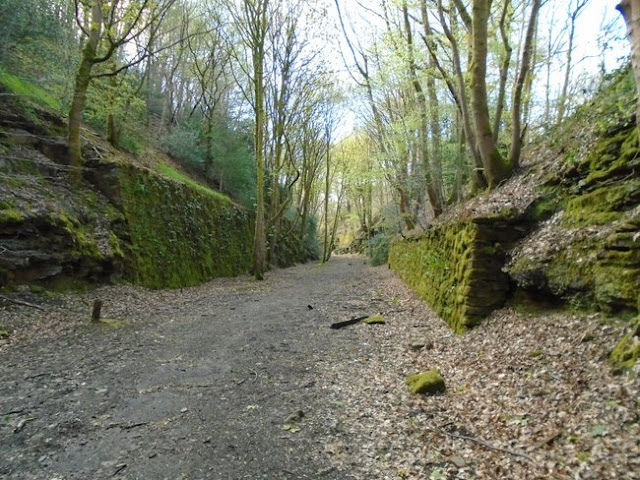
Considering this was such an early closure it is remarkable how much remains of the old railway today, walking it you could easily believe that you were walking a line that had been in use in to recent years and just been removed having lost some freight source in the last decade or two.
The first evidence of the line is at the back of Sowerby Bridge station. One of the old station buildings survives as the refreshment rooms, though there used to be a much larger building at right angles to this facing on to the end of Station Road and at the opposite end of that building access to the small Rishworth line platform. The platform was added to coincide with the introduction of the Railmotors and saved trains having to reverse out of Sowerby Bridge station to take the branch. Some photos of the station with its now demolished grand main station building can be seen on Alan & Kay Glasby's Sowerby Bridge Then and Now page
Just beyond the station the line went in to a tunnel and this can be seen at the back of the small industrial site that occupies part of the former station site.


Since we can't go through the tunnel we have to go 'over the top' to pick up the route at the other end of the tunnel. It is worth looking at some of the historic railway remnants along station road.
Below - The station refreshment rooms, previously dwarfed by the demolished main station building that would have adjoined it on the right hand side.


Below - The former coal drops survive as a builders yard.


Below - The bridge over Holmes Road and the former coal drops.


From here I followed Norland Road, Boggart Lane, Sowerby Croft Lane and Watson Mill Lane to reach the point where I could see the other end of the tunnel. As the name suggests the last road originally gave access to Watson Mill, a woolen mill. This and the former Asquith Bottom Dye Works site are still ocupied by factories. The other tunnel mouth can be seen at the back of one of the modern factory buildings.
Where the road meets the former railway line was the site of Watson's Crossing Halt, a simple wooden platform added in 1907 for the introduction of the Railmotor service in the face of increasing tramway competition.


With the trackbed through the factory site in private ownership a little detour is neccessary here to access the railway line, doubling back along Watson Mill Lane and following Long Lane. A footpath goes off opposite where Long Lane meets Goose Nest Lane, this path can also be seen on the old maps. Close to where the path meets the former trackbed the bridge that originally carried the path over the railway can still be seen.


The line is situated in a hilly area and much of the trackbed is in cuttings.


Below - a 3/4 Milepost still in situ


Below - Bridge that would have once provided access to Mill House woolen mill.


Below - Old footpath bridge


Below - Milepost 30, couldn't figure out where the mile posts were recording from.


Below - A steeper rock sided stretch of cutting. 


Below - The line curved on the approach to Triangle


Below - Stansfield Mill Lane bridge, Triangle station was immediately beyond the bridge with a station building on the right hand side accessed from the road.


Just beyond the site of Triangle station and the construction of a couple of houses next to the railway line has resulted in a substantial retaining wall.


Below - Bridge over the railway that appears to have given access to a farmer's field.


Below - Over 60 years since the line closed and still the odd bit of the trackwork turns up, such as this old fishplate.


Below - Another piece of steep sided cutting with retaining wall sections.


Below - Old bridge for a footpath linking Halifax Road with Hanging Stones Lane


Below - Milepost 31


Below - A short stretch of the railway wasn't walkable, a short detour along Hanging Stones Lane which runs alongside the old railway being neccessary.


Below - Old footpath between Hanging Stones Lane and a small field between the railway and the River Ryburn. The bridge is missing where this path passed under the railway.


As the railway passed through Ripponden there has inevitably been some redevelopment and we have to walk on the roads past the former station site which is now occupied by the houses of School Close. 
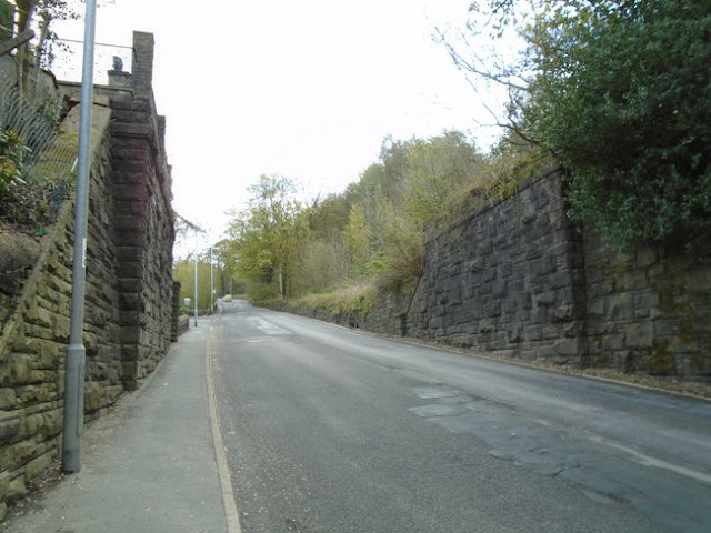
Below - The bridge that carried Ripponden Old Bank over the railway at the approach to the station, now filled in.


Below - The abbutments for the bridge that carried the railway over Elland Road immediately south of the station.


On the far side of Elland Road a path leads back to the railway line where the old Height Walk footpath once crossed the line, the path follows the edge of the cutting for a short while, rather than the trackbed itself.


Below - Footbridge for a path that connected Quakers Lane with a path along the river, the approaches to Rishworth station were under the bridge with a signal box on the right. Beneath the bridge is a very short piece of fence with stones acting as a style on either side. I'm not entirely sure what the legal situation was walking around the former station site but it seemed to be a well trodden path.


Below - At the site the old map shows a crane (shown "Cr") there was what was clearly the remains of the base of a crane.


Below - Looking towards the end of the line, the platform can be seen on the left. The goods shed would have been on the right.


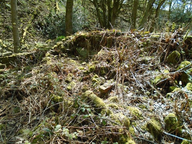
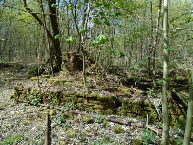
Below - The footings of the old station buildings. The nearest room looks to have been the toilets as some white glazed bricks can be seen.


Below - More footings of the old station buildings.


Though many of the platform edge stones and paving stones have gone, probably to several gardens in the area, a few of the platform edge stones could be seen. Still, not bad for nearly a century after the last passenger train departed.


Below - Pile of rubble at the site of the former goods shed.


There was an unusual arrangement at Rishworth where access from Oldham Road to the station site was via a wooden trestle bridge. This was likely built when it was still intended to extend the railway to Littleborough so may not have been seen as the permenant solution at the time. It was the conscerns about the state of this bridge that saw the line curtailed to Ripponden prior to full closure.
Below - Abutment for the station end of the trestle bridge.


Below - Stone pier for the trestle bridge as it crossed a mill stream. In the vegetation can be seen angled blocks on which the wooden trestle would have sat.


Below - End of the line, presumably the wall is made of reclaimed stone from the station site as this is where the access to the trestle bridge from Oldham Road would have been.