Starting Point - Ryde. Island Line Train Ride to Shanklin
Walk Shanklin to Wroxhall. Distance 2.7 Miles
Bus Wroxhall - Ventnor - Shanklin and train back to Ryde.
Ryde Pier
The section from Ryde Pier to Smallbrook Junction was also covered in my visit to the Cowes - Newport - Ryde route. With the Isle of Wight Railway and Isle of Wight Central Railway companies operating the routes to Ventnor and to Cowes they were operated as seperate bi-directional single track lines as far as Smallbrook Junction until both became part of the Southern Railway in the 1920s and a crossover at Smallbrook Juncion was installed. Today the line is still two tracks between Ryde Esplanade and Smallbrook Junction.
Below - A view along Ryde Pier. Effectively three phases of pier built alongside each other. On the left the 1880 railway pier, in the middle the 1864 former tramway pier and on the right the 1814 vehicle pier. The track on the left is currently disused as the railway only uses the single track on the right from Esplanade.

Ryde Esplanade
In the 1865 map above the pier tramway terminated here. It later continued through the streets to St Johns Road station until the railway reached the pier in 1880, at which time it went back to just running between the Pier and Esplanade stations again.
Below - Esplanade station. The pier tramway would have been on the left at the end of the canopy. On the right is the disused platform.
Below - The crossover at Esplanade beyond which the line runs as two tracks. When the railway was extended to the pier it tunnelled under parts of Ryde. The low height of the tunnel has resulted in the railway using second hand Underground stock since it was electrified in 1966 as conventional trains would be too high.

Below - Looking south from Park Road. The industrial building on the right is now the bus museum.

Ryde St John's Road
The Ryde terminus from 1864 to 1880 until the line was extended to Ryde Pier. The site is also home to the maintenance facility for the Island Line trains.
Smallbrook Junction
There was no station here until 1991 when it was built to allow passengers to connect between the Isle of Wight Steam Railway on part of the former route to Newport and the mainline.
North of Brading was another junction from 1882 when a branch line to Bembridge opened. This line was closed to passengers in 1953 and goods in 1957. Parts of the branch are walkable, though I didn't get chance on this visit.
Brading
The passing loop was removed in 1988 and was reinstated in 2021 to allow services to be increased to half hourly.
Below - A train arriving at the reinstated Platform 2. On the other side of the platform was once a run round loop for the Bembridge branch trains.

Sandown
Sandown was also a junction station with the line to Newport between 1875 and 1956. I walked the route from Newport to Sandown earlier. Remains of the platform for that line can be seen over the fence on the northbound platform, the track in the station site remaining as a permanent way siding.

Lake
This station doesn't appear on the old maps as it didn't open until 1987. It is a small unstaffed station at the railway's closest point to the coast. I didn't stop off at this station.
Shanklin
Since 1966 this has been the southern terminus of the railways of the Isle of Wight. It had been proposed to extend the electrification of the line to Ventnor but this would have required an additional sub station and extra expense.
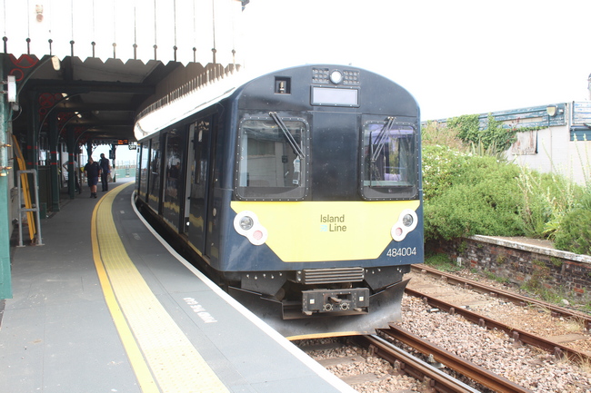
Below - A train from Ryde terminating at Sandown. The station used to have a passing loop and two platforms, the remains of the other platform can be seen.

Beyond Shanklin station the former railway trackbed survives as a footpath to Wroxall. The bridge over Landguard Road has been removed and a roadway to access a caravan park has been built on a short section of the railway trackbed, from which the footpath is accessed.
Below - The bridge carrying the path from Hyde Road over the railway.

Below - A former fog hut.

Below - Bridge carrying Victoria Avenue over the railway, this was built later than the old map. It has clearly been widened at some point and is now part of the A3020 route.

Below - The bridge from the other side.

Below - Bridge carrying a footpath over the railway.

Wroxall
Below - The footpath emerges at the site of Wroxall station's goods sidings.

Below - The bridge carrying Castle Road over the railway. This arch was for the roadway to the goods siding. The arch over the railway is filled in with an entrance to the timber warehouse built on the station site to the left. The back of the platform can be seen under the arch as well as the former station hotel which fronted on to the platform.

South of Wroxall the line entered a tunnel, emerging in to the station site at Ventnor. A short stretch of this trackbed is accessible by a footpath. I got the Route 3 bus from the stop next to the former railway station. This route heads south to Ventnor before returning to Shanklin.
Ventnor
The bus passed the site of Ventnor station. The tunnel entrance has been filled in and an industrial estate has been built on the site of the station. The top deck of the bus gave me a better view in to the site but I didn't get any decent photos due to it raining at the time. The former station hotel survives as private residences.
I returned to Shanklin on the bus and returned by train to Ryde.
No comments:
Post a Comment