Starting Point - Tondu Station. Finishing Point - Blaengarw. Distance 7.2 Miles
The line from Brynmenyn Junction just east of Tondu to Blaengarw at the head of the Garw Valley opened in 1876. Like most of the lines in the South Wales valleys it was built primarily to serve industry. Passenger facilities along the line were not provided until a decade or more after the line opened, although the line carried miners to and from the mines on the route. The line also closed to passengers before Beeching was even a glint in the eye of corrupt politicians, closing in 1953. The line remained open to coal traffic to the early 1990s. Much of it is now a cycle route and track is still in situ on parts of the route. A preservation scheme has also been established at Pontycymmer with the aim of reopening the route from Brynmenyn. More information about the heritage railway and the history of the line can be found on the Garw Valley Railway website.
Combining this route with a trip along the nearby Ogmore Valley line I visited by bike, starting at Tondu station.
From the junction immediately north of Tondu station the abandoned line is overgrown. There is a run round loop on the former trackbed immediately east of the junction, this is considered to be mothballed rather than abandoned. West of Tondu the line to Margam is also considered to be mothballed, in the past trains have been diverted on that route when there has been engineering work on the mainline, requiring running round at Tondu. It is some years since the last train ran that way.
To pick up the cycle path along the line it is necessary to head to the Bryngarw Country Park north of Brynmenyn. A stretch of the trackbed before here is accessible from another cycle path to the south of the railway and on another visit to the area I visited this on foot.
Below - Just west of Brynmenyn the abandoned line towards Tondu can be seen alongside a cycle route. A "fixed distance signal" sign can be seen next to the line, this would have instructed drivers to approach the run round loop and junction at caution.
On my way to the Bryngarw Country Park I stopped at the former level crossing in Brynmenyn where the line crossed Abergarw Road close to the junction with Pleasant View that leads to the country park.
Below - Level crossing at Brynmenyn.
Below - Joining the trackbed in the country park and the disused track can be seen alongside the cycle route.
At Llangeinor the former station is now in use as a house. The rails could still be seen in the road of the level crossing and a couple of single aspect signals and electrical equipment cupboards could be seen next to the line, presumably the signals would have had a flashing white light which would have told the driver that the crossing was closed to road traffic. Unfortunately I didn't get a photo of this.
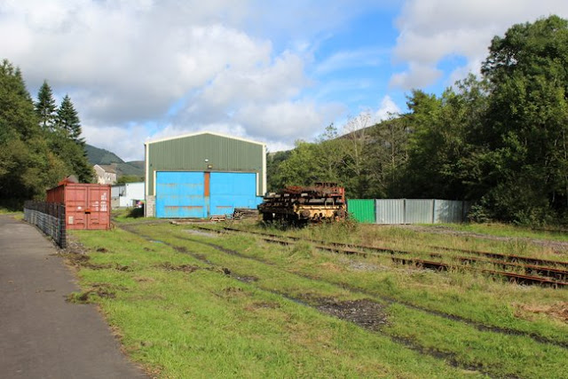
Below - The base of the preservation scheme at Pontycymmer.
The heritage railway is situated around what was once the goods yard south of the passenger station. The bridge over the station site has been filled in so there is a slight detour along Prospect Place to pick up the former railway line.
Beyond Pontycymmer the water of the Afon Garw has been diverted to follow the former railway and the path runs alongside the stream. From former railway route with track still in place it quickly becomes barely evident that there ever was a railway there. The site of the collieries have been landscaped over returning the landscape of the area to a more rural appearance.
Below - North of Pontycymmer the path crosses a stream off the hills around Foel Gwilyim Hywel offering this nice scenic view.
.JPG)
.JPG)


No comments:
Post a Comment