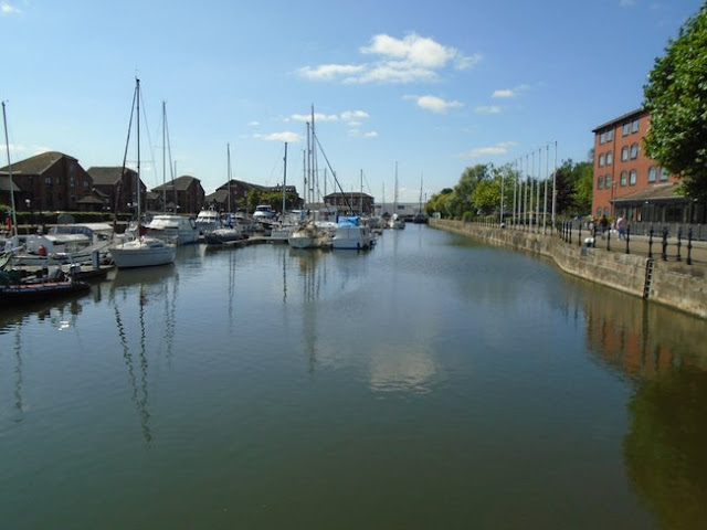
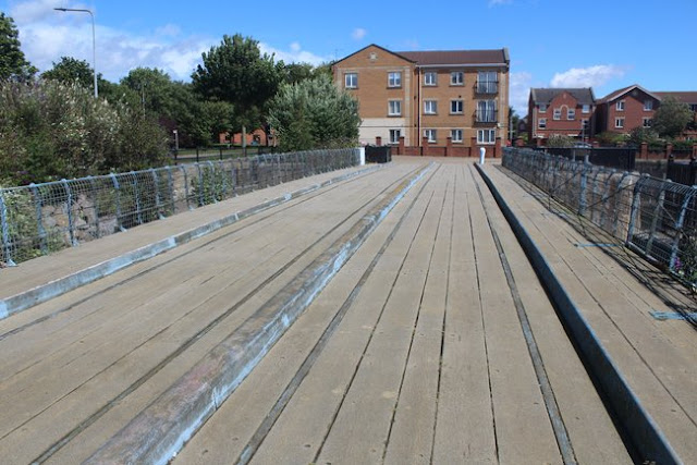
Starting Point - Railway Street / Wellington Street, Hull. Finishing Point - Eastern end of Victoria Dock site. Distance 2 Miles.
Continuing my walk along the docks along the River Humber in Hull from my visit to Riverside Quay and Albert Dock I headed East to explore the site of Humber Dock and Railway Dock (now Hull's Marina) and Victoria Dock.
Below - The entrance to Albert Dock seen from what was once Island Wharf, it was an island because of the Albert Channel which linked Albert Dock to Humber Dock's Basin, allowing boats to move between the docks without having to go out on to the tidal Humber. The channel is filled in now and modern offices have been built on the site but the site of the channel is marked in the paving.
Humber Dock, Prince's Dock and Queen's Dock formed a ring around the west of Hull's Old Town with the River Hull along the east. These three docks were built where Hull's walls and a ditch had once stood. Queen's Dock was the first, originally just called "The Dock" and later the "Old Dock" when other docks had been built. Though it relieved the congested River Hull, shipping still had to access it via the busy river and earlier proposals were to build a canal along the town wall ditch to access the dock directly off the Humber. With increasing traffic additional docks were built along the course of the proposed canal. Humber Dock opened in 1809, followed in 1829 by Prince's Dock which was originally called Junction Dock as it completed the link between the Rivers Humber and Hull. More can be read about the history of the dock on the Wikipedia article.
Below the lock office at the entrance to the dock from Humber Dock Basin with the swing bridge that carried the railway lines and other traffic across the lock.
Though the dock has not been used for shipping goods since 1968 it was converted for use as Hull's Marina. The old maps show railway lines along the dock fronts and as these were set in to the roads they were not removed when the dock closed to goods traffic. Many of the tracks are still in situ. Some pieces of the railway infrastructure were refurbished in the run up to Hull's 2017 UK City of Culture, including a number of the wagon turntables.
Below - The tracks that fanned out to the warehouses from the bridge across the lock around Wellington Street can still be seen today.
Below - Tracks and wagon turntables along Railway Street.
Hull's first railway station was Manor House station and was situated on Railway Street, on the right in the above photo. This station was very short lived, it opened in 1840 with the arrival of the Hull and Selby Railway but closed in 1848 with the opening of Hull Paragon station. Having only had one arrival and one departure platform it had quickly become inadequate, particularly once the route to Bridlington and Scarborough had been added in 1847. More information about Manor House station can be read in the Wikipedia article.
Below - Illustration of Hull's Manor House station from Wikipedia.
Once closed as a railway station it remained in use as a goods shed. This 1856 map shows the railway buildings in their original form with the former passenger station between the two goods sheds. In 1858 these buildings were replaced with the large goods shed shown in the later maps.
Below - Railway turntable that once connected to a line along Kingston street and the bridge over the entrance to Railway Dock.
Below - Kingston Street and one of the old warehouses between Kingston Street and Railway Dock. Railway Dock was opened in 1846 and as the name suggests was built to connect with the Hull & Selby Railway's goods shed along the south side of Kingston Street
Below - The track along Kingston Street where it curved in to the warehouse buildings as shown on the above 1910 map. The walls are remains of the later railway goods sheds built on the site. Further along Kingston street further rails that once entered warehouses on the side of Railway Dock can also be seen.
Below - The swing bridge that carried the railway tracks and other dock traffic across the entrance to Railway Dock.
Below - A look along Railway Dock.
On the north side of Humber Dock was once the lock that connected it to Prince's Dock, passing under Castle Street on the Mytongate swing bridge and the warehouses lining the north side of Humber Dock and the south side of Prince's Dock. Now these have all been swept away by the A63, now the key transport corridor to Hull's later docks situated to the east of the city. The busy road is something of a psychological barrier between the city centre shopping area (including Prince's Quay on the former dock) and the leisure facilities around the Marina and at the time of my visit the area between the two docks was a building site for a new pedestrian bridge.
Below - Usually situated on the north of the Marina but moved for the pedestrian bridge construction work, the Spurn Lightship that once protected the Humber shipping from the moving sandbanks at the mouth of the estuary.
Below - Along Humber Dock Street an old steam winding engine has been preserved in a glass case, this was from a slipway on Victoria Dock and I'll come to the winding house at Victoria Dock later on this walk.
Below - More old dockside railways and some of the surviving buildings of the various shipping merchants based along the docks on Humber Dock Street.
From the former Humber Dock it is a short walk to the former Victoria Dock, crossing the River Hull on the footbridge to The Deep. The 1910 map above shows the Victoria Dock site as being the site of a Citadel. Hull's earliest walls provided a ring around the west of the town with the river itself protecting the town to the east. By 1543 a castle and sections of wall were built on the east bank of the river, a century or so later this needed extensive rebuilding and a new Citadel was built. This was no longer in military use by 1848 and was demolished in 1864 to make way for the dock. A small fragment of the citadel remains, one of the watch towers which has been reconstructed close to the original site now next to the roundabout on South Bridge Road and Plimsoll Way. When the citadel was demolished the watchtower survived by being incorporated on a commercial building. It later ended up in East Park as part of the Khyber Pass attraction before being returned to its former site as part of the Victoria Dock redevelopment.
Across the other side of the roundabout is a building known as the Winding House, this was at the end of the "patent slip" on the old map and used to haul boats out of the water, this area of the dock site being used largely for ship repair work. The engine from this building is now preserved at the Marina site as mentioned previously.
Below - The old Winding House (with some modern steel and glass additions.)
The main part of Victoria Dock was filled in and much of it is now a parkland known as Victoria Park. Perhaps the developers were worried that the filled in dock might settle as happened with some of the St Andrew's Quay development on St Andrew's Dock? Sadly there is nothing to see of the main dock, however the Half Tide and Outer Basins survive, with the modern housing developments around them. The Outer Basin is largely silted up now, a problem the docks along the Humber and the River Hull itself regularly faced. Looking at how large these basins are, appearing to be large docks themselves, it gives an idea of the former extent of Victoria Dock.
Below - Half Tide Basin.
Below - The Swing Bridge between Victoria Dock and the Half Tide Basin survives, complete with former railway lines.
Aside from the above surviving remnants of Victoria Dock it has mostly been redeveloped with modern housing. Looking at the Google Maps satellite views in the link at the top of the page reveals the stump of the connection off the River Hull.
Below - The former entrance to Victoria Dock from the River Hull, seen from the west bank of the river near Drypool Bridge.
Also still visible from the satellite views are the stumps of the tidal docks of Earle's Shipbuilding yard to the east of the site. At the time of my visit there was some coastal defence work going on an many of the river front paths were fenced off so I didn't get to see these.
There are several information panels around the former dock site interpreting not only the surviving features but the sites of many of the lost features of the dock site.
Having mentioned Hull's first railway station at the Humber Dock site earlier it seems fitting to mention Victoria Dock Station. This was situated on the south side of Headon Road just north of the dock and served the Victoria Dock branch that ran to Hull Paragon and the line to Withernsea (featured in my coverage of the Hull to Withernsea railway), though only for a very short time before Withernsea services carried on to Hull Paragon. The station continued to be used as a goods shed known as Drypool Goods Station. Some buildings from the station survived until the 1980s, though the area is now occupied by modern industrial units.
East of here the path along the docklands continued until it was moved inland in recent years to make way for Siemens wind turbine factory. I did walk that part of Hulls docklands in the early 1990s and will probably dig out my old photos some time.


No comments:
Post a Comment