BROWSE JOURNEYS BY MAP VIEW

Saturday, 25 September 2021

18" Military Railway on the Ouse in York


Starting Point - Lendal Bridge, Yorks. Finish Point - Millenium Bridge, York. Distance 1.25 Miles


This is a short walk along the River Ouse as it passes through York. I particularly wanted to visit the remnants of a narrow gauge military railway that took supplies from boats on the river in to an Ordnance Depot, though with a city with as much history as York there were a few interesting sights along the way.


An obvious place to start is the city walls. York has an excellent set of city walls, although they got pierced by the coming of the railways and the improvements of roads in the Victorian age, the controversy of those acts lead to increasing support for the preservation of the walls. Much of the walls are walkable, details can be found here.

At what was once the north east edge of the city there are a couple of towers alongside Lendal Bridge, these are Lendal Tower and the North Street Postern Tower. A chain could be raised across the river at this point to prevent boats entering the city.

The above old map shows a dotted line where the Roman walls were lost to medieval development, it also shows the likely spot for the Roman bridge. Roman York (Eboracum) would have followed a grid pattern with Stonegate and Petergate following the course of the principle roads through the city today, hence the likely position of the bridge. The mish mash of other roads seen on the maps being from the much more un-planed developments of the Viking and medieval ages.

1936 Map

Below - This view of Queen's Staith is a reminder of the industrial use of the river through the city. The map above shows how the bank of the river was once lined with warehouses. 


Below - At the junction of the River Ouse and the River Foss an information board provides details of some of the sights along the rivers through York.


At the junction of the Foss and the Ouse a lifting bridge took the riverside footpath over the Foss. Shown on the above map as the Blue Bridge.
Below - The Blue Bridge today.


Where the rivers meet there were once a couple of canons from the Crimean war serving as a memorial, though these were sadly scrapped in the World War 2 scrap metal drive.

Below - Just up the River Foss from the Blue Bridge is the Foss Barrage. The River Ouse is notorious for flooding through York and this barrier prevents flood waters back filling the Foss and flooding properties around it.


Below - The former Castle Mills Wharf at the foot of York Castle. The Foss continued to be navigable beyond this point, notably serving York's confectionery industry.


Below - Returning to the Ouse and the 18th Century Pickering Well. Claimed to have been a natural remedy for eye conditions. Behind the iron railings the well can be seen and the green water probably doesn't have many health benefits these days.


Reaching the site of the Ordnance depot, the original walls of the complex can be seen. The bricked up entrance from the riverside staith now blends in well with the original wall. A narrow gauge (18 inch gauge line) ran in to the site and to the riverside where there was a run round loop and a crane. Looking at the maps there doesn't seem to be a headshunt off the run round loop. The wagons were probably moved around by hand or possibly by horse so the loop would have been for re-ordering the wagons to get them to closer to the crane rather than running an engine round. It looks as though a wagon turntable may have been used rather than a point at the far end of the loop. Though the river bank has been rebuilt and the crane has gone the tracks remain. In 2020 the local papers made a story of the tracks reappearing after flooding, though the stories were exaggerated, the line wasn't long lost as suggested. The Ouse regularly floods and the tracks have been covered with silt and reappeared at intervals over the years.

This page by Andrew Grantham gives an account of the tracks in 2003.

Below - bricked up entrance to the former ordnance depot.


Below - Plaque on the wall describing the railway.


Below - Point and surviving end of the loop on the river front. In the background the Millennium Bridge can be seen, giving the option of returning via Rowntree Park.


Below - The former riverfront staith where a crane would have transferred supplies from the "Powder Boat" on to narrow gauge wagons to be taken in to the depot. A passing loop is also shown on the map halfway along the line within the depot. Two other stretches of line within the depot can be seen on the map, as these aren't connected they may have been used for moving materials within the site or may have been for rail mounted cranes. The staith is now occupied by the Two Hoots Ice Cream Boat.


In the Ordnance Depot site itself many of the original buildings survive in industrial and retail use, there are no further traces of the railway lines. Perhaps one day if some of the car parking spaces are dug up other remnants might reappear? 


Saturday, 18 September 2021

Hull's Humber Dock and Victoria Dock

Starting Point - Railway Street / Wellington Street, Hull. Finishing Point - Eastern end of Victoria Dock site. Distance 2 Miles.

Continuing my walk along the docks along the River Humber in Hull from my visit to Riverside Quay and Albert Dock I headed East to explore the site of Humber Dock and Railway Dock (now Hull's Marina) and Victoria Dock.


Below - The entrance to Albert Dock seen from what was once Island Wharf, it was an island because of the Albert Channel which linked Albert Dock to Humber Dock's Basin, allowing boats to move between the docks without having to go out on to the tidal Humber. The channel is filled in now and modern offices have been built on the site but the site of the channel is marked in the paving.


Humber Dock, Prince's Dock and Queen's Dock formed a ring around the west of Hull's Old Town with the River Hull along the east. These three docks were built where Hull's walls and a ditch had once stood. Queen's Dock was the first, originally just called "The Dock" and later the "Old Dock" when other docks had been built. Though it relieved the congested River Hull, shipping still had to access it via the busy river and earlier proposals were to build a canal along the town wall ditch to access the dock directly off the Humber. With increasing traffic additional docks were built along the course of the proposed canal. Humber Dock opened in 1809, followed in 1829 by Prince's Dock which was originally called Junction Dock as it completed the link between the Rivers Humber and Hull. More can be read about the history of the dock on the Wikipedia article.


Below the lock office at the entrance to the dock from Humber Dock Basin with the swing bridge that carried the railway lines and other traffic across the lock.


Though the dock has not been used for shipping goods since 1968 it was converted for use as Hull's Marina. The old maps show railway lines along the dock fronts and as these were set in to the roads they were not removed when the dock closed to goods traffic. Many of the tracks are still in situ. Some pieces of the railway infrastructure were refurbished in the run up to Hull's 2017 UK City of Culture, including a number of the wagon turntables.
Below - The tracks that fanned out to the warehouses from the bridge across the lock around Wellington Street can still be seen today.


Below - Tracks and wagon turntables along Railway Street.


Hull's first railway station was Manor House station and was situated on Railway Street, on the right in the above photo. This station was very short lived, it opened in 1840 with the arrival of the Hull and Selby Railway but closed in 1848 with the opening of Hull Paragon station. Having only had one arrival and one departure platform it had quickly become inadequate, particularly once the route to Bridlington and Scarborough had been added in 1847. More information about Manor House station can be read in the Wikipedia article.

Below - Illustration of Hull's Manor House station from Wikipedia.


Once closed as a railway station it remained in use as a goods shed. This 1856 map shows the railway buildings in their original form with the former passenger station between the two goods sheds. In 1858 these buildings were replaced with the large goods shed shown in the later maps.

Below - Railway turntable that once connected to a line along Kingston street and the bridge over the entrance to Railway Dock.


Below - Kingston Street and one of the old warehouses between Kingston Street and Railway Dock. Railway Dock was opened in 1846 and as the name suggests was built to connect with the Hull & Selby Railway's goods shed along the south side of Kingston Street


Below - The track along Kingston Street where it curved in to the warehouse buildings as shown on the above 1910 map. The walls are remains of the later railway goods sheds built on the site. Further along Kingston street further rails that once entered warehouses on the side of Railway Dock can also be seen.


Below - The swing bridge that carried the railway tracks and other dock traffic across the entrance to Railway Dock.


Below - A look along Railway Dock.


On the north side of Humber Dock was once the lock that connected it to Prince's Dock, passing under Castle Street on the Mytongate swing bridge and the warehouses lining the north side of Humber Dock and the south side of Prince's Dock. Now these have all been swept away by the A63, now the key transport corridor to Hull's later docks situated to the east of the city. The busy road is something of a psychological barrier between the city centre shopping area (including Prince's Quay on the former dock) and the leisure facilities around the Marina and at the time of my visit the area between the two docks was a building site for a new pedestrian bridge.

Below - Usually situated on the north of the Marina but moved for the pedestrian bridge construction work, the Spurn Lightship that once protected the Humber shipping from the moving sandbanks at the mouth of the estuary.


Below - Along Humber Dock Street an old steam winding engine has been preserved in a glass case, this was from a slipway on Victoria Dock and I'll come to the winding house at Victoria Dock later on this walk.


Below - More old dockside railways and some of the surviving buildings of the various shipping merchants based along the docks on Humber Dock Street.


From the former Humber Dock it is a short walk to the former Victoria Dock, crossing the River Hull on the footbridge to The Deep. The 1910 map above shows the Victoria Dock site as being the site of a Citadel. Hull's earliest walls provided a ring around the west of the town with the river itself protecting the town to the east. By 1543 a castle and sections of wall were built on the east bank of the river, a century or so later this needed extensive rebuilding and a new Citadel was built. This was no longer in military use by 1848 and was demolished in 1864 to make way for the dock. A small fragment of the citadel remains, one of the watch towers which has been reconstructed close to the original site now next to the roundabout on South Bridge Road and Plimsoll Way. When the citadel was demolished the watchtower survived by being incorporated on a commercial building. It later ended up in East Park as part of the Khyber Pass attraction before being returned to its former site as part of the Victoria Dock redevelopment.


Across the other side of the roundabout is a building known as the Winding House, this was at the end of the "patent slip" on the old map and used to haul boats out of the water, this area of the dock site being used largely for ship repair work. The engine from this building is now preserved at the Marina site as mentioned previously. 
Below - The old Winding House (with some modern steel and glass additions.)


Below - The Winding House seen from the slip side.


The main part of Victoria Dock was filled in and much of it is now a parkland known as Victoria Park. Perhaps the developers were worried that the filled in dock might settle as happened with some of the St Andrew's Quay development on St Andrew's Dock? Sadly there is nothing to see of the main dock, however the Half Tide and Outer Basins survive, with the modern housing developments around them. The Outer Basin is largely silted up now, a problem the docks along the Humber and the River Hull itself regularly faced. Looking at how large these basins are, appearing to be large docks themselves, it gives an idea of the former extent of Victoria Dock.

Below - Half Tide Basin.


Below - The Swing Bridge between Victoria Dock and the Half Tide Basin survives, complete with former railway lines.


Aside from the above surviving remnants of Victoria Dock it has mostly been redeveloped with modern housing. Looking at the Google Maps satellite views in the link at the top of the page reveals the stump of the connection off the River Hull.

Below - The former entrance to Victoria Dock from the River Hull, seen from the west bank of the river near Drypool Bridge.


Also still visible from the satellite views are the stumps of the tidal docks of Earle's Shipbuilding yard to the east of the site. At the time of my visit there was some coastal defence work going on an many of the river front paths were fenced off so I didn't get to see these. 

There are several information panels around the former dock site interpreting not only the surviving features but the sites of many of the lost features of the dock site.

Having mentioned Hull's first railway station at the Humber Dock site earlier it seems fitting to mention Victoria Dock Station. This was situated on the south side of Headon Road just north of the dock and served the Victoria Dock branch that ran to Hull Paragon and the line to Withernsea (featured in my coverage of the Hull to Withernsea railway), though only for a very short time before Withernsea services carried on to Hull Paragon. The station continued to be used as a goods shed known as Drypool Goods Station. Some buildings from the station survived until the 1980s, though the area is now occupied by modern industrial units.

East of here the path along the docklands continued until it was moved inland in recent years to make way for Siemens wind turbine factory. I did walk that part of Hulls docklands in the early 1990s and will probably dig out my old photos some time.

Saturday, 11 September 2021

Barnsley Coal Railway

Starting Point - Barnsley Main Colliery, Oaks Lane, Barnsley. Finishing Point - Fitzwilliam Station. Distance -  12 Miles

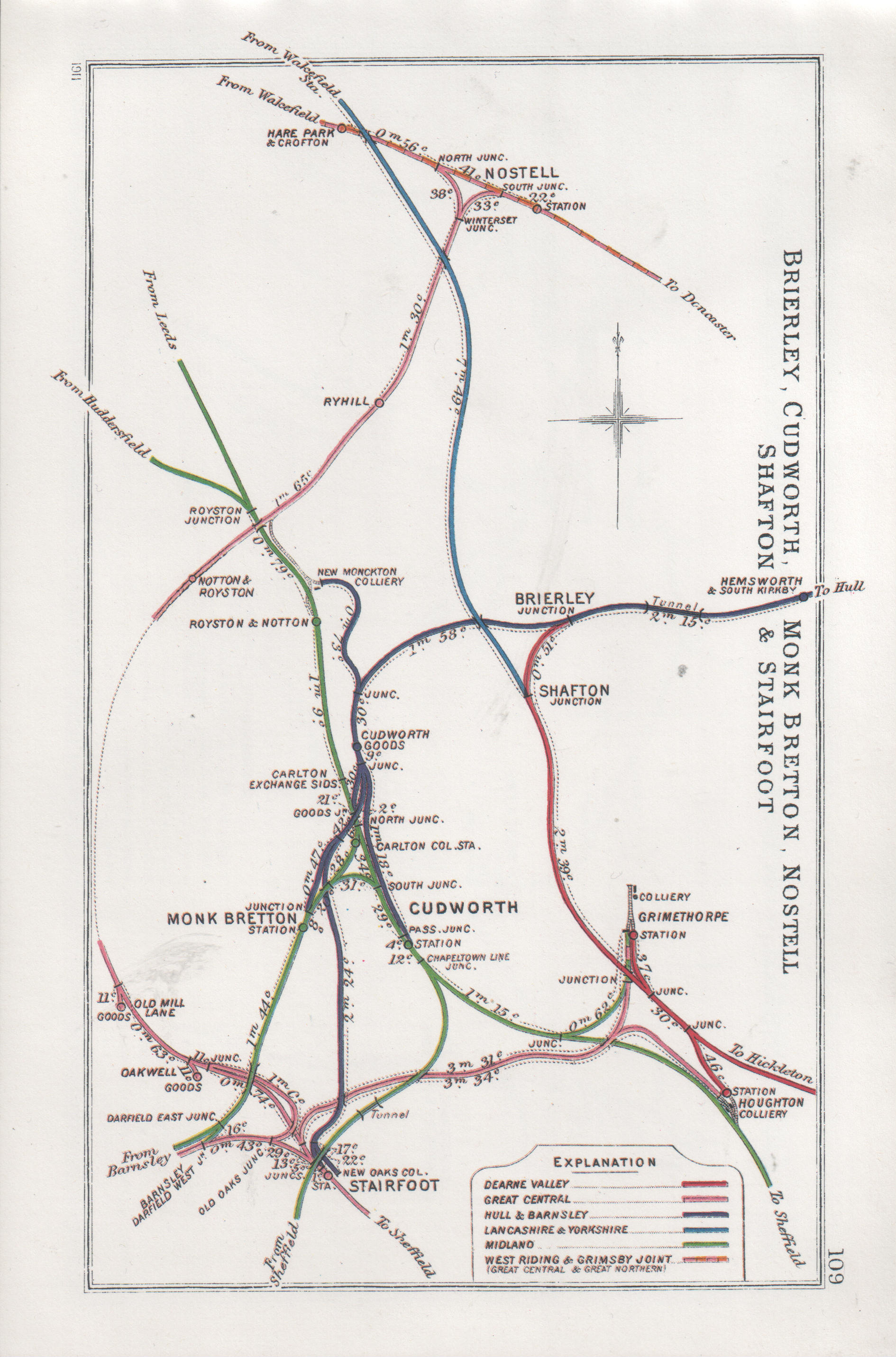
Below - Railway Clearing House map (from Wikipedia) showing the Barnsley Coal Railway in pink (for Great Central Railway who owned the line at the time) between Stairfoot and Nostell towards the left of the picture.

Primarily built to serve the local mining industry, the Barnsley Coal Railway connected Stairfoot Junction near Barnsley to Nostel on the West Riding and Grimsby Railway (now the section of the East Coast Main Line between Doncaster and Leeds). On completion the line became part of the South Yorkshire Railway which then became part of the Manchester, Sheffield and Lincolnshire Railway and later the Great Central Railway. A limited passenger service was operated from Leeds Central to Barnsley Court House but this finished as early as 1930, goods traffic carried on until 1961. More information about the history of the route can be found on the Wikipedia page. Today there are footpaths along much of the route.


Having travelled to Barnsley by train I walked to Barnsley Main Colliery on Oaks Lane, close to Stairfoot Junction where the route began. Here some of the pit head buildings have been preserved.


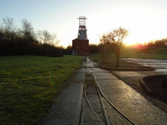
Below - Around Barnsley Main Colliery some of the narrow gauge internal railway system is in situ in the concrete roadways.

From here it was a short walk in to the Dearne Valley Country Park, through which the route now forms one of the paths through the park.
Below - Where the path crosses the River Dearne it does so on the site of southern most bridge of the two railway bridges that can be seen in the above map. The abutment of the northern most bridge can be seen.

Below - Remains of an aqueduct that carried the connection between the Aire and Calder Navigation and the Barnsley Canal


As the course of the railway leaves the country park as it passes under a modern bridge under Tannery Road the trackbed has been lost under a modern road junction. Continuing along Wakefield Road the former Old Mill Lane goods depot can be seen across the industrial site that now occupies the former trackbed. 


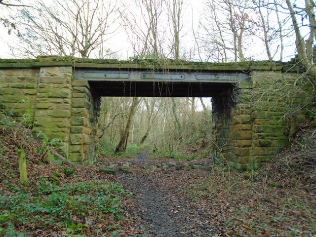
The railway trackbed is rejoined just off Smithies Lane just before it crosses Smithies Lane on a surviving bridge. Looking down at the abutments (not very clear on the photo for the trees) it can be seen that there were two bridges spanning the road, the missing one on the left having served Wharncliffe Carlton Colliery. On the right was access to Primrose Main Colliery. Some retaining walls can be seen in the trees on the right with industrial units and a bus depot on the former pit site.


Beyond Primrose Colliery was East Gawber Hall Colliery, though the colliery has gone and the site landscaped over. As the former line skirts the modern housing of New Lodge there has been a lot of landscaping since the mines and railway were in existence. The old maps show the railway going from an embankment to a steep rock lined cutting which aren't evident today, though the route is still a path across the fields and popular with dog walkers from the areas of modern housing that have sprung up nearby. A former British Coal sign is a remarkable survivor though. At this point the former trackbed was later used as a road access to East Gawber Hall Colliery.


Below - Though partially infilled, the bridge carrying the A61 over the former railway is still in situ.


This was the site of Staincross Station, the former station master's house survives as a private residence.


Below - The site of Staincross station. The path on the right is the former passenger access from the road to the station.
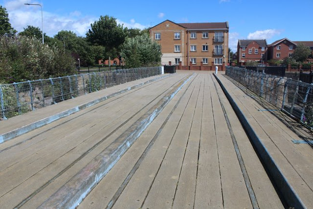

Just beyond Staincross station the branch to Wharncliffe Woodmoor Colliery went off, this was through North Rounds Wood on the 1893 map but today the wood has gone and the course of the branch forms the northern edge of the modern housing of Athersley North.
Below - Former junction of the Wharncliffe Woodmoor Colliery branch.


The bridge across Lee Lane is gone and a section of embankment alongside Muscle Hill Farm levelled, though the path climbs to join the former trackebed behind the farm buildings. Where the line curves to the right a branch once went off straight ahead to serve a quarry, this must have been short lived as it was already dismantled on the 1893 map. Much of the branch has been ploughed into the adjoining fields but is still evident on satellite views.


A short stretch of the trackbed was quite badly flooded when I visited so I had to take a detour around it using a footpath that connected to Parkhead Close, another path off Applehaigh view returned to the railway and this was an old footpath that existed when the railway was built so the remains of a bridge could be seen.

Below - Looking back along the flooded trackbed when I picked up the route.


At Bleakley Lane another bridge has gone. To the east of the road was Notton for Royston station, the trackbed is regained by taking what was originally the access road for the goods yard up the embankment. The former station master's house survives as a private residence at road level on the North side of the station site.
Below - Bridge abutment on the west side of Bleakley Lane.


Below - Former goods yard access road on the left and a bit of brickwork, possibly from the platform, on the right.


Beyond Notton for Royston station the line passed over the Midland Railway route at Royston. A chord branched off to connect with the Midland line in the northbound direction, though this chord had been disconnected in the 1893 map and was removed on subsequent maps. It is therefore quite remarkable that the footpath bridge over this long closed line is still intact.


The viaduct that carried the line over the Midland route and the canal has gone and the embankments up to it levelled off at both sides. A little deviation is necessary here along Navvy Lane and Church Lane.

Below - Navvy Lane crosses the former Midland Railway line, once one of the main routes between Leeds and Sheffield only a section of the line from Wakefield to Monk Bretton survives as a single track freight line to supply sand to a glass works. This was the site of the Midland's Royston and Notton station.

Church Lane crosses a footpath along the former Ryhill Main Colliery Tramway, this runs west up to where it met the Midland Line and the canal. Heading east that path heads to the site of Ryhill Main Colliery and it is where that line passed under the Barnsley Coal Railway that we can access the former trackbed again. The route has been ploughed in to the fields between the Midland line and this point.


Below - Looking along the Ryhill Main Colliery Tramway, on the right is the footings of the abbutment for the bridge that carried the Barnsley Coal Railway. The path heads up the embankment to the trackbed. 


Below - Old farm track bridge still in situ.


Approaching the site of Ryhill station, the Station Road bridge has been filled in but the path can be picked up on the north side of the road. The path was quite overgrown, remnants of Ryhill station's platform could be seen (below).


  Below - Another missing bridge but with surviving abutments where the railway crossed Long Dam Lane.


Below - The next bridge taking Back Lane over the trackbed was still in situ.


Below - Towards the top of the above 1893 map earthworks for a level crossing can be seen, though it was not connected to the nearby roads so was presumably a farm crossing. The earthworks can still be seen though and the gate posts are still in place.


A little further north the later Dearn Valley Railway crossed over the Barnsley Coal Railway on a bridge. Both old lines are now footpaths at this point (and I hope to walk the Dearn Valley line at some point) though the bridge is gone and the paths cross on the level, those of the Dearn Valley sloping up to embankment height.
At Winterset Junction two sides of the triangular junction with the main line from Leeds to Doncaster diverged, a bridge that carried a farm track is still in situ at the site of the junction.
 

Within the former triangular junction was a coal terminal alongside the surviving main line. This was used in to the 1990s to move coal from opencast mines in the area and known as Winterset Coal Sidings. Though now disconnected, the sidings are still in place.


 With this being the junction with the surviving main line that marks the end of the old railway walk, though there was still a bit of walk remaining to reach Fitzwilliam station for a train home. I found an underpass under the mainline at the site of Nostell South Junction flooded, I had hoped to look for remnants of the branch line in to Nostell Brick & Tile Works. Instead I had to carry on to Swine Lane.
Crossing over the mainline, nothing remains of Nostell station except for the Station Cottages. The brick and tile works is still in existence. After passing the brickworks I took Gamil Lane towards Fitzwilliam station.