Starting Point - Coombs Road, Bakewell. Finishing Point - Topley Pike Bus Stop, Buxton. Distance - 10 Miles
The Monsal Trail in the Peak District is probably one of the best old railway walks around featuring impressive scenery and surviving engineering works including several tunnels and viaducts.
The line was once a mainline of the Midland Railway Co connecting its Midland Main Line route from London St Pancras to its grand Manchester Central station. The latter is now an exhibition hall and the route is truncated as a branch line to Matlock with the Peak Rail heritage railway carrying on as far as Rowsley South. The route between there and Buxton Junction east of Buxton (where part of the line survives to serve nearby quarries) was closed in 1968. It was not actually part of the Beeching closures but closed shortly after under Labour's transport secretary Barbara Castle. The LNWR route to Manchester (the West Coast Main Line) was more highly regarded, and electrified. Another Midland route also connected Manchester to the east Midlands via the Hope Valley to the north. Having said that, if various former Midland lines hadn't been pruned back from the 60s onwards it is probably fair to say that the country wouldn't be needing to spend £100Bn on a new high speed line now to add capacity to the railway network. More information about the former rail route can be found on the Wikipedia page
Most of the abandoned section is now the Monsal Trail. The trail starts to the east of Bakewell where the railway formerly crossed Coombs Road on a three arch viaduct. The viaduct is still in place but the trail ends on the north side of the road where a slope up the embankment has been built for access. Plans are being developed to take it through the nearby Haddon Tunnel and on to Rowsley where it will run alongside Peak Rail to Matlock. Eventually a circular trail could be established with the Cromford and High Peak Railway.
I accessed the route by taking a train to Chesterfield and 170/X70 bus to Bakewell. From the main square I bought a Bakewell Tart (had to be done) and headed to Coombs Road to join the trail.
Google Map
(note: the Google Map directions above miss the Chee Dale stretch of the route and takes in Blackwell instead but it is possible to remain on the trackbed through Chee Dale.
1922 Map
Below - The current start of the Monsal Trail with the Coombs Road bridge in the background.
1922 Map
Below - Bridge carrying the footpath to Manners Wood.
BAKEWELL
Below - Bridge carrying Station Road over the former Bakewell station. The trackbed has been filled to platform level. Note the platform edge stones on the left of the picture.
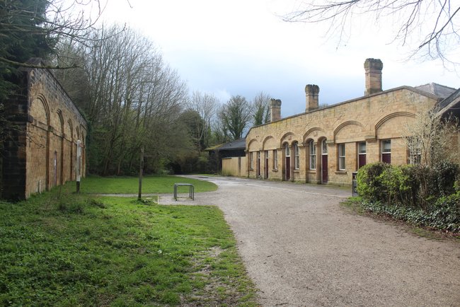
Below - Bakewell station seen from the approach road, this is now a car park for people using the trail.
Below - Former weighbridge and goods office.
Below - Bakewell station from the platform side. The platforms once had glass canopies.
Below - Bakewell station in 1905 (Photo Wikipedia)
1922 Map
Below - Former Bakewell goods shed, since built on at the side and front.
1922 Map
Below - Baslow Road bridge.
Below - Stonework of Baslow Road bridge, note the marks carved in to the bridge, these were the stonemasons marks. The stonemasons would be paid by piecework so marked the stones to identify which stones they had shaped so they would be paid appropriately.
Below - Embankment of the siding for Hassop on the west side of the running line. The running line was on a gradient so this higher level siding would have been built to prevent wagons running away.
HASSOP
Below - Looking towards Hassop station, the station master's house can be seen on the left along with remnants of where the northbound platform started.
Below - The building that once stood on the southbound platform at Hassop. Identical to Bakewell it would also have had glass canopies. The building has been extended to the front and is now a cafe, largely serving people using the trail.
Below - Bridge over the A6020
Below - Remains of a lineside hut (not shown on old map) with the footpath bridge from Rowdale House in the background.
Below - Bridge over Longreave Lane.
Below - Footpath Bridge.
GREAT LONGSTONE
Below - Looking through the Longstone Lane bridge the platforms of Great Longstone station can be seen.
Below - The steps from road level to the former up platform. Further along the platform a ramp from the platform to road level can also be seen.
Below - Great Longstone station. The station buildings can be seen behind the high fence, now in residential use.
Below - Farm access bridge.
Below - Farm access bridge.
Below - The steep cutting and entrance to Headstone Tunnel.
Below - The western portal of Headstone Tunnel.
Below - The route emerges from Headstone Tunnel on to a viaduct over the River Wye.
Below - A footpath from the western end of Headstone Viaduct gives a view of the viaduct.
Below - Bridge carrying the footpath that served Monsaldale Spar Mine.
MONSALDALE
Below - Building at the site of Monsaldale Station's goods yard.
Below - Former Monsaldale station. The former down platform survives, though the down platform was wooden.
Below - Although the wooden down platform isn't as evident today as the up platform a closer look reveals some remaining pieces of the woodwork that supported the platform on the edge of the embankment.
Below - On the left side of the above old map a siding can be seen on the south side of the line. The buffer stop of this survives. The buffer stop is constructed of earth and wood. The wood can be seen beneath the vegetation that now covers the buffer stop.
Below - The former Cressbrook Mill
Below - Remains of a signal post on the approach to Cressbrook Tunnel.
Below - The eastern portal of Cressbrook Tunnel.
Below - The western portal of Cressbrook Tunnel.
Below - The eastern portal of Litton Tunnel.
Below - The western portal of Litton Tunnel.
Below - Litton Mill situated along side the line to the north.
Below - The footpath bridge shown on the old map.
Below - One of the steep rock cuttings that feature a lot on this route.
Below - A telegraph post still in situ close to the site of the signal box.
Below - Remnants of the Miller's Dale Lime Works.
Below - The two viaducts at Miller's Dale, looking across the original viaduct. The viaduct to the north was added in 1905 along with additional platforms at the station on the other side of the viaduct. Compare the above old map with the earlier
1898 Map. The station acted as a junction for the services to Manchester and services to Buxton, though the actual junction was a couple of miles further down the line at Miller's Dale Junction.
Below - The viaducts seen from the path from the Miller's Dale Lime Works. The nearest viaduct being the original.
Below - The two viaducts from the station end.
Below - The 1905 viaduct, not currently open to walkers but seen through the fence at the end.
MILLER'S DALE
Below - The former Miller's Dale station. The platform on the right is part of the 1905 expansion to the station with the original platforms on the left. The station building now houses a cafe, time for a refreshment stop!
Below - The former Goods Shed.
Below - The station building from the former station approach, now a car park to serve the Monsal Trail.
Below - The cattle pens shown to the north of the station on the old map.
Below - Remains of the buildings of Station Quarry on the north side of the railway just west of the station.
Below - Remarkably the tank shown on the map on the south side of the line west of the station is still in existence.
Below - More details around the tank still surviving, the ladder up to the tank and what I presume was some kind of softening plant. The small cast tank on the right has remnants of the paintwork and lining under the vegetation growing around it.
Below - Lime kilns of the East Buxton Lime Works. These look to have been rebuilt around WW2 when several lime works were required to increase production to supply the steel industry for the war effort.
Below - Cutting for the head shunt of the lines serving East Buxton Lime Works curving away from the main line.
Below - Viaduct over the River Wye. As well as walking and cycling, abseiling off the viaduct is an option. I settled for walking but those on the right on the viaduct were abseiling.
Below - Eastern portal of Chee Tor Tunnel.
Below - The line emerged from the western portal of Chee Tor tunnel and straight on to a viaduct.
Below - From the viaduct the line then entered a second shorter tunnel, Chee Tor No 2 Tunnel. On the tunnel entrance was some information painted on by permanent way staff.
Below - Western portal of Chee Tor No2 Tunnel showing the small section on the viaduct between the two tunnels.
Below - Rusher Cutting Tunnel
Below - Viaduct over the River Wye.
As mentioned earlier, the routes to Manchester and Buxton diverged at Miller's Dale Junction. The junction was a triangular junction and the western side of the triangle is still used to serve the large quarries still in use in this area.
A piece of archive film on the British Film Institute website shows a cab ride on this part of the route when the railway was still in operation (
Click here)
Below - The former Miller's Dale Junction.
Below - The steep rock cutting west of Miller's Dale Junction.
Below - The bridge taking the former Manchester bound line over the River Wye seen from the Buxton bound line.
Below - The steep rock cutting and bridge carrying the footpath to Blackwell Mill Cottages.
Below - The end of a trail. In the background another bridge over the River Wye is gated off. Beyond this was the former Buxton Junction with the chord towards the line to Manchester. That line is still in use for stone traffic. The trail leaves the course of the railway to the south, joining the footpath along the River Wye at the foot of the embankment that can be seen on the old map.
The footpath along the river has been upgraded to a roadway to access the cycle hire facilities for the Monsal Trail. It emerges on to the A6 at the same point that the original footpath emerged near Topley Pike Quarry.
Below - The two bridges as the surviving railway crosses over the River Wye and the roadway that seams to weave around it.
Where the roadway emerges on the A6 another car park is provided for people arriving by car to visit the Monsal Trail. There is also a bus stop across the road at which the 65 bus continues for the last few miles in to Buxton. This bus is quite infrequent with gaps of a few hours. Google Maps provides bus information with bus tracking. I arrived at the stop around 20 minutes before a bus was due so this was the most sensible was in to Buxton. Google maps suggests walking along the A6 but this is a silly idea as it lacks pavements and is quite a busy narrow twisting road with a lot of lorry traffic for the local quarries. OS maps showed nearby footpaths that would have been better routes to reach the more built up areas where pavements are provided.
BUXTON
Buxton had two terminus stations side by side, one for the London and North Western Railway which is still in use for trains to Manchester and the since demolished Midland Railway station. They had matching fanlight windows. Station Road has since been extended across the Midland station site to meet Bridge Street.
Below - Remnants of the end wall of the Midland station
Below - The fanlight window of the former LNWR station.
Below - Looking across the former Midland station site the viaduct carrying the LNWR line across the town can be seen. This line served several nearby quarries south of Buxton and led to the Ashbourne line and the Cromford and High Peak Railway. The line is still in use to connect local quarries.
The preservation group that now operate between Matlock and Rowsley South had originally hoped to reopen the line through to Buxton and also had a site at the Buxton end of the route. With the original Midland station lost under the extended Station Road the preservation base was centered on the goods shed. A new platform was built in the former goods yard. The Buxton site of Peak Rail has since closed and the site is being redeveloped. At the time of my visit the platform and water column survived.
Below - Sign still showing Peak Rail, though it had clearly been blanked off at some point.
Below - Looking across the construction site at Buxton's former goods yard the platform and water column of Peak Rail's former Buxton site can be seen along with the bridge were the Midland line passed under the end of the LNWR's viaduct across the town.
A diesel depot was opened at Buxton in 1957 to the north of the station. This serviced locomotives used on local stone traffic and diesel units for the local passenger services until 1997 when fueling facilities were established at the former Peak Forest station closer to the quarries. The shed has recently been demolished but the site of the shed could still be seen from the end of Platform 1.
Below - The former staff access to the depot with much of the track still in place.
Below - An artwork created on Platform 2 with items recovered from the depot site.
Below - Looking north from the end of Platform 2 the semaphore signals and signal box are still in use. The remains of a bridge carrying a line off the LNWR viaduct across the station throat can be seen. This provided a flying junction. Though the Midland and LNWR lines south of Buxton survive as freight lines they join the passenger line on the east side north of the station and cross over the passenger lines.