Revisiting the Oldham Loop on the tram route that replaced it with a short walk around the abandoned section of railway around Oldham itself.
The Oldham Loop between Manchester Victoria and Rochdale via Oldham was closed in 2009 and converted into a tramway as part of Manchester's Metrolink system, reopening in 2012. The section where the line ran to the south of Oldham's town centre was replaced with a section of street running through the main Union Street. I travelled around the Oldham Loop in 1999, a decade before it's closure as a suburban railway route though the conversion to a tramway was already on the cards at that point. In 2024 I revisited the route by tram.
Rochdale
1930 Map (top left of map)
Below - The Oldham Loop trains used to depart from the Platform 2 bay at Rochdale. The bay platform is still there but just sees occasional use in the event of engineering work or service disruption resulting in services from the east turning back at Rochdale rather than Manchester Victoria.

Below - Since Platform 2 lost its regular Oldham services a new bay on the west side of the station has been added for services turning back from the Manchester direction.

Below - The current Rochdale station is about half of the station that used to be there. Currently the station is an island platform with bays at either end, originally there were two island platforms with the original Manchester facing bays on the abandoned one. Here the subway can be seen passing under the abandoned island platform.

Below - A southern entrance to the station has been reinstated recently opening up this previously blocked off view of where the subway passed under the abandoned island platform. Where the red fencing can be seen was the southern most platform of the station.

Below - Looking towards where the Manchester facing bays were located on the abandoned island platform.

Below - The reinstated southern entrance to the station.

Below - Stairs up to the abandoned island platform.

Below - The main entrance to the station. Originally there was a station building here but now there is just a canopy with the station buildings being at platform level.

Below - The tram line crosses over the lines through Rochdale station on a single track bridge before descending to street level. A tram stop to connect with the railway station is provided on Maclure Road. This was not the first time trams had operated at this location. The tram line extends in to Rochdale town centre, the route following Drake Street and Smith Street just as the original tram line in to the town centre did.

Below - The town centre stop in Rochdale.
.JPG)
Shaw & Crompton
Below - A Pacer at the original Shaw & Crompton station.
.jpg)
.jpg)
Below - A footbridge was provided at the level crossing at the station.
.jpg)
Below - The site of the station today


Below - The signal box across the road from the station. The tram stop for Shaw and Crompton has been built in this location, across the road from the original station.
.jpg)
Below - The tram stop seen from the site of the signal box.

Oldham Mumps
Below - Here the tram route through the centre of Oldham diverges from the original rail route. The masts of the tram line can be seen on the left at the other side of the road. The rails are still set in the road towards the original rail route. When the line reopened as a tram route it originally ran to a temporary tram stop built at the site of Oldham Mumps station.

Below - The trackbed looking towards Oldham Mumps.

Below - View from the site of Oldham Mumps station looking towards Rochdale

Below - A similar viewpoint when still in use as a railway station.
.jpg)
Below - The station building on the platform. On the left the subway to the station entrance can be seen.
.jpg)
Below - A train heading to Rochdale. The subway entrances on the platform and at the station entrance can be seen. Originally a building was provided at the entrance and this was replaced with a more modern building in 1957 but it was demolished in the 1990s with just a canopy over the steps to the subway replacing it, all station facilities then being provided in the buildings on the platform similar to the situation seen at Rochdale.
.jpg)
Below - A Pacer heading towards Manchester.
.jpg)
Below - A train heading to Shaw. Some trains were turned back at Shaw, the crossover just beyond Shaw station can be seen in the earlier picture. This practice continues with Metrolink but a third platform is provided for trams turning back there.
.jpg)
Below - Another couple of Pacers heading to Manchester.
.jpg)
.jpg)
Below - A Pacer heading towards Manchester seen from a footpath bridge over the site. The west facing bay platform can be seen. This was taken out of use in the 80s, the bay at the other end of the station was taken out of use in the 1970s but was filled in.
.jpg)
Below - A Pacer approaching Oldham Mumps from the Manchester direction.
.jpg)
Below - The former entrance to the station site today.


Below - There were remnants of a yellow sign for the temporary tram stop provided at Oldham Mumps before the street running section opened.

The footbridge across the western end of the station site from which a couple of the shots above were taken.

Below - A shot looking west from the above bridge of a Pacer heading towards Manchester.
.jpg)
Below - And a Pacer arriving from the Manchester direction.
.jpg)
Below - Bridges over Waterloo Street. The furthest bridge is Oldham Way, the middle bridge is the former railway, the missing span is the former line to Clegg Street station which diverged south towards Ashton under Lyne and the bridge I am on is the former rail access in to Clegg Street goods yard.

Oldham Central
Oldham Central was the most convenient station for the centre of Oldham but despite this it closed in 1966. It also connected with Clegg Street station on the line to Ashton under Lyne.
Below - The site of Oldham Central station today.

Below - Remnants of the retaining wall for the station.

West of Oldham Central the line went in to a tunnel, emerging at Oldham Werneth station. The tunnel is not visible on the photo above for the vegetation. I went to the Oldham Central tram stop on Union Street to continue my journey on tram.
Below - The Oldham Central Metrolink stop on Union Street.

Oldham Werneth
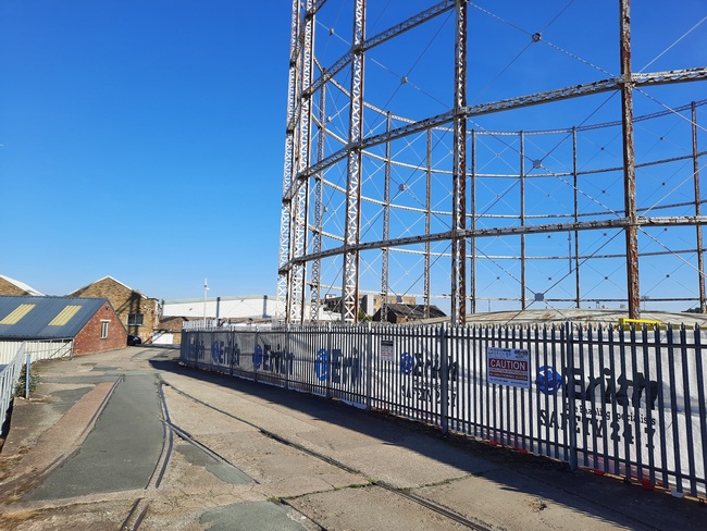
For a few years after the tram was diverted through the town you could clearly see where the line once went in to a tunnel just beyond Werneth Station at the tight bend in the tramline where it rejoins the former railway west of Oldham. Industrial units have since been built on the station site, you just get a glimpse of the tunnel behind them as you pass on the tram now.
Below - A Pacer heading towards Manchester at Oldham Werneth.
.jpg)
Dean Lane / Newton Heath
I got off the tram at Newton Heath, this tram stop is at the site of Dean Lane station. Here a stub of the railway survives to serve a waste terminal. It appears to be double track but is in fact a bi directional single track tram line and platform with the head shunt from the freight terminal alongside. Originally there were platforms on both tracks but the other platform was removed when the line was converted to a tramway.
Below - A tram at Newton Heath heading towards Manchester.

The Oldham Loop joined the mainline in to Manchester Victoria alongside Newton Heath depot. Now the tram line crosses over the line again on another bridge to use the trackbeds of the former Newton Heath Loop and Collyhurst Connecting Loop to join with the Metrolink line from Bury which was one of the first lines converted to tramways in Manchester. Metrolink has its depot on the site of the former sidings at Cheetham Hill Junction.
I continued into Manchester on the tram. The tram stop at Manchester curves across the site of several former bay platforms that were largely once used for local services that are now part of the Metrolink network.