Starting Point - Pontefract Monkhill Station. Finishing Point - Outwood Station. Distance 11.3 Miles
Google Maps (there are some slight differences in the route taken here)
The Methley Joint Railway was constructed by the Bradford, Wakefield & Leeds Railway, later a part of the Great Northern Railway, to connect to other companies lines. It was established as a joint line with the Lancashire & Yorkshire Railway and the North Eastern Railway giving the GNR running powers to Castleford and York on the NER and to Pontefract on the L&YR. Passenger services were operated to Castleford and Pontefract until 1964. The line remained open for freight until 1967, from when it was cutback to access Newmarket Colliery from the Methley end only until the colliery closed in 1981. The route now forms the Castleford Greenway foot and cycle path. I cycled the route starting from Pontefract Monkhill station.
The routes through Pontefract Monkhill remain open apart from the short branch to Pontefract Baghill on the York to Sheffield route. I started at Pontefract Monkhill station in order to visit a couple of signal boxes due to close at the time of writing.
Below - As the former Lancashire & Yorkshire route crosses Skinner Lane, the former Prince of Wales Colliery signal box shortly before closure. On the left of the picture were once lines in to the colliery, remains of the rail connection could be seen until recently when houses were built on the colliery site. With the resignalling work taking place the crossing becomes known as Skinner Lane, consigning the Prince of Wales name to history.
From Skinner Lane I continued via Pontefract Racecourse (stopping off there for a coffee) to Cutsyke Junction via the cycle track on the west side of the race track.
Cutsyke Junction is no longer a junction, it was the point where the former Lancashire & Yorkshire Railway lines towards Leeds and Castleford diverged. The former line towards Leeds has closed with trains to Leeds now either changing direction at Castleford or avoiding Castleford using the former Midland Railway route through Altofts.
Below - The signal box at Cutsyke Junction shortly before closure with work in evidence to replace the level crossing with automatic barriers controlled by Ferrybridge signal box.
The path along the former section of Lancashire & Yorkshire route from Cutsyke Junction to Methley is accessed from Granville Street.
Below - Cutsyke Bridge where the former railway crosses Cutsyke Road.
Castleford Cutsyke
Castleford Cutsyke station opened in 1860 and closed in 1968. It was used by Lancashire & Yorkshire Railway services between Leeds and Goole avoiding the need to change direction at Castleford Central as happens today.
Below - The site of Castleford Cutsyke station today. Until the cycle route was upgraded recently the remains of the southbound platform could be seen on the right.
Below - A marker for the cycle route at platform height.
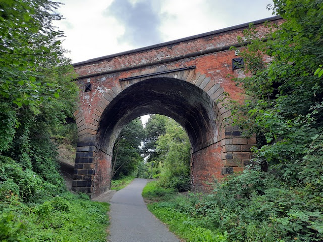
Below - The bridge taking Lumley Street over the line.
Below - The bridge taking Lumley Hill over the railway. On the other side of the bridge lines left to the west to serve Whitwood Colliery, as can be seen the site of this is well overgrown now.
Below - The abutments of the bridge carrying the line over Whitwood Junction on the former North Eastern lines through Castleford. The rail bridge was removed after the line closed and has in recent years been replaced with a footbridge when the Greenway was established on the former line. Whitwood Junction signal box used to stand to the left of the far abutment in the photo.
Below - The bridge taking the former railway over the River Calder.
Below - Looking west from the bridge over the River Calder the bridge taking the surviving Midland route over the river can be seen.
Below - The remains of the bridges carrying the lines over the path to Carr Houses, now called Private Road, on the old map. This was the site of Lofthouse Junction where the Methley Joint line to Lofthouse left the L&YR line towards Leeds. The Methley Joint line ran on the span to the left and the L&YR line on the removed span on the right. The bridge span on the right was removed quite recently.
Methley South / Methley Joint
The site of Methley South station (originally known as Methley Joint station) is in private ownership and the greenway emerges on to Private Road.
Below - The former Methley South station today. The station closed in 1960.
Below - The bridge carrying the former station approach road, now part of Private Road, over the L&YR lines towards Leeds. The L&YR had it's own station, Methley Junction, nearby.
Methley Junction
The main building of Methley Junction station survives in the middle of a modern housing development between Burnleys Court and Drive. It opened in 1849 and closed in 1943.
Below - The former Methley Junction station building.
The modern housing around Methley Junction leads out to Barnsdale Road and Pinder Green Bridge at the site of the junction between the L&YR and MR lines in to Leeds.
Below - Pinder Green Bridge.
Methley North
For the sake of completion this would be a good point to mention another Methley station, Methley North. The station was originally just called Methley but was renamed in 1950 to avoid confusion with Methley Joint which was renamed Methley South (Methley Junction had closed by then). It was situated north of Methley Junction on the Midland Railway route in to Leeds. It opened in 1841 and closed in 1957. When Methley South closed a few years later Methley had gone from having three stations to none.
The former Methley North station can be seen to the north of Pinder Green Bridge where a foot crossing on Station Road crosses the surviving line.
Below - The former Methley North station.
Returning to the Methley Joint line it can be picked up again on the west side of the surviving railway lines off Pinders Green Walk. An abutment of the bridges over the remaining lines can be seen from passing trains but this is not accessible.
Below - Bridges carrying the railway over farm tracks.
Below - The greenway is part of the Transpennine Trail as indicated by this sign.
Below - The bridge under the motorway. At first I figured this had been added as a pedestrian tunnel after the railway closed but under the bridge refuges in the side walls suggest it was built when a single track branch survived on the former route up to Newmarket Colliery.
Below - The foot and cycle path diverts alongside a couple of removed bridges.
Below - The site of Newmarket Colliery, now occupied by warehousing. On a previous journey I noticed that rails were still set in to the road on Newmarket Lane north of the colliery site. Beyond here we are on part of the route that had closed by 1967.
Holmfield Chase is built over the course of the railway. A path runs through the housing development crossing Bottomboat Road and emerging onto Aberford Road.
Stanley
Aberford Road was crossed by a level crossing with Stanley station on the west side of the road. The station was in use between 1869 and 1964. Housing on The Chase has been built on the former station site.
Below - The site of Stanley station, a bit of brick retaining wall can be seen on the right.
Between The Chase and Mount Road the cutting has been filled in. A detour was possible on a path between Aberford Road and the junction of Mount Road and Lake Lock Road, this is actually the course of an early coal wagonway I visited previously.
Below - The bridge carrying Mount Road over the line, the cutting now filled to road level.
Below - The bridge carrying Long Causeway over the railway. The metal bridge span has been removed and replaced with plain wall.
From Canal Lane a path leads to Longfellow Grove which leads to Gainsborough Way. Gainsborough Way is built on the site of the railway and footpaths follow the course of the line to Leeds Road, though the embankments have been levelled off as the area has been redeveloped and there is no indication the railway once ran here.
Lofthouse and Outwood
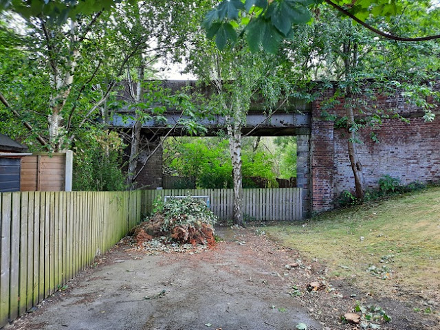
I continued by road to Lingwell Gate Lane and Outwood station. Lofthouse station was opened in 1858 by the Bradford, Wakefield & Leeds Railway (later part of the Great Northern), it was renamed Lofthouse and Outwood in 1865 and remained in use until 1960. Originally the station was on the south side of Lingwell Gate Lane at the junction with the Methley Joint line. The parapets either side of the removed bridge span over the joint line can be seen, wooden fence now fills in the gap where the bridge span was.
The station reopened, just as Outwood in 1988. The new station is on the north side of Lingwell Gate Lane consisting of basic wooden platforms and waiting shelters.
The north side of the triangular junction between the joint line and the main Great Northern route in to Leeds was alongside the colliery site in what is now Lofthouse Colliery Nature Park.
From Outwood I returned home by train.


.jpg)
.jpg)
.jpg)
.jpg)
.jpg)


