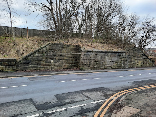
Starting Point - Guiseley Railway Station. Finishing Point - Green Lane Mills, Yeadon.
Distance 2 Miles
The Guiseley to Yeadon branch line was part of a scheme that was never completed to connect the Midland Railway line at Guiseley to the North Eastern Railway line at Horsforth. The line was opened in 1894 and although a station was built at Yeadon it never had regular passenger services, seeing only occasional excursion traffic. The line was used for goods traffic until 1964 when it closed completely. The trackbed remains as a footpath linking Guiseley with Yeadon. More details can be found on the Wikipedia article.
Guiseley
From Guiseley station I walked to where Leeds Road meets Otley Road, from here a footpath heads to Silverdale Drive and then to Coach Road where the path on the Guiseley to Yeadon railway line can be picked up.
Below - Coach Road bridge across the surviving line to Leeds. The buildings in the background are on the site of the Ghyllroyd Iron Foundry.
Below - Looking from Coach Road Bridge towards the former Rawdon Junction. The Yeadon line was on the right climbing at top of the embankment.
Below - The bridge taking New Road over the railway, it can be seen how much the cutting has been filled since the railway was removed.
Below - The bridge taking St John's Road over the former railway.
Yeadon
Below - The path emerges on to Parkland View close to where the bridge over Henshaw Lane has been removed. Yeadon station stood on the left at the top of the bridge. A footpath up from the street to the station was on the left, though there is no trace of it now.
Below - The former Station pub just west of the bridge and the former entrance to the station site.
A council depot now occupies the former station site. The footpath that ran along the eastern edge of the station site survives and is accessed of Henshaw Avenue.
Below - Seen from the path at the edge of the former goods yard site, I'm not sure if this building was associated with the railway goods yard or built afterwards as part of the council depot. It looks as if it had canopies on the side at one time.
Below - The Fire Station occupies the site of the end of the line where a loop and headshunt was provided and from where wagons could be backed in to the goods yard.
A small spur connected the goods yard to Green Lane Dye Works. At the time of writing this was shown on Google Maps satellite images as being derelict but work seemed to be nearing completion rebuilding the site as housing. Unfortunately this meant that rails set in to the roadway where the rail link entered the complex seem to have been recently removed.
Below - The former Green Lane Dye Works, now named Green Lane Mills as I guess that sounds nicer as a residential address. The areas to the left of the picture have been replaced with new housing, thought it has been built of stone and to a style that fits in with the old mill buildings.
From here I returned to Guiseley the way I had come along the former railway.


No comments:
Post a Comment