Starting Point - Langley Mill station. Finishing Point - Beeston Station. Distance - 11 Miles
The Erewash Valley Trail features footpaths along both sides of the valley with a number of links between them providing several options of circular walks. The path on the east side of the valley mostly follows the course of the abandoned Nottingham Canal. On this walk I started at Langley Mill and followed that route, also checking out the latest link between the two sides of the valley, the Bennerley Viaduct that has recently been reopened to pedestrians and cyclists.
A
guide to the Erewash Valley Trail (pdf) shows basic maps of the trail and some background information, though doesn't say much about the Nottingham Canal which the eastern side of the trail largely follows. The canal was completed in 1796, linking the Cromford Canal and Erewash Canal to the centre of Nottingham, providing a more direct route for coal in to Nottingham and serving several collieries on the way. The canal ended up owned by the Great Norther Railway but as was often the case with canals much of the traffic went to the railways and the canal was run down. It closed in 1937 but it was retained for some years. In the 1950s sections within Nottingham were filled. There was a scheme to revive the canal between Trowel and Langley Mill in the 1970s but with the expense of making new bridges for road improvements suitable for navigation the scheme was abandoned at the end of the decade. Parts of the canal route north of Bennerley Viaduct were lost due to open cast mining. Some sections have been filled but sections remain with either water or weeds and most of the route between Langley Mill and Trowel is now footpath or bridleway. More information about the Nottingham Canal can be found on the
Wikipedia pageFrom Langley Mill station it is a short walk to Langley Mill Basin on the Erewash Canal, also known as Great Northern Basin after the nearby Great Northern Railway's Erewash Valley Line. The course of the former GNR is now occupied by the A610 road.
Below - Langley Mill Lock on the Erewash Canal.
Below - The former junction with the Nottingham Canal, the Nottingham Canal toll office can be seen on the left of the picture.
Below - Information board about the Erewash Valley Trail at Langley Mill Lock.
Below - Langley Mill Basin. The Nottingham Canal used to continue beneath where I am standing.
Crossing the A608 from the basin, the former canal route is now occupied by Anchor Road. There is nothing besides the old maps to suggest it was once a canal.
Where Anchor Road turns a sharp right there was once a rail and road bridge over the Nottingham Canal and the nearby Erewash Canal. A colliery waggonway connected wharfs on both canals to Bailey Brook Colliery. The path along the course of the canal leaves the road where the access to the original towpath would have done.
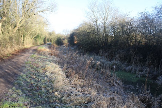
Between Anchor Road and Tinsley Road there path starts looking like any path through a wooded area but the outline of the old canal becomes visible, even with some water if there has been recent rain.
At Tinsley Road the original canal bridge survives, the first intact structure on the route since leaving Langley Mill Basin.
Below - Former Bridge Street (now Tinsley Road) bridge.
Below - South of Tinsley Road another stretch where the now almost dry cut of the canal can be seen.
Below - Swing Bridge still in situ. At this point a branch line from the GNR line to Eastwood Colliery once crossed on a bridge.
Below - The former canal continues in its empty state to Newmanley's Road South.
Until the course of the canal meets Bennerley Viaduct the landscape has been obliterated by the open cast mining in the area from the 1970s. Up to Halls Lane the path follows the course of the canal before diverting on to old paths through Newthorpe Farm and a stretch of the former Midland Railway Bennerley and Bulwell branch.
The opencast mining has affected the approach to Bennerley Viaduct from the east, the railway embankment up to the viaduct having been removed. There is now a path through a field and a staircase up to viaduct level.
The wrought iron lattice viaduct was built between 1876 and 1877 as part of the Great Northern Railway's Derbyshire Extension, built mainly to serve the local coal industry. It closed in the 1960s but unlike most metal viaducts it survived due to the costs of scrapping it being uneconomical. More about the viaduct can be read on the
Wikipedia page.
Below - Looking along the viaduct from the eastern end.
Below - Looking north from the viaduct across the site of Bennerley Iron Works and the later open cast coal mining site.
Below - The surviving Midland Railway route passing under the viaduct. The remains of the rail access to the open cast site (and previously the iron works) can be seen near the foot of the viaduct.
Below - Returning to the canal, the point nearest the viaduct does have water, though now for use by an angling group.
Below - Bennerley Viaduct seen from the former canal.
Below - An information board about the former canal.
Below - Another view of the viaduct from Newton's Lane.
Below - Looking north along the canal from the site of the bridge that is now replaced with a modern culvert on the widened Newtons Lane.
The water continues for a stretch. As the later Shilo Way crosses over the canal another modern culvert has been used and the path crosses over the road.
A swing bridge crosses over the canal and a bit sticks out of the canal. On the old maps this looks to have been a wharf for a brick works. At this point the Midland Railway's Babbington Branch once crossed on a bridge. At the time of the 1915 map this branch had already been dismantled east of the brick works here. With sidings shown in the brick works it would seem there was some rail traffic from it.
Below - Site of Midland Railway Babbington Branch crossing over the canal.
Coronation Road crossed under the canal and a bridge that carried a railway track to the canal side from Consall Colliery. The footpath diverts to the site of the railway line and crosses the road on a concrete bridge. Though the canal bridge has been removed there is now a pipe bridge over the road. The pipe continues in the dry cut of the former canal to a culvert beyond which the canal has water again. The pipe is presumably meant to prevent the abandoned canal from becoming stagnant. It seems it must be blocked as even in the middle of winter there was algae on the surface of the water.
Below - Algae covered former canal south of Coronation Road.
Below - Site of the bridge carrying a tramway from Consall Colliery to a drift shaft.
Below - A view along the straight section of canal towards Mill Lane.
The bridge at Mill Lane was gone and the canal filled in for the path to cross, though the next swing bridge serving a footpath was still in place.
Below - Former junction with the Robbinetts Arm
Beyond the Robinnetts Arm junction the canal again becomes more weed and less water and is soon found to be mostly filled in. What seems to be a small pond has walls either side of the former canal edges and is in fact the site of a swing bridge.
Below - Site of the former swing bridge.
As the canal passed Grange Wood a couple of short stretches of former canal have water. Amongst the trees alongside the former towpath I found the remains of a wooden hut with a brick chimney and fireplace.
Below - Front of the wooden hut with a hole that appears to have been a window.
Below - Inside the wooden hut the fireplace and brick chimney.
As the village of Trowell has grown modern housing has been built up to the former canal and the route of the canal is now a footpath at the back of the residential area. Where it passes under Nottingham Road the bridge seems to be largely modern but with remnants of the earlier canal bridge such as the retaining walls at the side. Beyond the bridge the weed filled trench of the former canal can be seen again.
Below - Bridge under Nottingham Road, Trowell
Below - The footpath bridge at the top of the above map.
The two cottages and their wooded grounds on the above map survive as a garden centre and the path detours around the garden centre using the footpath shown on the old map.
Below - Swancar Farm bridge.
Below - The point on the old map where the canal narrows. This would have allowed a wooden dam to be inserted in the slot still seen so a section of the canal could be drained for maintenance work.

The Coventry Lane bridge shown on the old map is now the somewhat wider A6002. At this point the Erewash Valley Trail leaves the former canal and continues towards Attenborough and I followed the route of the trail leaflet except for turning left for Beeston station (with more trains) instead of right for Attenborough to pick up a train in to Nottingham and head home from there. In retrospect I should have at least stuck with the route of the canal as far as Latimer Drive as I would have seen the bridge under the railway. Beyond Latimer Drive the former canal has been obliterated by the development of Nottingham. Part of the former canal route is now a water feature at the back of the University of Nottingham Jubilee Campus and the River Leen has been diverted on to the former canal for the final section up to the former junction with the Beeston Canal
Below - One of the other sights taken in on the Erewash Valley Trail, the Hemlock Stone, a pillar of the sandstone on which much of Nottingham is built. In medieval times it was believed that this stone was thrown here by the devil from Castleton in Derbyshire 40 miles away when he was annoyed by the ringing of church bells.


No comments:
Post a Comment