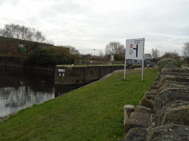
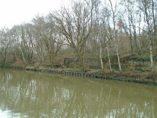
Starting Point - Wakefield Kirkgate Station. Finishing Point - Dewsbury Station. Distance - 12 Miles
Current Map 1938 Map
The Aire & Calder navigation had made the River Calder navigable to Wakefield and in the mid 18th Century the Calder & Hebble Navigation scheme engineered by John Smeaton extended the navigable waterways to Sowerby Bridge. More detail of the scheme can be read on the Wikipedia article.
The section from Wakefield to Dewsbury makes an interesting walk with most of it having decent tow paths and interesting sights related to the industrial heritage of the route on the way.
South of Wakefield Kirkgate station an interesting sight from long before the industrial revolution is the Grade 1 listed Chantry Chapel of St Mary the Virgin from the 14th Century. In medieval times bridge chapels were a common site, however there are now only four left in the UK and this one is said to be the most ornate. More information can be found on the Wikipedia article.
Above - Chantry Chapel of St Mary the Virgin
Turning a river in to a navigable waterway involved building sections of canal with locks alongside the river in order to gain height. The first section of canal is the Fall Ings Cut section just south of Wakefield Kirkgate station. This section bypasses a wier just west of the medieval bridge.
The tree lined canal was once surrounded by industries. The island created between the river and Fall Ings Cut is sheding its image of industrial dereliction with the Hepworth Gallery providing a notable tourist attraction while the former worsted mill of Rutlands Mill is being regenerated as a mixed use development.
It is neccessay to cross the River Calder, either on the medieval bridge or the new one next to the Hepworth Gallery as the towpath runs out. From Thornes Lane Wharf a few of the warehouses that once lined the river through Wakefield can still be seen.
The back of a bus depot can be seen, it is interesting to note that previously this was a tram depot.
Unfortunately (regardless of what Google maps says) the old towpath is no longer accessible beyond Thornes Lane Wharf so a detour along the roads is neccessary to Holme Lane where we rejoin at Thornes Lock where the next section of canal leaves the river.
On the far side of the canal and river at this point once stood the Hodgson & Simpson's Soap Works. The firm were taken over by Lever Brothers, now part of Unilever who manufacture several familiar brands, though the soap works here is long gone and nothing can be seen of it now as a modern health centre occupies the site.
Below - A steam locomotive built by John Fowler of Leeds seen on the soap works railway circa 1881. This is an unusual UK example of a type of locomotive mainly exported for use in sugar plantations overseas. (Photo - Michael R. Lane Collection - leedsengine.info)

After this section of canal we follow the river for a stretch. Alongside the river are a number of ponds, gravel and sand were extracted in this area. Where the railway line between Wakefield and Barnsley crosses the river we cross the river again, the footpath crossing is beneath the railway on a walkway between the bridge girders. Before crossing the river it is worth looking at at the former Charles Roberts wagonworks. Charles Roberts previously built railway wagons in Wakefield from 1856, moving here in 1873 and operating for a century before being taken over by Canadian wagon maker Procor in 1974. In 1990 it was taken over by Canadian train builder Bombardier and used to assemble Virgin Voyager trains in the early 2000s before closing in 2005. The plant is now divided in to several industrial units.
There is a cafe in the former Charles Roberts offices.
Having crossed 'in' the railway bridge we are on another island between the river and the next section of canal. Broad Cut Road puts us on the canal section.
Below - The railway crosses the canal section, looking at both sides of the railway bridge it can be seen how the original bridge has been later widened.
On the far side of the canal we see the remains of a coal staith. A railway once connected the staith to a few mines, extending to Caphouse Colliery which now forms the National Coal Mining Museum of England. Unfortunately if you are following this on the map, the colliery railway is split across a number of map sheets with the staith itself just making it on to the top left of this
1907 Map.
A short way along the canal a railway bridge crosses over. This is from the now abandoned Horbury and Criggleston Loop line. The large Healey Mills marshalling yard was once situated near Horbury and this line gave access to the yard for freight trains from the Sheffield and Barnsley direction without having to reverse at Wakefield.
Further along the remains of another railway bridge that has been removed can be seen. This is from another colliery railway, this one having connected Hartley Bank Colliery to the former Lancashire & Yorkshire Railway Line to the north.
At Horbury Bridge I found a section of the towpath closed for some maintenence work, this resulted in a lengthy detour along the roads to pick up the canal further along, however I did get to see some remnants of the Midland Railway line to Saville Town near Dewsbury.

This was part of a scheme to give the Midland its own route to Huddersfield and Bradford, though with running powers negotiated on the Lancashire Yorkshire Railway line it connected to at Thornhill it was never completed. The section from the Midland's main line at Royston to Thornhill and Saville Town was opened in 1906. With the grouping of the railways seeing the L&Y and MR both become part of the London Midland & Scottish Railway the route became an unneccessary duplication which was closed in 1950, quite a short lived line. The impressive viaducts here at Horbury Bridge and Calder Bridge survive, sadly not open to the public as footpaths. More information about this line can be found on the
Lost Railways of West Yorkshire website.
Below - Before returning to the canal I cross over the former Midland Railway line at Hall Lane, the line was in a deep cutting here but this has been filled in.
Below - I'm back on the canal and the bridge is still in situ from the former Midland Railway link to the L&YR at Thornhill.
Below - Mill Bank Lock

The canal is then crossed by another colliery railway line. Shown on the map as Ingham's Siding, this line connected Combs Colliery with the L&YR line and had a staith on the far side of the canal, which can still be seen.
Below - The Colliery Railway bridge, under the bridge the moorings for the coal staith can be seen on the left.
Below - A view at the top of the bridge after climbing up the embankment.
At Thornhill Lees Locks the Dewsbury Arm leaves the navigation, which continues through Brighouse and Elland to Sowerby Bridge (a future walk no doubt).
The Dewsbury Arm passes under the L&YR's main line and then under the former branch to Dewsbury Market Place station which diverged close to the canal junction. Dewsbury Market Place station closed in 1930 after the 1923 grouping of the railways. The line survived for goods traffic and a stub of it is still in use to serve a cement works.
Below - The former Dewsbury Market Place branch and the cement works connected to it.
The canal passes under another old railway bridge, this one long since disused as a railway but now in use with a footpath / cycleway. This was formerly used by the Great Northern Railway's Headfield spur that connected to the L&YR from it's own Dewsbury goods yards and its line through Dewsbury Central.
We then reach Saville Town Wharf, the end of the Dewsbury Arm of the canal and not far to walk to Dewsbury station for a train home. There are still several Victorian factories and warehouses in this part of Dewsbury that can be seen on the walk in to the town centre.


No comments:
Post a Comment