Starting Point - Meadowhall Interchange. Finishing Point - Wombwell station. Distance 15 Miles
To those with an interest in diesel shunters the name South Yorkshire Railway may bring back memories of the yard at Meadow Hall that through the 1990s housed a comprehensive collection of shunter types. The group had aspirations of running trains on the disused line towards Chapletown but faced an uphill battle against vandals. In the end they moved in 2001 to a new more secure site at Rowsley on Peak Rail where they operate to this day under the Heritage Shunter Trust name. More about this preservation scheme can be read on the
Heritage Shunter Trust history.
That disused freight line to Chapeltown was itself a stub of a through route of the South Yorkshire Railway. The original South Yorkshire Railway was in fact a network of several lines in the area that became part of the Manchester, Sheffield and Lincolnshire Railway and subsequently the Great Central Railway. This route linked Meadow Hall with Wombwell on its route through Barnsley to Doncaster. The line closed as a through route before the Beeching cuts. With the nationalisation of the railways in 1948 British Railways were operating several duplicating routes in the area and this line lost its passenger service in 1953, it survived for freight in to the early 1960s with stubs at either end lasting in to the 1980s. More about the route can be found on the
Wikipedia article.
My walk of the line began at the modern Meadowhall Interchange built to serve the Meadowhell, sorry, Meadowhall shopping centre. From a corner of the station car park the Blackburn Valley Trail begins and crosses over the bridge over Barrow Road. This was once the access to the preservation group site, where the hut was that sold the "day membership" tickets to visit the site is now a Travellodge hotel.
Below - The bridge over Barrow Road.
Just after this bridge another line crossed above us on a higher level, the Wincobank North Curve that connected the former Midland line to Barnsley to the line through Rotherham (Masborough). Though the viaduct is gone an abutment survives on the left.
Below - A look along the former Meadow Hall Yard
Below - The site back in 1994, only the wall on the left links the two images.
To the right of the former yard is an industrial building that has another connection with industrial shunting locomotives as it is the former Meadow Hall works of the Yorkshire Engine Co. The company produced steam locomotives and later diesel locomotives at the site between 1865 and 1965. Many of their locomotives were employed by the steel industry and some can still be found in use in steelworks around the country. More about the Yorkshire Engine Co can be read on the
Wikipedia article.
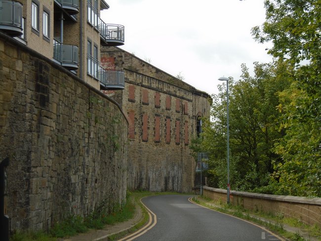
Below - The former Yorkshire Engine works. Looking at Google's arial views the rails are still in place through the two middle doors. When the preservation group were based in the sidings here any locomotives arriving or departing by lorry were unloaded or loaded in the former Yorkshire Engine Co yard.
Below - A pair of Yorkshire Engine Co shunters at nearby Aldwark near Rotherham.
On the left hand side of the yard stood a gas works. The gas holders have been removed in recent years but some of the pipes and the filled in footprints of the gas holders can still be seen.
Below - Another 1994 view of the site with the gasworks in the background.
After the former Yorkshire Engine works a line came in on the right, this was the connection to Sheffield Victoria station. This being a former Great Central route the passenger trains would have gone to Victoria station and the short stretch from the modern Meadow Hall station (on the former Midland route) would have just served as a freight connection.
At this point the line to Sheffield Victoria is overgrown but on the other side of the existing line to Rotherham the trackbed at the foot of the motorway viaduct is used by the Supertram.
After crossing over Fife street the South Yorkshire Railway's Meadow Hall station can be seen. The former station master's house seems to be occupied but the station buildings are boarded up.
On the left there was a connection in to the Trubrite works. The gates at the entrance to the works complex survive.
Though the works has been demolished the footbridge that spans the site still stands, though is fenced off.
The line follows Blackburn Brook, giving it the Blackburn Valley trail name. Where it crosses Grange Lane was the next station. The station master's house survives but the station buildings have been demolished.
Below - Former station master's house of Grange Lane station.
Below - A bit of Grange Lane's Wombwell bound platform edge visible in the vegetation.
Below - Surviving bridge carrying Butterthwaite Lane over the former line.
Approaching Ecclesfield we reach the end of the southern stub of the line that remained in use for freight in to the 1980s it served a works on the right hand side which has now been demolished. I seem to recall it was a concrete works but haven't been able to confirm this.
Below - Piles of sleepers from the former sidings in the works site.
Below - As the line crossed Loicher Lane was once the site of Ecclesfield station. The bridge survives but remnants of the station have gone.
There's a bit of a detour where an industrial estate is being constructed on the site of Smithy Wood Colliery but the Blackburn Valley Trail continues and a connection to the roundabout at Smithy Wood Drive and Cowley Way leads back on to the trackbed.
Below - Bridge carrying Cowley Hill over the trackbed.
The Blackburn Valley Trail ends at Coppice Rise, a street of modern houses built on the former Chapeltown goods yards. From here much of the route is on footpaths rather than paved cycle route. On the other side of Station Road a footpath runs alongside the former site of Chapeltown Central station. The station building has recently been bought and restored as a home.
Below - Section of wall and platform of Chapeltown Central station.
Below - Chapeltown Central station.
The footpath now runs through some quite thick woods for some distance and the trackbed is easily lost. On a few occasions I had to use the Google Maps app on my phone to pinpoint my location and compare old and modern maps. Also useful is
Open Street Maps which better shows the paths through Parkin Wood.
Below - View from the south portal of Tankersley Tunnel with the former Midland line below. Over the top of the tunnel sidings fanned out into Thorncliffe Colliery and the Newton Chambers factory which once had it's own extensive railway system.
Part of the site is now in other industrial uses. There are footpaths in the woods on various levels that would have been railways in to the work. I eventually found a path following the perimeter of the surviving works site that would have been the main railway trackbed, the standard BR concrete fence posts being a clue.
Below - After a bit of hunting around in the woods, the railway trackbed to the left in a slight cutting, marked by the concrete fence posts. The fence in the background is the edge of the industrial site.
On the other side of Thorncliffe Road the trackbed is shown as a cycle track on Google maps, running parallel to Churchill Way. This route continues in to Westwood Country park, again the woods have taken over the trackbed and surrounding industry so it was necessary to check location and compare maps a couple of times. The abutments of the bridge at Bridge Houses on the above map survive where the track following the former railway crosses the unmade road through the woods.
There has been some landscaping around the clearings in Westwood Country Park. The railway ran roughly where the woods end and the clearings begin. Occasionally it is clear that the path is following an old railway but some features have disappeared, most notably the site of Westwood Station which was on an embankment with a bridge next to it. Some of the embankments seem to have been levelled.
Below - Next to the roundabout on Westwood New Road (Westwood Main Road on the old map) a filled in railway bridge can be seen where the path pops out from the country park.
On the other side of the bridge a footpath follows the trackbed for a few yards before veering left and popping out on Maple Road. Following Maple Road as it turns right it passes the former railway route again. South of Maple Road the trackbed hasn't been built on but is private land, north of Maple Road it is lost under Wentworth Industrial Park. I followed a path through Potter Holes Plantation to New Road, where New Road meets Lidget Lane I found the trackbed again.
Below - Looking like it was a bridge carrying the road over the railway, this is in fact the bottom of a former abutment of a bridge that carried the railway over the road. On the opposite (west) side of that bridge was Birdwell & Hoyland Common Station, the site of the station was in the process of having housing built on it to form Rockley Grange.
In the old map a footpath can be seen alongside the railway after New Road. The footpath still follows the former rail route towards the Motorway but unfortunately a bridge wasn't built where the motorway crossed the former railway, instead the old footpath can be followed as it turns left and crosses under the motorway in a subway further up. The overgrown path pops out near the corner of The Walk and Sheffield Road.
Below - Obelisk near the corner of the Walk and Sheffield Road where the footpath leads to on the old map and still does today. This 1775 built Obelisk marks three miles to Wentworth Castle, details are shown on the
British Listed Buildings website.
The railway has disappeared in housing development around Birdwell. To pick up the trackbed again I went to Alverley Way, which was actually built on the former Midland Wharncliffe Branch and on to the path to the north of the industrial units off Rockingham Roundabout. A path turns right following the course of a link between the Midland and South Yorkshire Railways up to a subway under Dearne Valley Parkway. From that subway a path shown as a cycle track on Google Maps heads north east following the railway route.
Below - Back on former railway after the redevelopment around Hoyland and Birdwell. The trackbed looking from Shortwood Way.
After all the detours where the railway had been lost to redevelopment it is a relief to know that footpaths now follow it for the remainder of the route, though some of it has been landscaped since the railway closed with some of the embankments and cuttings levelled off. There is a slight dog leg in the path where Warwick Ward Machinery's yard occupies the former trackbed near Blacker Hill.
Below - A former stone window surround of a Methodist Chapel at the side of the former railway trackbed. Looking at the old maps I couldn't see where this had come from.
The path comes out on Station Road where it meets Wentworth Road, on the south side of the road was the site of Dovecliffe station. Today just a bit of platform edge in the vegetation survives.
From the site of Dovecliffe station we are on the northern stub of the line that survived in to more recent times. Just before the station a line went off to Barrow Colliery, though the site of that mine has been landscaped since. The colliery remained open until 1985 and the line between the colliery including the former SYR line remained open until 1986 to take coal to Wath sidings on the Barnsley to Doncaster line. Barnsley to Wath yard closed at the same time with the yard itself closing in 1988.
Below - Former platform of Dovecliffe station.
Below - Looking along the line at the site of Dovecliffe station.
On the north side of Station Road are remnants of a concrete building that stood alongside the railway, this is marked on the old map.
Below - Another small brick building that stood alongside the line survives.
The SYR route crossed over the Midland route near Wharncliffe Branch Junction. The bridge is no longer there and the path ends in the fencing at the abutment where the bridge over the Midland line once stood.
Below - looking towards the missing bridge over the Midland line.
The path resumes on the other side of the Midland line, to reach it it is necessary to head back to Station Road. Heading North on Station Road, the road crosses the former Great Central route from Silkstone Common which also closed in 1986 and is now a cycle route.
Below - On the way along Station Road passing the abutments of the Midland Railway's Wharncliffe Branch.
Below - The Great Central trackbed passing under the Midland Railway's viaduct.
At the site of Wombwell Main Junction a path leaves the tarmaced cycle route on the right and this leads to the path along the route we have been following back towards the site of the other side of the missing bridge over the Midland line. An old bridge survives crossing what was Crawshaw Lane on the old maps but is now a diverted Smithley Lane.
Below - Looking towards Wombwell Main Junction from the footpath between there and the site of the bridge over the Midland line.
Doubling back again to Wombwell Main Junction and another path goes to Smithley Lane following the Wombwell Main Railway. South of Smithley Lane the line and the colliery it served are all landscaped over and are now a farmer's field. The footpath shown on the old map leading to Aldham House Lane is still there though and from there the roads can be followed to Wombwell station on the former Midland route for a train home.