A short walk and a Canal Trip around Skipton

Above - The castle's gatehouse.
Skipton Castle is one of the best preserved medieval castles in England. Beyond the castle, Castle Wood also contains some interesting industrial relics. My visit began with a look around the castle itself. More information can be found on the Skipton Castle website. The website contains information about the castle's history so rather than repeat this I'll just include some of the pictures from my visit.
Below - The earliest phase of the castle, now a museum. To the right more modern phases of the castle still serve as private residences.

Below - The main entrance to the castle.

Below - The ruins of the chapel on the right and a carriage shed on the right. The buildings behind would have housed stables and other facilities to service the castle.

Below - The courtyard within the castle.

Below - Inside one of the towers. This shows how the castle was "slighted", the thickness of the walls was reduced as part of the agreement of surrender at the end of the Civil War. Most castles that picked the wrong side in the Civil War were largely ruined.

Below - View of the gatehouse from the castle. To the right the historic market square of Skipton can be seen.

Heading out of the castle, the road outside is called The Bailey. Just north of the entrance to The Bailey car park a narrow gauge industrial railway once ran alongside The Bailey from Skipton Rock Quarry above the village of Embsey to chutes for loading the stone in to barges on the Springs Branch canal at the back of the Castle. Where the railway met the road a stretch of the former railway trackbed survives as a private driveway in to the parts of the castle grounds that are still in residential use. There is no trace of the railway where it ran alongside The Bailey as the road will have been upgraded and widened since.
Below - Looking along the former trackbed from The Bailey. One of the two surviving bridges over the former railway can be seen.

Near the entrance to the car park a path in to Castle Woods crosses this bridge.
Below - View of the other surviving bridge from the above bridge.

Between here and where the railway, or tramway as it was called, met the canal branch it ran down an incline towards the end of the canal. This is now overgrown within the woods and is not accessible as it is on the part of the castle site still in residential use.
In Skipton Castle Woods the stream Eller Beck can be seen. The stream was adapted to better serve water powered mills around Skipton Castle. Large man made channels such as the Long Dam can be seen in the woods.
Below - One of the mad made weirs between the Long Dam and Eller Beck heading towards the mills of Skipton.

Below - An information panel next to the weir, click to enlarge.

Below - One of the artworks along the paths in Castle Woods.

Below - The former High Mill, now a holiday cottage.

Below - Looking north, this is where the path meets the former railway line again, it stood on the other side of the wall and this was where it met the canal branch. A narrow path runs between Eller Beck and the canal. The mechanism of a sluice between the beck and the canal can be seen on the left.

The canal was known as the Springs Branch or Thanet Canal, after Lord Thanet, the owner of Skipton Canal and the quarries the canal served. It was a 1773 built branch from the Leeds & Liverpool Canal and in 1785 the canal company took over the lease of the branch. The movement of stone by the tramway and canal carried on until 1946 when road haulage took over.
Below - The end of the canal can just be seen in the trees. A rock slip in 2016 closed the final stretch of the canal from Mill Bridge to boat traffic and it has quickly become overgrown since. On the far side of the canal, between the canal and the castle were chutes to load the boats from railway wagons.


Below - The rear of the castle seen across the overgrown end of the canal.

Below - An overflow from the Mill Dam to Eller Beck, a man made reservoir that allowed a consistent supply of water to reach the mills. Mill Dam above the waterfall shown below is the Mill Race for High Corn Mill which I'll come to shortly.

Below - The path between the beck and canal.

Below - High Corn Mill.

Below - A waterwheel fed by the higher Mill Dam discharges in to Eller Beck which passes under the mill.

Below - Mill Bridge passing over the Springs Branch canal.

Below - Information board about the canal branch (click to enlarge).

Below - High Corn Mill, now in various retail uses.

Below - Beyond Mill Bridge the canal is still navigable.

Below - Another sluice feeding the canal from Eller Beck.

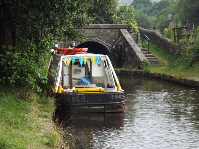
Below - Hire boats from Pennine Cruisers who have a boat yard at the junction with the Leeds & Liverpool Canal.

Below - Coach Street bridge looking from the canal junction.

Below - The canal junction and Pennine Cruisers' boat yard.

Below - Wharfs now in use by Skipton Boat Trips seen from Belmont Bridge.

Pennine Cruisers and Skipton Boat Trips offer short boat tours on the canals around Skipton. I went for a 30 minute tour with Pennine Cruisers (website), this starts by heading south towards the former Ilkley / Grassington railway bridge, now just used by stone trains from Rylstone Quarry.
Below - Maintenance barges next to the former Firth Shed cotton mill.


The 30 minute tour then takes the Springs Branch as far as it can, Mill Bridge, the current limit of navigation.
Below - Mill Bridge on the Springs Branch seen from the tour boat. Ahead the overgrown end of the canal can be seen, disused since stones fell in to the canal around the back of the castle.