Starting Point - Stoke on Trent station. Finishing Point - Congleton station. Distance 16.2 Miles

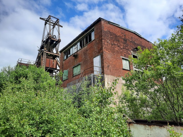
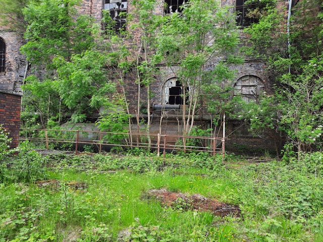
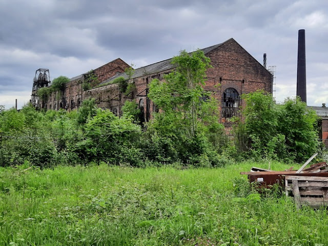
Chatterley Whitfield was the first colliery in the UK to produce a million tons of saleable coal in a year. It was the largest mine in the North Staffordshire Coalfield and today it is one of the largest surviving colliery sites in the UK. It closed in 1976 with its coal subsequently being extracted through Wolstanton Colliery. Within a few years a museum opened at the site offering tours of the mine workings. These tours had to be suspended in 1984 as the pumps and fans at Wolstanton Colliery were turned off following closure of that mine in 1981 and the salvage of equipment there. A new replica underground display closer to the surface opened in 1986 but the museum closed in 1993. Ownership of the site passed to Stoke on Trent City Council, though the council's interest in industrial history is largely confined to the pottery industry in the area. Fortunately key parts of the site were listed and scheduled as ancient monuments in 1993 preventing their demolition, though nature has been allowed to take over and the site is listed as "at risk" by Historic England and the Victorian Society. Should the buildings deteriorate until they are unsafe it could get to the stage where there is no option but to demolish them. Not helping the situation are urban explorers breaking in to the site to shoot videos for You Tube. A volunteer group was established to safeguard the site, the Friends of Chatterley Whitfield. They have established a heritage centre and memorial garden at the site and run monthly tours around the colliery site. More information about the
history of the colliery can be found on the
Friends of Chatterley Whitfield website.
I joined one of the guided tours, though to reach the site I travelled by bike from Stoke on Trent along the Caldon Canal and the trackbed of the Biddulp Valley Railway. After this tour I continued on the former trackbed to Congleton.
From Stoke on Trent station I cycled to Hanley Park which remains just as shown on the old maps. The Caldon Canal runs through the middle of the park, though with a much less industrial look to it these days more befitting to the park.
Below - The canal passing the bandstand and pavilion.
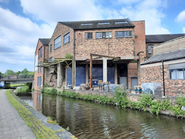
Below - Industrial buildings lining the canal.
Below - Lifting bridge taking Ivy House Road over the canal, replacing a similar structure shown on the old maps.
Below - Bridge taking Botany Bay Road over the canal.
Below - Bridge taking the former Biddulp Valley line over the canal. Track is still in situ at this point, though has disused since 1988. The route connected to the Leek branch which survived in freight use to Caldon Low Quarries. In the early 2000s there were proposals to reopen that route under the Moorlands and City Railway name but in the meantime nature has taken over the trackbed.
Below - The bridge taking Birches Head Road over the canal. It is at this point that the canal is left to join the railway which at this point runs alongside on the west.
Below - The level crossing still in situ on Birches Head Road. Thee path runs alongside the surviving single track on the west side.
Below - The disused track.
At the site of Milton Junction the footpath deviates a little to the west of the former railway but shortly returns to former trackbed though without track in place now as with the line towards Caldon Lowe branching off to the east this section closed earlier when coal traffic ended in 1977.
Below - The bridge carrying Leek New Road (A53) over the former railway. The bridge has been strengthened by building a pedestrian tunnel under the road, the brick of the original bridge can be seen above.
Ford Green & Smallthorne
Below - The former site of Ford Green station. Opened in 1864 and renamed Ford Green & Smallthorne in 1887. This route was predominantly a freight line and lost passenger services quite early. The station closed to passengers in 1927 and freight in 1964.
1899 Map (right hand side of map)
1941 Map (right hand side of map)
Chatterley Whitfield Colliery
The Biddulph Valley line passed Chatterley Whitfield Colliery to the west in a deep cutting. Since the colliery and railway closed the pit spoil tips have been levelled off and the area landscaped, leaving the railway cutting filled. The landscaped area around the colliery is now the Chatterley Whitfield Heritage Country Park.
Site plan of the colliery site on the Friends of Chatterley Whitfield website.
Below - View of the Chatterley Whitfield Colliery from the view point at the highest point of the landscaped tip.
Below - Remains of part of the conveyor system at the edge of the colliery site.
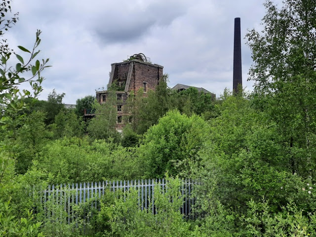
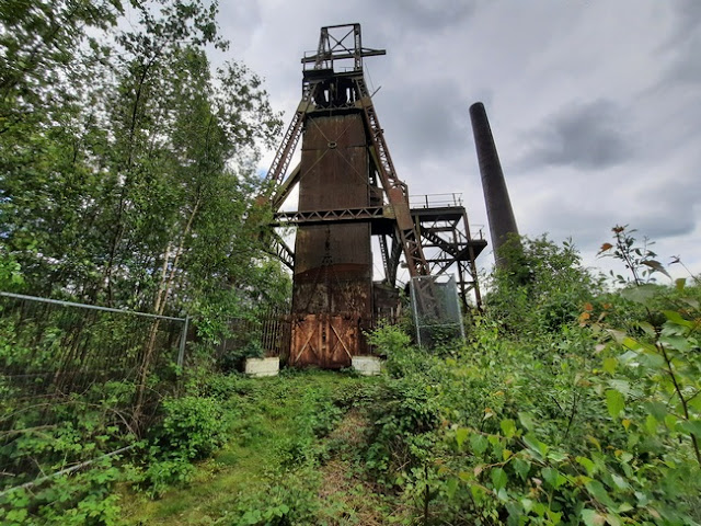
Below - The Winstanley Shaft with its unique surviving brick structure seen from outside the perimeter fence showing how nature has taken over the site since the museum closed.
Below - A surviving bit of railway track set in to the concrete.
Below - The art deco office building for the colliery built during modernisation work in the 1930s.
Below - The weighbridge on the right and the former museum car park.
Below - The former lamp room on the left, the former entrance to the museum.
Below - Former car parking.
Below - The pit head baths complex added in the 1930s. After the mining industry was nationalised in 1947 similar facilities were added to countless mines across the country.
Below - The start of the Friends of Chatterley Whitfield tour and the entrance from the heritage centre to the abandoned colliery site.
Below - The winding engine buildings for the Hesketh Shaft.
Below - One of the roadways around the site with the pit head bath building on the right. In the building were examples of maps and plans that the Friends have been digitising.
Below - A view through a window of part of the pithead baths complex currently sealed off for safty reasons.
Below - Entrance to the pithead baths building.
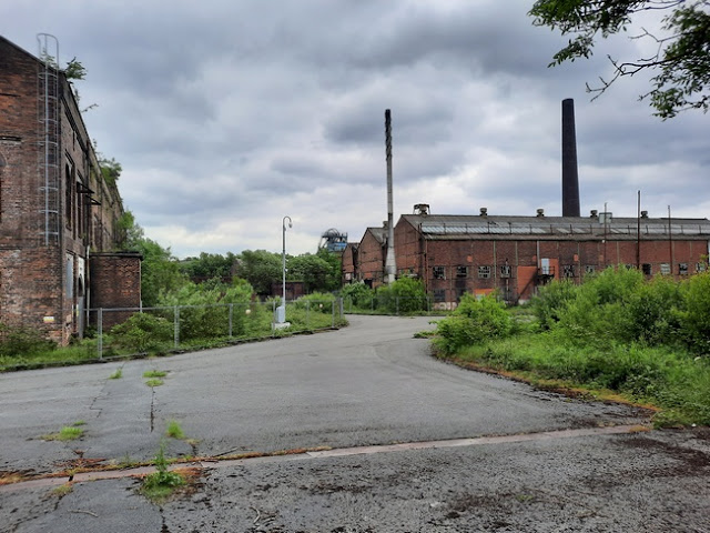
Below - Some of the workshop buildings of the colliery complex.
Below - The former lamp hut.
Below - The main entrance to the lamp hut. This was also the visitor entrance to the museum. One of the pillars of the canopy still has the stop sign for the shuttle bus that linked the museum with Stoke on Trent.
Below - One of the museum signs that would have adorned the building. It is now in a store building in to which many museum items went when the museum closed in 1993. The tour included this building which is next to the heritage centreat the end of the tour.
Below - One of the boiler houses which contained (and still does but is not accessible) a series of Lancashire boilers.
Below - Information board from the building seen in the store.
Below - The area shaft building.
Below - The Winstanley Shaft. On the right hand side a crater can be seen in the wall as the result of frost over winter dislodging the outer layer or bricks.
Below - The chimney at the back of the boiler house shown earlier on the left and the chimney of the Hesketh Shaft on the right.
Below - The headgear for the Institute Shaft.
Below - Remains of an electric auxhiliery winder.
Below - The Walker Fan House.
Below - An earlier fan house and workshop buildings.
Below - The institute shaft headgear.
Below - The Platt Shaft head gear.
Below - The Platt winding house.
Below - The Hesketh Heapstead and head gear.
Below - An upturned coal tub.
Below - Railway tracks from the workshop building looking towards the Hesketh Shaft.
Below - The workshop building. In museum days this part of the workshops contained a locomotive display featuring working steam and diesel locomotives which could operate on a piece of demonstration track. In colliery days the locomotives were kept in a shed at the western edge of the site but would come here for major maintenance work.
The winding engine and boiler house building for the Hesketh Shaft
Below - Headgear for the Hesketh Shaft with the coal screens behind.
Below - Next to the Hesketh boiler house a boiler can be seen, though it looks to be an old boiler re-used as a compressed air receiver.
Below - A set of man riding cars outside the store building.
Below - Coal tubs outside the store building.
Below - Another view of the Hesketh Shaft winding engine and boiler house building.
Below - In the store building some relics of the time as a museum can be seen. When the museum was closed many items were sold off. Some items went to Caphouse Colliery near Wakefield which has since served as the National Coal Mining Museum for England.
Below - A couple of the three English Electric battery locos in the store.
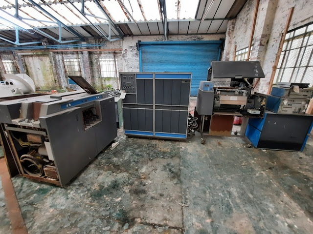
Below - Computer equipment used in the mining industry.
Below - Some British Coal signage.
Below - A steam winch.
Below - A tub cage.
Below - At the visitor centre a demonstration of mine workings has been set up above ground.
The tours are certainly to be recommended, or even just visiting the heritage centre from which many of the colliery buildings can be seen through the fence. This will help the efforts to preserve the site, unlike encouraging the You Tube urban explorers who are vandalising the site to gain access and risk giving the council the excuse to demolish buildings if an accident should lead to them being deemed unsafe.
After my tour ( and tea and cake in the heritage centre) I returned to the Biddulph Valley Way to continue north to Congleton.
Chell Halt
A halt was provided for workers travelling to and from Chatterley Whitfield colliery. The site of this can't be seen now as the cutting for the Biddulph Valley line was filled in when the waste tips were levelled. Chell Halt was only in use between 1890 and 1923 and was only used by mine workers so was not advertised in timetables and is not shown on the maps.
Below - Looking towards the colliery. The path heading east - west follows the course of a railway that went to Tunstall where it met the Potteries Loop line, also part of the North Staffordshire Railway. Prior to the 1930s improvements at the colliery the company had its offices at Tunstall and a weekly pay train would bring the wages to the mine. The bridge takes that path over Ford Green Brook, the railway was just beyond the bridge.
The Biddulp Valley Way runs to the west of the former railway route until it rejoins the trackbed where the path crosses the A527 on a footbridge.
Black Bull
Below - A picture of Black Bull station in 1962 from Wikipedia
(details)
Black bull also closed to passengers in 1927 and goods in 1964, though coal traffic passed through until 1976. The spoil tip in the background has been levelled and the area landscaped, the railway cutting has been filled and the path now runs over the top of the filled in cutting so there is no trace of the station.
1899 Map
Knypersley Halt
Knypersley Halt was only in use between 1914 and 1927 so did not make it on to any of the old maps available.
Below - The halt was situated south of the bridge taking Newpool Road over the railway so to the left of the shot. There is no trace of the station but the bridge survives.
Biddulph
Below - The former Biddulph station. This too saw use between 1864 and 1927, it closed to goods in 1964 with through freight traffic continuing until 1976. The site of the goods shed is now occupied by the car parking on the right.
Below - The footbridge north of Biddulph station shown on the old map, the metal structure seems to be made from old rail.
Below - The bridge taking Mow Lane over the railway. The bridge span seems to be a much newer construction on the original abutments.
Mossley Halt
Mossley Halt was only operational between 1919 and 1925 and doesn't show on the old maps. It was located south of the bridge over Reades Lane.
Below - The bridge over Reades Lane, the station would have been on the other side of the bridge.
A footpath from the Biddulph Valley Way leads up to the Macclesfield Canal, this path follows the route of a siding that served a canal basin. The siding doesn't show on the old map but it can be seen from the earthworks where it was.
Below - The canal basin can still be seen.
Below - The canal seen crossing over the railway.
Below - Returning to the Biddulph Valley Way this is the aquaduct taking the canal over the former railway. The lower section in the middle of the bridge being where the canal runs.
Just after the canal crossing a chord linked the Biddulph Valley line to the North Staffordshire Railway's mainline to Macclesfield where it connected to the London & North Western Railway to Manchester. A footpath follows the course of this before joining the canal towpath.
Below - Former farm access bridge over the railway.
Below - Bridge carrying Bromley Road over the railway.
Brunswick Wharf
The line terminated at Brunswick Wharf goods yard (not a passenger station). The yard closed in 1968 and the site is now a council depot. Housing has been built on the site of the gravel pits that provided some of the traffic for the yard.
Below - The former Brunswick Wharf goods yard, some of the walls of the yard survive.
From Brunswick Wharf I followed the roads to Congleton station.
Congleton
Below - The station building at Congleton.
Below - The former goods shed, now in retail use.
From Congleton I got a train back to Manchester for a train home.




















_-_geograph.org.uk_-_1810541.jpg)


