Starting Point - Bury Interchange. Finishing Point - Bolton Station. Distance - 6 Miles
To travel by rail from Rochdale to Bury or Bolton now involves heading south into Manchester to get either a tram or a train north, either journey being two sides of a triangle and a considerable distance compared to the direct route that used to connect them.
The line between Bury and Bolton was promoted as the Liverpool & Bury Railway, the primary reason for the line being to move freight between the mills and factories of the region and the port of Liverpool. By the time the line opened in 1848 it had become part of the Lancashire & Yorkshire Railway who had also built the link from Bury to Rochdale.
The closure of the line came later than most of the Beeching closures. It wasn't proposed for closure in Beeching's report but BR tried repeatedly to close it from 1964, it finally closed in 1970.
The line diverged at a triangular junction south of Castleton station just south of Rochdale. As far as Bury the route is now part of the East Lancashire Railway and passenger services are operated from Heywood to Bury and then north to Rawtenstall on the former Baccup line. I therefore pick up the former route in Bury.
Bury Knowsley Street
Rail Map Online view (heading west from Bury)
1939 Map
Bury had two stations, the Rochdale to Bolton line was served by Bury Knowsley Street station while other routes used Bury Bolton Street station, just the latter survives of the two. In the 1980s a new Bury Interchange station was created north of the site of Knowsley Street, this used the former goods chord, the "Bury Loop" before heading north to cross the site of the demolished Knowsley Street station at a right angle. Originally this involved a flat crossing as the line to Rawtenstall served a coal depot in to the 1980s. When the East Lancashire Railway reopened the section from Bury Bolton Street to Heywood it had to build a steeply graded flyover to cross the line in to Bury Interchange which is now part of the Metrolink tram network. The railway flyover and a multi storey car park occupy the site of Knowsley Street station today. The Disused Stations page has much more information about Knowsley Street station.
Below - Looking west from Knowsley Street bridge. The station was on the other side of the bridge but nothing remains of the station. On the west side of the bridge the East Lancashire Railway's line curves right on the course of the Bury East Fork in to Bury Bolton Street station.
The trackbed under the bridge is higher than it used to be in order to gain height for the flyover. Originally another line carried straight on towards Bolton, this crossed under the line from Manchester. Since the line from Manchester was diverted in to Bury Interchange the line south out of Bury Bolton Road today is just used by the East Lancashire Railway to access the Buckley Wells engine shed seen on the old map which has been used by the ELR since BR ceased using it when the Bury line was converted to a tram route.
Open Street Map (starting at the top right and heading to the bottom right)
The path along the former line towards Bolton is accessed off Belle View Terrace, the first leg of the path is known as the Daisyfield Greenway.
Below - Looking south from the footbridge over the railway. On the left the site of Buckley Wells Coal Siding has been used for additional shed space for the ELR. Behind it is the original engine shed still in use to maintain steam locomotives today.
Below - The Daisyfield Greenway joins the former trackbed as it crosses over the Daisyfield Viaduct.
Below - The former New Victoria Mills seen from the viaduct.
Below - Looking back along the viaduct towards Bury.
Below - The site of the Florence Nightingale Hospital for infectious diseases is now the Cygnet Hospital, the bridge that took the access to the hospital over the railway survives. On the right is the bridge span over the former Bury Corporation Gas Sidings.
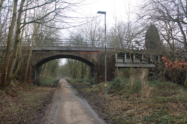
Below - The former Coal Pit Lane bridge, now the Bury - Bolton Cycleway. The path takes a little detour off the former railway to the south here.
Radcliffe Black Lane
1939 Map (starting in top middle of page)
Just before the site of Radcliffe Black Lane station the path leaves the railway again, emerging on Hardman Street.
Below - The former Black Lane Mills seen from Hardman Street.
Below - The site of Radcliffe Black Lane station where the green buildings now stand. The wall along the access to the platform off the bridge can be seen.
Across the road from the former station the Railway Hotel survives. Wilton Lane, Leander Close and Codrington Way occupy the former trackbed
Below - At the end of Codrington Way the trackbed becomes a footpath again and the bridge that took the access to Moss Shaw Farm over the railway survives. This was the site of Bradley Fold Junction, a chord from Radcliffe on the line from Manchester to Bury joined here. Much of this route to what is now the Radcliffe tram stop is also a footpath.
Below - Remnants of the Bradley Fold Works, the site of which is now the Bradley Fold Trading Estate.
Bradley Fold
Below - Looking back towards Bury, Bradley Fold station was across the road. There was a level crossing here and a footbridge. The Queens Hotel survives and can be seen on the left.
Below - The Queens Hotel Bowling Green, this sign would have been see from passing trains. On the right of this view looking towards Bury was the goods yard. From this point the line had a section of four tracks, an indication of what a busy route it had been.
From the side of Bradley Fold station a stretch of the trackbed has been built on, a slight detour is necessary on Boundary Street and Boundary Drive, from Boundary Drive a path returns to the former of the railway.
Below - Remnants of a concrete line side structure.
Below - A mile post found in the vegetation at the side of the trackbed.
Below - The footings of the footbridge shown on the above map, this was on the four track section with two tracks between the piers and tracks either side.
A football club has been built across the former trackbed and this means taking the path around the north of the football club to Hollycroft Avenue. From Hollycroft Avenue a path along the backs of the houses runs alongside the trackbed which was in a cutting at this point.
Below - The overgrown cutting and the bridge taking Long Lane over the line.
From Long Lane a path runs alongside the trackbed to Gorses Road.
Below - The bridge carrying Top O' The Lane, now part of Gorses Road over the former railway.
From Gorses Road the path returns to the former railway for the highlight of the journey, two grand viaducts. It is worth taking a detour to look at the viaducts from ground level.
Below - Darcy Lever viaduct seen from Woodside Place.
Below - Darcy Lever Viaduct towering over Lever Bridge Mills.
Darcy Lever
After crossing Lower Darcy Street on a modern footbridge the site of Darcy Lever station is reached. More about this station can be found on the
Disused Stations page.
Below - The site of Darcy Lever station looking towards Bolton, nothing remains of the former station.
Below - On the approach to Burnden Viaduct a section of cast iron railing can be seen at the side of the former trackbed.
Below - Burnden Viaduct seen from the path alongside the west side of St Peters Way which now runs under the viaduct, the River Croal has been culverted beneath the road.
The path off the viaduct emerges on to Scholey Street. A supermarket and other retail units have been built on the site of the triangular junction with the main line through Bolton. From here I walked to Bolton station for my train home.


No comments:
Post a Comment