BROWSE JOURNEYS BY MAP VIEW

Saturday, 29 April 2023

Bury to Bolton Railway

Starting Point - Bury Interchange. Finishing Point - Bolton Station. Distance - 6 Miles

To travel by rail from Rochdale to Bury or Bolton now involves heading south into Manchester to get either a tram or a train north, either journey being two sides of a triangle and a considerable distance compared to the direct route that used to connect them.

The line between Bury and Bolton was promoted as the Liverpool & Bury Railway, the primary reason for the line being to move freight between the mills and factories of the region and the port of Liverpool. By the time the line opened in 1848 it had become part of the Lancashire & Yorkshire Railway who had also built the link from Bury to Rochdale.

The closure of the line came later than most of the Beeching closures. It wasn't proposed for closure in Beeching's report but BR tried repeatedly to close it from 1964, it finally closed in 1970.

The line diverged at a triangular junction south of Castleton station just south of Rochdale. As far as Bury the route is now part of the East Lancashire Railway and passenger services are operated from Heywood to Bury and then north to Rawtenstall on the former Baccup line. I therefore pick up the former route in Bury.

Bury Knowsley Street

Rail Map Online view (heading west from Bury)

1939 Map

Bury had two stations, the Rochdale to Bolton line was served by Bury Knowsley Street station while other routes used Bury Bolton Street station, just the latter survives of the two. In the 1980s a new Bury Interchange station was created north of the site of Knowsley Street, this used the former goods chord, the "Bury Loop" before heading north to cross the site of the demolished Knowsley Street station at a right angle. Originally this involved a flat crossing as the line to Rawtenstall served a coal depot in to the 1980s. When the East Lancashire Railway reopened the section from Bury Bolton Street to Heywood it had to build a steeply graded flyover to cross the line in to Bury Interchange which is now part of the Metrolink tram network. The railway flyover and a multi storey car park occupy the site of Knowsley Street station today. The Disused Stations page has much more information about Knowsley Street station.

Below - Looking west from Knowsley Street bridge. The station was on the other side of the bridge but nothing remains of the station. On the west side of the bridge the East Lancashire Railway's line curves right on the course of the Bury East Fork in to Bury Bolton Street station. 


The trackbed under the bridge is higher than it used to be in order to gain height for the flyover. Originally another line carried straight on towards Bolton, this crossed under the line from Manchester. Since the line from Manchester was diverted in to Bury Interchange the line south out of Bury Bolton Road today is just used by the East Lancashire Railway to access the Buckley Wells engine shed seen on the old map which has been used by the ELR since BR ceased using it when the Bury line was converted to a tram route. 

Open Street Map (starting at the top right and heading to the bottom right)
The path along the former line towards Bolton is accessed off Belle View Terrace, the first leg of the path is known as the Daisyfield Greenway.

Below - Looking south from the footbridge over the railway. On the left the site of Buckley Wells Coal Siding has been used for additional shed space for the ELR. Behind it is the original engine shed still in use to maintain steam locomotives today.


Below - The Daisyfield Greenway joins the former trackbed as it crosses over the Daisyfield Viaduct.


Below - The former New Victoria Mills seen from the viaduct.


Below - Looking back along the viaduct towards Bury.

Below - The site of the Florence Nightingale Hospital for infectious diseases is now the Cygnet Hospital, the bridge that took the access to the hospital over the railway survives. On the right is the bridge span over the former Bury Corporation Gas Sidings. 


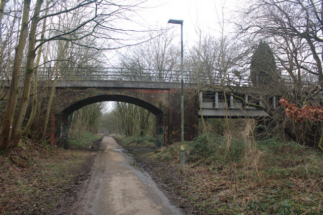
Below - The former Coal Pit Lane bridge, now the Bury - Bolton Cycleway. The path takes a little detour off the former railway to the south here.


Radcliffe Black Lane

1939 Map (starting in top middle of page)
Open Street Map (starting at the top right corner of the map)

Just before the site of Radcliffe Black Lane station the path leaves the railway again, emerging on Hardman Street.
 
Below - The former Black Lane Mills seen from Hardman Street.


Below - The site of Radcliffe Black Lane station where the green buildings now stand. The wall along the access to the platform off the bridge can be seen. 


More about Radcliffe Black Lane station can be found on the Disused Stations page.
Across the road from the former station the Railway Hotel survives. Wilton Lane, Leander Close and Codrington Way occupy the former trackbed


Below - At the end of Codrington Way the trackbed becomes a footpath again and the bridge that took the access to Moss Shaw Farm over the railway survives. This was the site of Bradley Fold Junction, a chord from Radcliffe on the line from Manchester to Bury joined here. Much of this route to what is now the Radcliffe tram stop is also a footpath.


Below - Remnants of the Bradley Fold Works, the site of which is now the Bradley Fold Trading Estate.


Bradley Fold

More information about the next station stop I passed can be found on the Disused Stations page.
Below - Looking back towards Bury, Bradley Fold station was across the road. There was a level crossing here and a footbridge. The Queens Hotel survives and can be seen on the left. 


Below - The Queens Hotel Bowling Green, this sign would have been see from passing trains. On the right of this view looking towards Bury was the goods yard. From this point the line had a section of four tracks, an indication of what a busy route it had been.


From the side of Bradley Fold station a stretch of the trackbed has been built on, a slight detour is necessary on Boundary Street and Boundary Drive, from Boundary Drive a path returns to the former of the railway.

Below - Remnants of a concrete line side structure.


Below - A mile post found in the vegetation at the side of the trackbed.


Below - The footings of the footbridge shown on the above map, this was on the four track section with two tracks between the piers and tracks either side.


Open Street Map (starting at the middle right of map and heading left)

A football club has been built across the former trackbed and this means taking the path around the north of the football club to Hollycroft Avenue. From Hollycroft Avenue a path along the backs of the houses runs alongside the trackbed which was in a cutting at this point.

Below - The overgrown cutting and the bridge taking Long Lane over the line.


From Long Lane a path runs alongside the trackbed to Gorses Road.
Below - The bridge carrying Top O' The Lane, now part of Gorses Road over the former railway.


From Gorses Road the path returns to the former railway for the highlight of the journey, two grand viaducts. It is worth taking a detour to look at the viaducts from ground level.

Below - Darcy Lever viaduct seen from Woodside Place.


Below - Darcy Lever Viaduct towering over Lever Bridge Mills.


Darcy Lever

After crossing Lower Darcy Street on a modern footbridge the site of Darcy Lever station is reached. More about this station can be found on the Disused Stations page.

Below - The site of Darcy Lever station looking towards Bolton, nothing remains of the former station.


Below - On the approach to Burnden Viaduct a section of cast iron railing can be seen at the side of the former trackbed.


Below - Burnden Viaduct seen from the path alongside the west side of St Peters Way which now runs under the viaduct, the River Croal has been culverted beneath the road.


1947 Map (bottom right of map)

The path off the viaduct emerges on to Scholey Street. A supermarket and other retail units have been built on the site of the triangular junction with the main line through Bolton. From here I walked to Bolton station for my train home.

Saturday, 15 April 2023

Central Parks, Preston

Starting Point - Bamber Bridge Station. Finishing Point - Preston Station. Distance 6 Miles

South of Preston station was once quite a network of railway lines with four triangular junctions. Many of the routes that have been closed are now footpaths and cycle routes within Preston's Central Parks.
Open Street Map (starting at the bottom right corner of the map)

Bamber Bridge

I started at Bamber Bridge, having arrived there on my walk of Preston's Old Tram Road. The line through Bamber Bridge survives on the route from Preston to Blackburn, this line was part of the East Lancashire Railway which became part of the Lancashire & Yorkshire Railway. The L&Y shared Preston station with the London & North Western Railway. Platforms 8 to 13 on the east side of Preston station (of which 8 and 9 survive and are now numbered 6 and 7) served the East Lancashire lines. These days trains through Bamber Bridge pass through Lostock Hall, cross over the former LNWR line and join it via the Farington Curve to reach Preston with many of the trains using platforms 1 and 2 on the west side of Preston as they turn off to head west to Blackpool just north of the station.
West of Bamber Bridge station disused sidings survive at the site of the junction. The trackbed of the abandoned route from Bamber Bridge to Preston can be accessed next to the roundabout connecting Brownedge Road to the A6. The connection between Brownedge Road on the east side of the roundabout is built on the course of the railway. Looking at the old maps this is close to the site of the bridge where the railway crossed Green Lane.

Below - The first triangular junction, this view is taken from what the old maps show as Junction Bridge looking back towards Bamber Bridge on the left. On the right is the site of the former Preston Junction Fork that had a west facing connection to the surviving line near Lostock Hall. This chord is also a footpath, emerging at the bridge where Brownedge Road crossed the railway. At the time of my visit the path seemed quite flooded. 


The site of the bridge carrying Todd Lane over the railway has been filled in, the path climbs to road height.

Preston Junction / Todd Lane Junction

Where the path descends back to track level was the site of Preston Junction station. Renamed Todd Lane Junction in 1952, the station was closed to passengers in 1968 and the line closed completely in 1972. The station had an island platform accessed by steps from the bridge.

Below - The site of Preston Junction station. The building on the right looks like it was likely the station master's house.


Below - Information board at the site of the station.


Below - Leigh Brow bridge from road level. Note the concrete fence posts at track level on the left which were typical of industrial sites, this was the location of the rail connection in to Lostock Hall Gas Works.


Below - A concrete lamp post at the site of the interchange sidings for the gas works. The gas works doesn't appear until the 1946 map.


The path along the railway meets the path along the Old Tram Road which also continues into Preston. The two lines came close to each other but didn't connect, the tram road was a 4' 3'' plateway. At the junction I headed left to stick to the railway.

Open Street Map (starting at the bottom right corner of the map)

Coming to the next triangular junction, this was where the East Lancashire lines were connected to the West Lancashire lines via another triangular junction on the other side of the L&NWR line. The bridges on two sides of that triangle over a footpath have been demolished so the footpath descends the embankment to that footpath.

Below - Site of the bridge under the line in to Preston. 


Below - Site of the bridge under the Whitehouse Junction line.


I headed west on the Whitehouse Junction line to see some of the West Lancashire lines connections in to Preston.

Below - At the site of Whitehouse West Junction the line passed under the L&NWR route, now the West Coast Main Line.


The bridge over Leyland Road and the embankment between there and Stricklands Lane have been removed and the site built on. The path descends to road level on Leyland Road, from there I walked to Stricklands Lane.

Below - Abutments of the bridges on the west side of Stricklands Lane. There would have been two bridge spans as this was the eastern point of another triangular junction. This triangle was known as Penwortham Junction. South of the former triangular junction the A59 uses the former railway trackbed through the south of Preston. 


Within the former triangular junction is a caravan park accessed by a road at the site of the footpath shown on the old map, the bridge has been removed. The site of the west side of the triangle is shown as a footpath, though the path was closed with signs mentioning flood defence work dated several months previously.
 
Below - The bridge abutments for the bridge over Leyland Road north of the triangular junction survive.


Below - Remains of the West Lancashire Railway viaduct over the River Ribble. The bridge deck has been removed and the piers are now used to carry pipes over the river.


Preston (West Lancashire)
The West Lancashire Railway had its own station in Preston until it was taken over by the L&YR and services were diverted in to their East Lancashire lines platforms at Preston by 1902. From the viaduct over the river the line approached the station on embankment and viaducts at the height of the first floor windows on the surrounding houses. After closure the former station was used to stable coaching stock until closed completely in 1965. The station was demolished in the late '70s and the area levelled and redeveloped in the '80s. A park and footpath now occupies the site of the station approaches, though at ground level. More information about the station can be found on the Disused Stations article.
Below - Site of the approach to Preston (West Lancashire) station which stood where the houses are in the background at first floor height.


I Retraced my steps to Whitehouse West Junction to follow the former L&YR  / East Lancashire Railway route in to Preston.

Below - The site of Whitehouse West Junction. On the right is the route from Bamber Bridge I followed earlier. On the left is the route towards Preston. On both routes the bridges survive carrying the former lines over a footpath.


The chord heading towards Preston was added when the L&YR took over the West Lancashire Railway to allow it to divert trains in to their platforms at Preston.
Between Whitehouse North Junction and Preston a couple of culverts over a meandering stream and a bridge allowing access between various sports fields either side of the railway survive. The most significant piece of engineering work is the bridge over the River Ribble. When the railway was still in use the bridge also carried a footpath on the eastern side. The bridge is still a public footpath, though pedestrians can now walk where the tracks once ran.


North of the river the railway was the divide between Miller Park and Avenham Park, it is now a useful path connecting both. The railway passed under a bridge on East Cliff to emerge in to Preston Station. There is still a bridge at this point though the original bridge that spanned the railway has recently been replaced. I found a new fence between the edge of the park and the station car park at Preston that now occupies the site of the East Lancashire Lines.

Below - The modern East Cliff bridge spanning the former railway lines on the old abutments.


Preston
At Preston station platforms 6 and 7 and the roof span over them are shorter than the other through platforms, this is because the East Lancashire lines curved east towards the line I've just walked. On the east side of the surviving part of the station there were a further couple of through platforms and a couple of south facing bays between them, these platforms curving towards the East Cliff bridge. The site of these platforms is now all station car parking. The L&YR had its own station entrance and buildings on Butler Street. The land previously occupied by the Butler Street goods yards is now occupied by the Fishergate shopping centre and its car park. More information about Preston station can be found on the Preston Station Past and Present website.
South of the station the Park Hotel had a long covered footbridge to the station. The hotel is no longer a hotel and the building has seen used as offices so the bridge has long since been removed.
Below - Abutment of the footbridge that connected the station to Park Hotel, the building of which can be seen in the background.


Saturday, 1 April 2023

Preston's Old Tram Road

Starting Point - Preston Station. Finishing Point - Walton Summit. Distance 5 Miles.

The Preston Old Tram Road was a 4ft 3in gauge plateway, having L shaped rails on which flangeless wheels could run. It was built as a temporary substitute for a canal until funds could be raised to extend the Lancaster Canal to meet the Leeds & Liverpool Canal, a scheme that required extensive engineering works. The tram road opened in 1803 and ten years later the conversion of the route to a canal was still beyond the means of the company. In the end the coming of the railways meant the canal would never be built and the tram road (like many canal systems) was taken over by a railway company and wound up in the 1860s and 1870s. Much of the route from Preston to Bamber Bridge passed to the local authority for use as a footpath and remains as such today. More about the history of the tram road can be found on the Wikipedia article


On the above old map the coal wharfs can be seen just north of the main Fishergate street. The main purpose of the tram road was to bring coal from the Leeds & Liverpool Canal for transhipment north. On the north side of the coal wharf the rail connection to the coal yard from the railway through Preston's stations (the site of the current station and West Coast Main Line) can be seen. This connection allowed coal to reach Preston and the Lancaster Canal by rail and ultimately made the Old Tram Road obsolete. The site of the coal wharf is now an Aldi supermarket and retail park.
The tram road passed under Fishergate in a single track tunnel, this was widened after the tram road closed for use as a road access to the railway goods yards next to the station. Than tunnel survives as access for the Fishergate shopping centre car parks.

Below - The tunnel under Fishergate today.


I walked to Fishergate and Mount Street. On Mount Street I photographed the derelict hospital building below.

At the end of Mount Street is Garden Street and one of the walls of the tram road bridge over Garden Street survives.
Below - Abutment of the Garden Street bridge.


On the opposite side of the road Victorian houses have been built on the course of the track, a reminder of how long it is since the route closed.
The route can be picked up again in Avenham Park, it route along the northern edge of the park and the route survives as a path along the northern edge of the park.

Below - The Belvedere Pavilion was built on the site of the winding engine for a rope worked incline.


Below - Looking up the former rope worked incline.


At the foot of the incline the tram road crossed the River Ribble on a wooden trestle bridge. This survived long after the closure of the tram road for use as a footpath but the wooden trestles were replaced with concrete beams in 1938 and the deck replaced with concrete in the 1960s so although it has the look of the old trestle bridge there is little of the original bridge now. The bridge was closed in recent years due to structural concerns, in fact looking at the bridge it was clear at least a couple of the concrete beams were missing altogether. Plans for the replacement bridge leave nothing off the table and could see the Tram Road Bridge replaced with a modern suspension bridge. With the Tram Road Bridge closed I had to make my way around to the other end of the bridge on the disused railway bridge on the west of it.

Below - The closed concrete bridge that has its origins in the wooden trestle Tram Road Bridge.


Below - The stone abutment and cast iron connections for the wooden trestles, replaced with concrete in 1938. These are probably the only remnants of the original bridge.


There are a set of steps up the embankment from the path along the riverside, at the top of the steps one of the stones was revealed to have been a stone sleeper from the tram road.


Below - A look south along the Old Tram Road.


Below - Where the footpath (seen on the old map at the top of the page) connecting to Winery Road joins the path along the Old Tram Road some more stone sleepers can be seen.


The tram road curved to the east close to meeting the later railway route from Bamber Bridge to Preston.
Below - The curve in the Old Tram Road route, the later railway line can be seen on an embankment to the left, now also a footpath.


Below - An information board where the paths along the railway and tram road connect.


The footpath leads out on to a road also called Old Tram Road entering an area redeveloped with modern houses as Walton Park. After crossing Carrwood Road the route of the line continues as a footpath through the modern housing.


The path emerges on to Todd Lane North. The tram road continued through a field on the east side of the road but is not accessible and is also shortly after severed by the A6.

Below - The embankment of the Old Tram Road through the field east of Todd Lane North.


I took the footpath off Todd Lane North which crosses the A6 and emerges on to Danesway. The tram road ran along the back of what are now the backs of the houses on Danesway. A footpath is shown there emerging on to St Mary's Avenue but I found in very overgrown. The exit on to St Mary's Avenue had also at some point been fenced over but it was possible to exit to the road.
The trackbed has been built over in this area. I followed the roads to Meanygate, where this crossed under the surviving railway line the tram road used to cross under at the same bridge. The bridge has since been replaced with a smaller bridge, probably when the railway above was widened to access sidings here.


Most of the remainder of the route has been built on. At the corner of Smithy Street and Station Road a building has an irregular shape having been built up to the trackbed, I was unable to photograph this due to construction work on the pavement outside.
I took the footpath alongside the surviving railway line from Cambridge Road to Brierley Road. Brierley Road joins end on to a road called Tramway Lane, though this is just to the north of the course of the tram road. Tramway Lane continues under the M65, emerging on to Clayton Brooke Road. Across the route a footpath follows the course of the tram road for the final stretch to Walton Summit. The path is on an incline and was presumably rope worked like that at Avenham Park but this is not shown on the map.

Below - Looking down the course of the tram road from Walton Summit.


Below - The site of the connection between the tram road and the canal onward to the connection to the Leeds & Liverpool Canal at Whittle Springs. There used to be canal basins, wharves and a warehouse here but it is now just a small park within the modern housing.
 

The route of the old canal is cut across by the M61, which is unfortunate as Open Street Map shows a surviving bridge over the former canal in a field just east of the motorway, otherwise it is mostly built on apart from a small stretch at the junction. It would have been quite a trek to check out these remnants so I instead returned to Bamber Bridge station, though not for a train home but to return to Preston by some of the other old railways in the area.