Starting Point - Penarth Station. Circular Walk. Distance - 5 Miles
Penarth
Rail Map Online view
The former Taff Vale Railway line from Cardiff to Penarth branches off the Barry line at Cogan and now terminates at a single platform in Penarth. Until 1968 it continued to Cadoxton where it met the surviving line to Barry again forming a loop known as the Taff Vale Railway Cadoxton Branch.
In the early 1900s Railmotors were operated to remain competitive with local buses. A few small halts opened to serve areas of housing between the existing stations.
1920 Map
Below - The remaining station at Penarth. On the left the former platform for trains towards Barry can be seen. In the foreground on the left the Railway Hotel still stands. Behind it the modern building of the Job Centre occupies the site of the station building.
Heading across the railway bridge to Plymouth Road the Railway Walk footpath leaves the road to join the railway trackbed to the south of the surviving station.
Below - The bridge that took Archer Road over the railway.
Alberta Place Halt
A footpath crosses the former railway linking Alberta Place to Westbourne Road, this was the site of Alberta Place Halt. Nothing remains of the simple station here.
Below - The bridge that took Augusta Road over the railway.
Below - Bridge that took Raisdale Road (built after the old map) over the railway.
Below - Bridge that took Forrest Road over the railway.
Lower Penarth Halt
Below - Bridge that took Brockhill Rise (the former access road to the station) over the railway.
The cycle path ends at Cosmeston Drive but a footpath continues to the next bridge over the former railway. Beyond this bridge the trackbed is private land, a path connects to the path over the bridge leading out to Lavernock Road. The houses off Cosmeston Drive are a modern estate occupying the site of the South Wales Portland Cement and Lime Works. This had extensive standard and narrow gauge sidings.
Below - Bridge that took the footpath over the railway.
Crossing Lavernock Road leads to the Cosmeston Lakes Country Park. The course of one of the narrow gauge rail links between the quarry and the cement works survives as the path sandwiched between the lake and the golf course.
Below - Course of the narrow gauge quarry line, in the ground on the left is a bit of rubble of a loading building.
Below - Course of the narrow gauge quarry line.
Below - A Hudson tipper wagon from the quarry railway displayed at the park visitor centre. The visitor centre also has a handy cafe and toilets.
Returning to the standard gauge railway it runs through private land on an embankment but a couple of bridges can be seen where it crossed roads.
Below - The bridge over St Mary's Well Bay Road.
Below - The former railway bridge over Fort Road (shown on the old map as Station Road.)
Just beyond the Station Road / Fort Road was Lavernock station. Like the railway trackbed at this point it is private property, a more modern house has been built on the station site. The two railway cottages survive, also looking at the satellite view on Google maps or Rail Map Online the platform edge can be seen.
Swanbridge and Sully
Since the railway closed a stretch of embankment has been removed and Cosmeston Road has been straightened out and widened. Stretches of trackbed survive either side of Sully but these are not open as footpaths. The bridge that carried the railway over Swanbridge Road survives, this was the site of Swanbridge Halt. At Sully the site of the railway has been mostly built over and the course of the railway is for much of the way through Sully the meeting point of gardens for properties built either side of the line.
Near the site of Biglis Junction where it joined the Barry route is a retail and industrial estate. The site of the junction is visible from a passing train as the formation widens and a pipe bridge survives over the removed branch line tracks.
Lavernock Fort
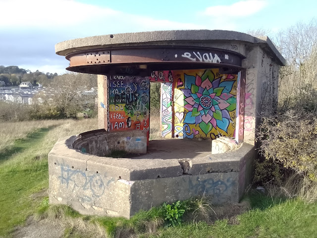
Rather than explore the scant remains around Sully I carried on along Fort Road to the remains of a World War 2 look out post and gun battery on the cliffs looking out over the Bristol Channel. At the entrance to the Marconi Holiday Park a footpath runs alongside the park towards the fort, nearer the fort it is evident that a concrete roadway has been built for the fort. The holiday park site would have been barracks to serve the fort, though originally wooden huts were used and these have long since been replaced.
Interesting the fort is not shown on the 1947 map above.
Below - Building seen at the entrance to the fort site.
Below - The remains of the gun batteries.
Below - The former search light emplacement further along the clifftop.
From Lavernock Fort I returned to Penarth via the cliff top path.


No comments:
Post a Comment