Round Trip Port Penrhyn to Bethesda. Distance 12 Miles
Below - One of the Hunslet saddle tanks that operated between Port Penrhyn and the quarries at Bethesda on the narrow gauge Penrhyn Quarry Railway, the standard gauge LNWR branch from the North Wales Coast line in to the dock can be seen on the right. (Photo on historypoints.org)

In the hills near the North Wales coast town of Bangor stands the village of Bethesda, home to Penryhn Quarry, once the largest slate quarry in the world. It is said that Bethesda roofed the world, it's slate being exported across the globe. The slate was largely exported from Port Penryhn, a pier and dock just east of Bangor. In 1793 famous canal builder William Jessop suggested the use of a waggonway from the mine to the port to help transport the slate and turn it in to the global product it became. The first waggonway opened in 1801 and was known as the Penryhn Railroad. It used horses for haulage and three balanced rope worked inclines on the steepest sections. In 1878 construction started on a route suitable for steam haulage, this opened a year later and was known as the Penryhn Quarry Railway. As well as these narrow gauge routes the London and North Western Railway built branches from its North Wales coast mainline to Port Penryhn from the east and to Bethesda from the Bangor direction.
The narrow gauge and standard gauge routes both closed in 1962 but a footpath and cycle route has been established from Port Penryhn to Bethesda, this follows the route of the Penryhn Quarry Railway as far as Glasinfryn where it crosses the A55, from there it follows the LNWR Bethesda branch.
With the various lines this could get complicated so I concentrated on the LNWR lines to Bethesda and the Penryhn Quarry Railway on the way back, deviating from the path were necessary. My account of the explore of these routes is broken up in to five sections.
1 - Port Penryhn
2 - Penryhn Railroad
3 - LNWR Port Penryhn branch
4 - LNWR Bethesda branch
5 - Penryhn Quarry Railway
More detail of the history can be read on the Wikipedia article about the Penryhn Quarry Railway (which also covers the earlier Penrhyn Railroad) and the article about the LNWR's Bethesda branch.
1 - Port Penrhyn
1914 Map
Below - Approaching Port Penryhn from the Bangor direction the first sight is this complex of buildings that date back to the days of this being a slate port, I believe they housed workshops. In the bottom right a length of narrow gauge track can be seen. Originally tracks ran in to a few of the buildings around the courtyard.
Below - This double arched bridge carried the road in to Lord Penryhn's estate and castle over the LNWR branch on the left and the Penryhn Quarry Railway on the right.
Penryhn Castle is well worth a visit. Mostly dating from 1822 - 1837 and built in a fashionable castle style of the time on the site of a medieval manor house which was crenellated in 1438 to technically become a castle. Aside from seeing the seat of quarry owner Lord Penryhn there is also a collection of industrial locos on display including Hunslet saddle tank Charles that worked the narrow gauge line here.
Below - The former narrow gauge engine sheds.
Below - The port offices.
2 - Penrhyn Railroad
Following the path through the road bridge soon brings us to the bridge over the River Cegin. The standard gauge and narrow gauge lines ran parallel and shared a bridge over the river. Alongside that bridge is a remnant of the 1801 horse drawn waggonway.
Below - The Penryhn Railroad's Cegin bridge.
South of the Cegin bridge the course of the 1801 line curves sharply, probably why the route was realigned here.
Below - An archway at the side of the path, most likely connected with the nursery that stood on the other side of it, the path through the nursery lines up with the horse drawn waggonway so this part of the waggonway was likely used as a footpath when the railway was diverted in 1878.
Below - Another bridge on the earlier waggonway.
Beyond here was the foot of the first incline "Port Incline." Incline Cottages are still standing at the top of the former rope worked incline but the incline and cottages are on private land. On the satellite maps the curve of the route can be seen up to where the A5 was built on part of the formation. South of the final incline, the Dinas Incline, the Penryhn Quarry Railway retained part of the 1801 alignment which I'll come to later.
3 - LNWR Port Penrhyn Branch
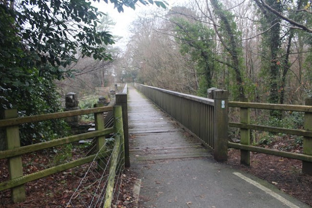
Below - The bridge taking the PQR and LNWR over the River Cegin looking north, the Penryhn Railroad bridge is just out of shot on the left. The bridge span has been replaced with a wooden footbridge for the foot and cycle path.
Below - Bridge under the A5, clearly this has been substantially widened though there are remnants of the retaining wall off the earlier bridge on the left. The PQR had a separate bridge on the right slightly lower down but this seems to be lost under the A5 now.
Below - The LNWR route diverging on the left from the PQR on the right. The cycle route dips a bit, the LNWR route begins its climb but the with the PQR bridge under the A5 filled in the cycle route has had to use the bridge from the mainline.
Below - The LNWR branch runs through a cutting. This isn't a footpath but it seems to be a well trodden route. The vegetation gets thicker and the ground quite boggy so I didn't carry on to the end where it meets the road through the industrial estate near the site of the mainline connection. I did look at that road later and found the trackbed not fenced off at that end but the vegetation was pretty bad.
4 - LNWR Bethesda Branch
Below - Returning to the PQR as it passes under the viaduct of the North Wales coast line, where the line crossed under Lon Cefn Ty the bridge that took the LNWR line over the road is along side on the right.
The path follows the PQR and part of the LNWR trackbed is now used as a farm track. The LNWR trackbed can be seen on the right. A substantial bridge can be seen through the trees where the original farm access crosses the trackbed now in farm use.
Below - After crossing under the A55 the path to Bethesda switches to the LNWR trackbed. Just beyond the A55 it utilises one of the most significant structures on the route, the Glasinfryn Viaduct.
Below - Shortly after the viaduct the LNWR crossed over the PQR, the bridge is still in situ and the overgrown trackbed can be seen passing underneath in a small cutting.
The path crosses the A4244 Felin Hen road on a footbridge just west of the original railway bridge. The abutment on the south side of the road and the former Railway Cottages survive. This was the site of Felin Hen station. The owner of the station site has put a bit of railwayana up around the site.
The path returns to the trackbed roughly where the access to the station would have been.
Below - Farm access bridge.
Below - Bridge under the B4409.
Around this part of the route it can be seen that stretches of cutting have been filled in since the railway closed with the path climbing and descending in and out of the cutting between filled in cutting and surviving bridges.
Below - Footpath bridge at Ty'n-y-lon.
On the approach to Tregarth the cutting has been filled in, the path runs along the roads to Tregarth Park which is on the former station site.
Below - The filled in bridge where the B4409 crossed the line.
Below - The filled in bridge where Ffordd Tanrhiw crossed the line, access to the station was just beyond the bridge on the right.
Below - The site of Tregarth station. A bit of the platform edge can still be seen.
Below - Towards the end of the park near the site of the goods yard were several concrete sections that looked like platform edging. They weren't from the passenger platform but look like they could have come from the goods yard.
Below - The bridge carrying the PQR over the LNWR line.
Below - A small tunnel carries Maes Ogwen diagonally over the former railway.
Below - Looking back at the Maes Ogwen tunnel from the other side, the PQR bridge can be seen behind it.
Below - This was quite a stretch for structures to cut the railway through, the line then entered Tregarth Tunnel which is now open to pedestrians and cyclists.
Below - The line emerged from the tunnel straight on to a viaduct over the River Ogwen. The PQR ran over the top of the tunnel mouth.
Below - The bridge carrying Llwyn Bleddyn Road over the former railway.
Just beyond the above bridge the trackbed is occupied by farmland and the path runs alongside Bangor Road for a stretch, returning to the trackbed north of the site of Bethesda station. It leaves the trackbed again north of the station site.
Below - Remains of a bridge that carried the railway over a footpath north of the station.
The above footpath still exists and can be followed along the banks of the River Ogwen in to Bethesda. The former station site is now occupied by a medical centre with just the retaining wall along Station Road at the end of the embankment as a reminder that it once stood there.
The footpath along the Ogwen also crosses the river on a bridge to emerge on the B4409 just north of the former slate works at Felin Fawr through which the Penryhn Quarry Railway ran.
5 - The Penrhyn Quarry Railway
Most of the buildings of the old slate works remain in various industrial uses. An attempt to revive part of the railway as a heritage railway was made in 2012, though this closed in 2017. Some of the track from that scheme could still be seen.
Below - The former slate works offices.
Below - Some of the former slate works buildings, the old maps show a network of narrow gauge lines around the site.
Below - The platform of the short lived preservation scheme. In the latter days of the PQR the scrap loco sidings were here. Fortunately many of the engines from the quarry and the PQR ended up preserved rather than scrapped.
Below - Bridge carrying the road across the south of the Felin Fawr complex. Beyond this the line carried on to the slate quarry.
The above map is to a larger scale as the OS 25 inch series doesn't cover the slate quarries at Bethedsa. The map gives an idea of the scale of the quarries and waste tips. The path circles the edge of the quarry site where the railway used to run. The old map shows the line running on an embankment but with decades of slate production since the railway closed there are now large piles of slate waste alongside the trackbed.
Google maps mentions the surviving ruins of the quarry's hospital, though recent reviews mention that this is now fenced off. Though there is still an active slate mine on the site there is also a tourist attraction of a zip line across the quarry. I stuck to exploring the area at walking pace and with both feet on the ground though.
Returning to Felin Fawr and following the course of the narrow gauge PQR north I returned to the B4409. The line ran alongside the road to the left. The earlier course of the horse drawn Penrhyn Railroad can also be seen on the above map.
A small branch ran off from Felin Fawr to the Ogwen slate works, the latter works is now a car dealership though the slate retaining wall for the Felin Fawr works seems to have been patched up and I couldn't see any trace of the railway connection.
I walked along St Ann's Hill but there was no sign of where the railway crossed on a bridge. The footpath heading north that met the railway before veering west is still there but a look at Open Street Maps didn't show any footpaths where the railway ran so I returned to the B4409 to head north.
Where Lon Hafoty leaves the B4409 to the left the driveway accessing the back of the houses of Hen-durnpike runs along the former trackbed.
Below - A bit of trackbed now in use as a driveway to the back of the houses of Hen-durnpike.
The B4409 has been widened north of the junction so the embankment has burried any trace of the railway crossing on the east side of the road, though I did find a stretch of trackbed by turning right on to Llwyn Bleddyn Road. The footpath on a set of steps near Pont Coetmor is still there, accessed through a hole in the slate retaining wall for the railway. The trackbed is not shown as a footpath but seems to be a well trodden route with no signs to say an explore wasn't welcome.
Below - Looking back towards the B4409 from the footpath crossing the trackbed becomes overgrown and dissapears in to the embankment of the widened road.
Below - Looking north the trackbed is on a substantial ledge with slate retaining road between the railway and the road to the left on a lower level.
1914 Map
The trackbed can be followed until the point shown on the above old map where it emerges from the trees in to the fields, at this point it is fenced off farmland. While the LNWR passed through the Tregarth Tunnel mentioned above the PQR route took a wide arc through the fields to maintain a gradient suitable for steam power without major engineering works. Following the right hand side of the map towards the top some of the earthworks of the earlier horse drawn Penryhn Railroad can be seen, the earlier route having used a rope worked incline seen as a straight line running past Dinas Farm.
The PQR trackbed can be picked up again where it crossed Maes Ogwen and the LNWR line.
Below - Looking north over the bridge across the former LNWR line the abutment and embankment of the PQR line can be seen. There is a footpath along the PQR trackbed from here to Tregarth.
Below - Bridge abutments of the PQR line.
Below - The remains of the bridge seen from the top of the embankment.
Below - The bridge across the LNWR Bethesda branch.
Below - A bit of stone cutting along the trackbed.
Below - A number of sleepers are still in situ on this section of the trackbed.
Where the trackbed reaches the B4409 at Tregarth it disappears in to vegetation where the footpath leaves it, I expect a bit of poking around would reveal a filled in bridge under the road but even in the middle of winter the vegetation was quite thick. On the other side of the road the trackbed has been built on and a section of trackbed is in private use. The trackbed is regained by following the LNWR trackbed a short distance to the three arch footpath bridge at Ty'n-y-lon on the old map and crossing over the bridge, a public footpath follows the narrow gauge trackbed past the allotments up to their road access off the B4409
Below - Where the PQR crossed a stream on the old map the abutments of the culvert are still there with a couple of slabs of slate at the site of the old bridge to serve the footpath.
Below - The PQR trackbed looking towards Port Penryn, note the slate fencing on the left hand side, this was quite common along the route.
Below - More sleepers still visible.
Below - Where the road from the allotments to the B4409 crosses the trackbed a filled in bridge that took a much narrower farm track that preceded it over the railway.
The line curved in quite a wide arc to Felin Hen, though this is not accessible to the public. I walked along to the B4409 to Felin Hen Road (the A4244) where the path along the LNWR branch crosses on the footbridge near the abutment at the site of Felin Hen station.
From here the PQR ran alongside the LNWR on the left for a short way before crossing under the standard gauge line. the bridge that took the LNWR over the PQR is still in place across the overgrown trackbed.
Below - View from the LNWR bridge looking south along the PQR trackbed below.
Below - Looking north from the LNWR bridge a short stretch of PQR trackbed can be seen before it fades in to the surrounding farmland and ends up buried under the A55. Note the slate fencing.
After crossing under the A55 the foot and cycle path from Bethesda to Port Penrhyn follows the PQR trackbed rather than that of the LNWR line so we are on the PQR again for the remainder of the journey back to Port Penrhyn. Just north of the A55 there are some remains of Coed-Howel Mill seen on the old map, already disused in 1914. The buildings look precarious and a sign saying to keep out seems like sound advice but some of the mill buildings and chimney can be seen from a footpath alongside the former mill.
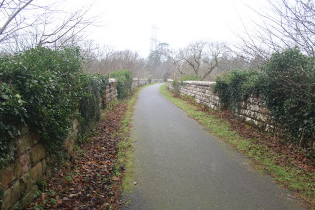
Below - Looking south along the PQR trackbed, at this point a well maintained tarmacked cycle route.
Below - Bridge carrying Lon Cefn Ty over the former line.
Below - The former narrow gauge trackbed passes under the viaduct of the LNWR's main North Wales coast line.
Reaching Port Penryn mentioned at the beginning of the article completes the walk along the various railways that operated between the mines of Bethesda and the port.