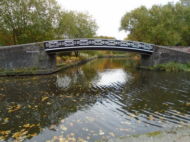
Starting Point - Love Lock Bridge, Birmingham. Finish Point - Bordesley Street Wharf (or Typhoo Basin). Distance - 6.2 miles plus a 3.1 mile walk between locations.
With a day free in Birmingham before a concert at the Utilla arena (itself situated by Old Turn Junction on the Birmingham Canal Old Line) I went for a bit of a walk around some of the key canals around the centre of Birmingham.
Below - Diagrammatic map of the canals around Birmingham, my walk takes in some of the canals radiating from Gas Street Basin in the centre of Birmingham. The map is from the
Minimal List website where it has been used to illustrate a narrow boat tour.
More can be found about the history of the local canal network on the
Wikipedia article.
Having arrived at New Street station the closest point to access the canals was at the back of the Mailbox shopping centre. The shopping centre itself is built across the site of a basin at Worcester Wharf where the Worcester & Birmingham Canal turned through a right angle. A stub of the entrance to the basin survives at the back of the shopping centre.
North of the basin was the Midland Railway's Worcester Wharf Goods Station. This was accessed by a railway tunnel under the canal. The site is now occupied by offices.
Below - The modern Love Lock Bridge and the former Corporation Wharf at the right angle in the Worcester and Birmingham Canal. Canal maps show this as Worcester Bar Junction.
Below Looking towards Worcester on the Worcester & Birmingham Canal from the Love Lock Bridge.
Heading north on the Worcester & Birmingham Canal soon brings me to Gas Street Basin, one of the well known centres of the local canal network. This was a triangular junction in to the Old Wharves. Just a stub of the connection survives, the canal filled in just before Bridge Street and the Wharves redeveloped with a Crown Plaza hotel, HMRC offices, HSBC and other high rise buildings.
Beneath the Love Lock Bridge on the corner of the former Corporation Wharf are narrow gauge railway tracks. Something of a historic red herring, rather than being a remnant of industrial tracks on the wharf they were added in the modern redevelopment of the canal side.
Below - The narrow gauge rails on the corner of Corporation Wharf.
Below - Gas Street Basin.
A couple of basins went off to the south west of Gas Street, now filled in though a short section of one survives as a water feature.
[B] Below - Former entrance to one of the filled in basins off Gas Street.
At the north west edge of Gas Street Basin the canal passes under Broad Street and the buildings lining the street.
Below - Broad Street Tunnel.
The Old Turn Junction is where the canal heading under Snow Hill Station to various points to the east leaves, I'll come to that later. It is also where the curve of the "Old Turn", one of a series of meandering curves that were bypassed with straighter shortcuts goes off to the south west. A basin also goes off to the east just before the junction.
Below - Basin and Old Turn Junction.
Below - Old Turn Junction.
I headed west along the "mainline" of the canal.
Below - Sheepcote Street bridge.
An interesting old building survives on the north side of the canal, the building s of the former Corporation Wharf (another one) including the Rotunda building which is now used to stage events on the canal and the buildings on Sheepcote Street that are now The Distillery bar and restaurant.
Below - The Rotunda.
Below - The Distillery.
Below - At Vincent Street bridge. Note the small red doors in the bridge, a common feature on canal bridges in the area, they allowed fire engines to drop hoses in to the canal to pump water from the canal on to fires.
Below - Bridge over the former basin into the Standard Bedstead Works and Ledsam Street Works.
Below - Bridge over the basin that once served the Monument Lane Goods Shed.
Monument Lane has been replaced with the modern dual carriageway Ladywood Middleway. On the south west side of the canal another earlier meander of the canal goes off, the Birmingham Canal Old Line. At the time of my visit most of the old industrial buildings here had been leveled for redevelopment.
Below - Remnants of the wharf at the corner of the Old Line. This is shown as Icknield Square Junction on canal maps.
Below - Information board about the towpaths down both sides of the canal amongst the capacity improvements the canals saw here.
Below - Harborne Junction where the earlier meandering Old Line crosses the later direct route. The junction is also shown on canal maps as Rotton Park Junction.
Below - The Railway's Harborne Junction where the branch line to Harborne crossed over the canal. The central pillar of the bridge can still be seen in the middle of the canal.
From here I did a walk on the former Harborne branch railway which I will cover separately. I pick up my canal walk across the city at Somerset Road near Edgbaston to the north of the University.
Below - Looking south from Somerset Road bridge. The railway line running alongside the canal is a common occurrence. The route taken by the canal would be well suited to the railways with the lack of steep gradients. In later years there were proposals to fill canals to increas rail capacity, though since loosing their freight traffic the local canals have seen new liesure uses.
Somerset Road once had a railway station, the only sign of it now is evidence in the brickwork of the bridge where the entrances to the station have been filled in.
Below - A winding hole for turning boats, looking at the old maps this seems to be a modern edition for turning the liesure craft that now ply the route.
Below - The approach to Edgbaston Tunnel
Below - The north portals of Edgbaston canal and railway tunnels. There was previously Church Road station on the railway here.
Below - North of Five Ways station, which is still in use, the canal passes under Bath Row. Alongside is the former railway bridge, this was for the lines to Worcester Wharf Goods Station, a student accommodation block now occupies the trackbed, behind the scaffolding on the photo.
Below - On the right the remains of earlier buildings of Queens Hospital can be seen.
This brings me back to the corner of the Worcester and Birmingham Canal at Corporation Wharf / Worcester Wharf where I started. I retraced my steps to Old Turn Junction to this time take the canal east to Snow Hill and beyond.
Below - Just beyond the Old Turn Junction the Kingston Buildings survive as offices. Note the doors for loading boats moored against the building.
Below - Cambrian Wharf today, still used for mooring boats, though leisure craft rather than freight barges so the crane just serves as a historic monument. Originally a short branch went off to wharves in the block of buildings on Newhall Road and Great Charles Street. This branch has been filled in and the wharves are now occupied by university buildings, apartments and offices.
Below - Cambrian House, the offices of the canal. The building is in use with the Canal and River Trust today and houses a shop and visitor centre.
The canal descends a flight of locks called the Farmer's Bridge Locks, now surrounded by hight rise flats rather than the factories seen on the old maps.
Below - Some of the blocks appeared to be wrapped in plastic. Further along a detour for a couple of blocks was necessary with a stretch of the canal closed off for building work.
Below - A piece of the filled in Whitmore's Arm restored as a water feature next to an old canal side building now in use as apartments.
Below - The canal passes under Snow Hill station. Snow Hill was a large mainline station of the Great Western Railway. It lost mainline status in the 1960s when the West Coast Mainline was electrified and services were diverted into the New Street station on that route. The station was closed altogether in 1972 but that was soon realised as a mistake and it reopened in 1987, though much smaller than the original station. It reopened with four platforms, one subsequently was closed to provide space for a tram terminus but with the tram line now a through route alongside the station it is planned to reopen the platform at some point.
Below - North of Snow Hill Station the canal locks and hut shown in the above map can be seen. An earlier map shows the factory in the background as an upholstery works.
Below - The Barker Bridge carrying Lower Loveday Street over the canal.
Below - On the curve on the canal the former copper works and iron works with the bridges on the towpath for the basins that once served them.
Below - Aston Junction with the Birmingham and Fazeley Canal under the towpath bridge.
From the above junction I turned right on to the Digbeth Branch in order to continue with my tour around the canals around the centre of the city.
Below - The Love Lane bridge over the canal. Remains of the wharf of the Iron Hinge Works can be seen.
Below - Heneage Street bridge.
Below - The canal descends down Ashted Lock and in to the entrance of Ashted Tunnel.
Below - The south entrance to Ashted Tunnel, the tunnel now passes beneath the A47 rather than the Belmont Glass Works. A pumping station was once situated to the right of the picture to maintain the water level in the canal.
Below - Ashted locks, the canal is now lined by university buildings and student accommodation.
Below - The bridge beneath the former lines in to Curzon Street Goods Sheds. This was the site of the first railway line in to Birmingham, the London and Birmingham Railway opened in 1838. Despite the grand classical style building which survives to this day and was designed to complement the Doric arch at London Euston, it's use as the main passenger terminus was short lived. The coming of several other railways in to Birmingham saw the opening in 1854 of the more conveniently situated Grand Central station which would later become known as New Street. Curzon Street was used for goods traffic and until 1893 occasionally for excursion traffic, closing in 1966 and becoming a parcel depot. The site is being redeveloped as the Birmingham terminus of the HS2 high speed line.
Below - The stone arch of the original bridge of lines in to Curzon Street meets the later metal spans of the tracks in to New Street.
Below - Proof House Junction with the Grand Union Canal to London. The road bridge behind the towpath bridge is the former road access to the railway goods yard at Banbury Street Wharf.
Below - The towpath emerges on to Fazeley Street next to the former entrance to the Banbury Street Wharf Goods yard.
Below - Looking south from the Fazeley Street bridge the canal fans out towards what was the Bordesley Street Wharf. The canal has been cut back to allow for the construction of the later warehousing seen in the background.
From here it was a short walk back in to the centre of Birmingham. The area is currently undergoing a lot of regeneration prior to the arrival of the high speed rail link to London. At the time of my visit there were a few old small scale factories in various states of dereliction. It would be interesting to see how many of these buildings are refurbished for new uses and how many are replaced with modern buildings.