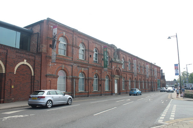
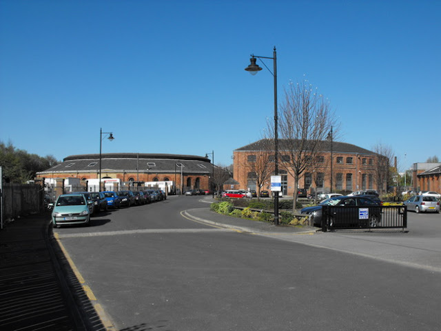
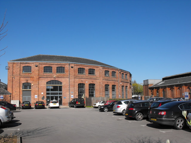
Starting Point - Site of Hunslet Lane Station. Finishing Point - Site of Holbeck Station.
Above - 1913 Railway Clearing House map of the Leeds area.
Leeds Hunslet Lane
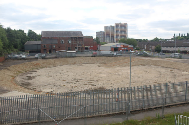
My starting point was Crown Point Retail Park just south of the city centre. This was built on the site of Hunslet Lane Goods. The site was home to a short lived passenger terminus in the early days of railways. From 1840 the North Midland Railway from Derby arrived at Hunslet Lane. The York & North Midland Railway also ran services from York and Selby in to Hunslet Lane. A year later Manchester & Leeds Railway trains arrived, using running powers over the NMR from what was then an important junction station at Normanton.
The NMR went on to be part of the Midland Railway and in 1846 its services were diverted to Wellington Station closer to the city centre and connecting via a triangular junction to the Leeds & Bradford Railway that also became part of the Midland Railway.
The M&LR became part of the Lancashire & Yorkshire Railway and continued to use Hunslet Lane for a further couple of years before using running powers over the London & North Western Railway to reach Leeds via Bramley, initially to a temporary station close to the site of Leeds Central until that station was completed in 1851. From 1848 until 1972 the site remained in use as a goods depot.
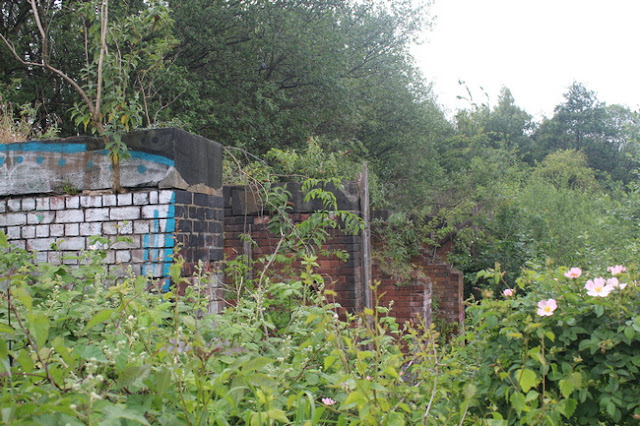
Below - At the south end of the retail park site the former railway approaches to the site can be seen behind the B&M store. After the bridges under Ivory Street and Pottery Bridge which can be seen in the photo the line passed under a further bridge for Jack Lane before joining the former Midland line which remains in use today.
Below - At the north end of the site some of the perimeter walls of the site remain on Hunslet Lane.
The Hunslet area was well known for engine building and I have previously written about touring the engine building area on foot for the Leeds Engine website.
Along the east side of the site the former John Fowler locomotive works buildings remain on Butterley Street.
On the west side of the site is Kidacre Street, this was the home of coal staithes for Middleton Colliery and for many years the terminus of the line which dated back to 1758 and from 1812 was the first line to put steam locos to regular use. Nothing remains of the staiths, though parts of the trackbed survive through the nearby gas works site (not open to the public).
From the site of Hunslet Lane I walked along Crown Point Road to the site of another early passenger station at Marsh Lane. This can be seen on the above old map at the top of the page.
Marsh Lane
The Marsh lane site is split across the top of the above old map and the bottom of this
1893 Map. The site can also be similarly split in two from a historic point of view, the original terminus was to the north of the surviving line through the site. When the through line was built a later through station was constructed on it.
Marsh Lane was the first passenger railway station in Leeds when the Leeds & Selby Railway opened in 1834. It was short lived as the Leeds & Selby railway was leased by the York & North Midland in 1840 with services diverted to the above Hunslet Lane terminus, a large detour via Normanton. From 1850 a stopping service was run from Marsh Lane to Milford Junction where it met the Y&NM trains. In 1854 the Y&NM (and the L&S which it had acquired completely in 1844) became part of the North Eastern Railway.
The old station was demolished in 1863 and a railway served grain warehouse built on the site. In 1969 the NER extended west to meet the LNWR at New Station connecting services across the country. A new two platform Marsh Lane station was built on the through line, this remained in use until 1958.
Below - Gateposts for the entrance to the goods yards that stood on the site of the original 1834 passenger terminus.
Below - The gateposts again. The original station had a building just inside the gates with a booking office at road level and the trains at first floor level. In the background the viaduct carrying the 1869 through line can be seen. That was the site of the later through station, in fact the slope of the wall at the back of the platform end can be seen where the viaduct meets the road bridge.
Below - Looking under the arch the two different heights of the arches for track level and platform level can be seen.

Below - Turning on to Railway Street the site of the west bound platform can be seen along with where step access to the platform was provided.
Below - From Railway Street a footpath to Shannon Street crosses the railway on a bridge.
Below - Looking towards Selby, the original terminus and later goods yard site was on the left and the later through lines on the right. The goods yard site was a stone terminal in to recent years but is now being used for the Transpennine Route Upgrade works.
Below - Looking towards Leeds. The original terminus was on the right and the later through station on the left. Remnants of platforms can be seen from passing trains.
Leeds New Station
Built to link up the NER and LNWR networks in 1869 the station has been rebuilt several times since, particularly when it was merged with the nearby Wellington Station in 1938 to form Leeds City Station, resulting in the Art Deco North Concourse and Queens Hotel. It was rebuilt again in 1967 when Leeds Central station closed and all traffic was concentrated on Leeds City. It was rebuilt again between 1999 and 2002 when the 60s station proved inadequate for growing passenger numbers and parts of the Wellington site which had been used for parcels and car parking (even in the grand north concourse) were brought back in to passenger use along with new platforms on the station's freight avoiding lines.
Below - Once the ground floor level to a four storey red brick building at the Bishopgate entrance to Leeds New Station. The final remains of the building were about to be demolished for a grand staircase and plaza as part of council plans to drastically reduce road capacity in the city centre. The building first appears on the
1908 Map.
Though platforms 4 to 14 are part of the original layout of Leeds New Station and the station is built on the original viaducts (widened a couple of times since 1869) there is nothing to see above platform level of the original station.
Leeds Wellington
This was the Midland Railway station opened in 1846 to provide better access to the city centre than the original Hunslet Lane terminus. The main passenger facilities were replaced with the art deco north concourse in 1938.
The north concourse was restored around the turn of the 21st Century after being used for car parking since the 1960s rebuild. Platform 0 and 1 of the modern station are roughly where the most southerly passenger platforms of Leeds Wellington stood. Since the 1960s rebuild they had been used for parcels traffic. When the station was rebuilt in the early 2000s the original south face of the island platform was opened as Platform W, later renumbered as 1 when the rebuild was completed. At the time the Midland Railway canopies survived but they were removed and the platform realigned when platform 0 was added recently. Platforms 2 and 3 now occupy the site of the Midland's carriage shed shown on the old map. The station car parking and drop off point now occupy most of the Wellington station site.
Below - London Midland & Scottish Railway coat of arms on the entrance to the offices above the north concourse in the 1938 buildings.
Leeds Central
Leeds Central was opened in 1854 and served by the Great Northern Railway, NER, LNWR and L&YR. It closed in 1967 when all services were concentrated on Leeds City station.
Not much remains of Central Station. The former Station Hotel survives, it became the Wellesley Hotel and has recently been converted to apartments. A stub of the walkway that connected to the station survives.
Below - The former Station Hotel. Note the newer top couple of floors, these were part of the original design but it was curtailed with a flat roof and were only added with the recent redevelopment of the building.
Below - Remains of the walkway from the station. The modern buildings behind occupy the station site.
North of the passenger station several goods warehouses of the various railway companies serving Leeds stretched to Wellington Street. As the lines were on arches four wagon hoists were built to lower wagons to ground level. One of the hoists survives and has been restored as a focal point of the modern development.
Below - The wagon hoists today.
Below - The side that joined the viaduct, where it joined the arch of the viaduct can be seen in the rougher stonework.
Below - Inside the former hoist.
A stretch of the viaduct survives where the lines crossed the River Aire and the Leeds & Liverpool Canal. This is being restored as an arial garden between office blocks.
Below - Steps and lift access to the viaduct where the remaining viaduct in to Central station has been demolished.
Below - The first section of completed garden where the railway crossed the River Aire.
Below - Remains of signalling equipment and a lineside phone in one of the refuges on the viaduct.
Below - Bridge over the River Aire.
Below - Bridge over the Leeds and Liverpool Canal.
Below - The former junction where NER trains for the Harrogate line diverged to the right while GNR, LNWR and L&YR trains to Wakefield, London & Manchester carried on straight ahead.
Below - The viaduct of the main lines seen from the NER chord.
Below - The end of the viaduct for the NER chord with the NER's engine sheds seen in the background.
Below - An old signal at the junction.
At the time of writing it wasn't possible to emerge on foot at the Armley Gyratory end of the development around the viaduct. Armley Gyratory occupies part of the site of Holbeck station. The station had high and low level platforms for the routes out of Central and Wellington stations respectively and served as an interchange between the routes out of the separate stations. I walked to Whitehall Road to visit what traces of the station at Holbeck that remain.
Below - Between Whitehall Road and the viaducts for Central station was previously occupied by the Monkbridge Ironworks, here are a couple of photos of the works before it was demolished in the early 2000s. Office blocks now occupy the site.
Holbeck
Below - As the lines out of Wellington / New / City stations cross over Whitehall Road this blocked up archway on the north side of the road was once a pedestrian entrance to the low level platforms.
Below - Next to the bridge the former Whitehall Goods Yard survives as a Network Rail maintenance depot. The furthest bridge span that now brings lines from the Huddersfield direction originally carried goods lines. Trains from the Huddersfield direction used to use Holbeck Viaduct to the south, crossing over the Midland routes near Holbeck engine shed and avoiding conflicting between LNWR / MR routes in and out of the station. A chord was built to divert Holbeck Viaduct to the Wakefield and London route before the viaduct was closed in the 1980s when the route was electrified.
Below - Looking through the film studio site this fenced off subway can be seen. This was once the site of Sutton Street and the subway accessed the high level platforms before emerging on to Talavera Street.
Continuing on the pavements and footpaths on the east side of Armley Gyratory the other side of the subway can be seen, though it is fenced off. Since the lines to Central station were closed part of the embankment has been cut away for construction of the roundabout, the northern most four track bridge spans over Gelderd Road have been removed and the site of an entrance off Gelderd road has disappeared.
Below - Site of the Talavera Street entrance, though the high level platforms were above this portal here. Here the subway narrowed for the footpath to Sutton Street.
Below - On the South West corner of the Gyratory remains of the gas works can be seen.
Below - The edge of the gasworks site and evidence of the wider embankment for the tracks towards Central station.
Continuing to the north east side of the Gyratory where Gelderd Road passes under the former Midland and North Eastern lines to meet Wellington Road another entrance to Holbeck Low Level can be found.
Below - Former Gelderd Road / Wellington Road entrance to the Low Level platforms. The path from here met that from Whitehall Road.
Below - Crossing the footpath bridge over Wellington Road the coal drops of the former coal depot can be seen.
On the east side of Wellington Road many of the buildings of the NER engine sheds survive. The surviving roundhouse was being reroofed at the time of my visit so I've included pictures of an earlier visit.
Below - The half roundhouse.
Below - The roundhous and half roundhouse.
Below - The workshop and stable building.
Below - The half roundhouse.
Below - The roundhouse
Another roundhouse was situated on the east of the site but this doesn't survive. The site ceased to be used as engine sheds quite early as engines became bigger than the turntables. The buildings are therefore remarkable survivors of an early engine shed.


